<dd3:EEAissue><![CDATA[Agriculture]]></dd3:EEAissue><dd3:EEAissue><![CDATA[Soil degradation and pollution]]></dd3:EEAissue><dd3:EEAissue><![CDATA[Eutrophication ]]></dd3:EEAissue><dd3:EEAissue><![CDATA[Water]]></dd3:EEAissue><dd3:PlannedUpdFreq><![CDATA[4 years]]></dd3:PlannedUpdFreq><dd3:Methodology><![CDATA[The data requested for Nitrates Directive should be derived from existing national and/or regional monitoring networks within each Member State.
The combination of the elements CountryCode, NationalStationCode and StationType must be a unique record in the table. No duplicate records should exist with this combination.
Please consider the following when compiling your data delivery:
1. Provide information on the monitoring stations. The station location must represent a point location.
2. Submit NO3 concentrations (measurement unit: mg/l NO3) for groundwater- and surface water monitoring stations sampled during a period of one or more years within the reporting period.
3. Submit information on the trophic state (and eutrophication parameters) for the surface water monitoring stations.
4. Submit data for each sample site (no aggregation of stations).
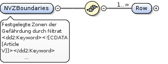
5. Submit geographical data sets (in shapefile or geodatabase format) for the Nitrate Vulnerable Zones and Potential Vulnerable Zones in order to create and update the NVZ database (hosted by JRC). For GIS guidelines go to http://eionet.europa.eu/gis/ .
6. Use the templates (XML schemas or Excel) and these specifications to guide you in formatting and collating your data delivery. All are available for download from the data dictionary.
7. Supply data on monitoring stations in XML or Excel format. In the case of Excel format, xls files (= Excel 1997 - 2003) can be used only. Do not use xlsx files. Ensure commas are not used as decimal separators. Please do not use formulas in Excel template fileds, fill values only.
8. Upload your data files to your nominated repository: the Central Data Repository at http://cdr.eionet.europa.eu/
DATA FOR THE EVALUATION OF WATER QUALITY UNDER THE NITRATES DIRECTIVE
==================================================================
The data required for the evaluation of water quality for Nitrates Directive are the following:
MONITORING NETWORKS
- groundwater sampling points - types: phreatic (unconfined) shallow, phreatic deep, captive (confined) and karstic groundwater.
- surface (fresh) water sampling points - types: rivers and lakes/reservoirs
- transitional, coastal and marine water sampling points - types transitional (=estuarine) water, coastal water and marine water.
GROUNDWATER QUALITY DATA LINKED TO THE MONITORING STATIONS
- data per station on average annual nitrate concentration (this should be read as one value per year i.e. four values for the whole reporting period)
- data per station on maximum nitrate concentration
- trends per station on average nitrate concentration between the current and previous reporting period.
SURFACE WATER QUALITY DATA LINKED TO THE MONITORING STATIONS
- data per station on average annual nitrate concentration (this should be read as one value per year/season)
- data per station on the maximum and winter average nitrate concentration
- trends in average nitrate concentration between the current and previous reporting period
- trophic state / eutrophication parameters per station
- trends on trophic state / eutrophication parameters between the current and previous reporting period
DEFINITION OF NITRATE VULNERABLE ZONES DATASET
================================================
General information for Nitrate Vulnerable Zones dataset:
The database on the geographical information of Nitrate Vulnerable Zones is hosted by JRC.
Templates have been developed by JRC based on the recommendations made in the Water Framework Directive (Common Implementation Strategy for the WFD (2000/60/EC); Guidance document n°9 'Implementing the GIS elements of the WFD (EC 2003 ISBN 92-894-5129-7)).
Shapefiles according to the templates are requested for the Nitrate Vulnerable Zones.
The Member States that apply a whole territory approach (according to article 3 §5 of the directive) or the Member States that have not changed NVZ designation in the current reporting period do not have to provide the GIS file.
]]></dd3:Methodology><dd3:Version><![CDATA[February 2012]]></dd3:Version><dd3:ShortDescription><![CDATA[Ground- and surface water sampling points to define waterquality based on nitrate concentrations and other parameters]]></dd3:ShortDescription><dd2:Keyword><![CDATA[water quality]]></dd2:Keyword><dd2:Keyword><![CDATA[Eutrophication]]></dd2:Keyword><dd2:Keyword><![CDATA[NO3]]></dd2:Keyword><dd2:Keyword><![CDATA[Surface water]]></dd2:Keyword><dd2:Keyword><![CDATA[Groundwater]]></dd2:Keyword><dd2:Keyword><![CDATA[Article V]]></dd2:Keyword><dd2:Keyword><![CDATA[Water]]></dd2:Keyword><dd2:Name><![CDATA[Evaluation of water quality under the Nitrates Directive.]]></dd2:Name><dd2:Definition><![CDATA[Data on monitoring stations are collected for each reporting period (4 year period). Full details of the data requested on water are presented in this specification by tables and include characteristics on the water monitoring stations, values for the concentrations of NO3 for each station as well as information on the Nitrate Vulnerable Zones.]]></dd2:Definition>
<xs:element name="NiD"><xs:annotation><xs:documentation xml:lang="de" source="http://dd.eionet.europa.eu/datasets/3008">Nitratdirektive 91/676/EWG, Nachrichtenmodell</xs:documentation><xs:documentation xml:lang="en"><dd3:EEAissue><![CDATA[Agriculture]]></dd3:EEAissue><dd3:EEAissue><![CDATA[Soil degradation and pollution]]></dd3:EEAissue><dd3:EEAissue><![CDATA[Eutrophication ]]></dd3:EEAissue><dd3:EEAissue><![CDATA[Water]]></dd3:EEAissue><dd3:PlannedUpdFreq><![CDATA[4 years]]></dd3:PlannedUpdFreq><dd3:Methodology><![CDATA[The data requested for Nitrates Directive should be derived from existing national and/or regional monitoring networks within each Member State.
The combination of the elements CountryCode, NationalStationCode and StationType must be a unique record in the table. No duplicate records should exist with this combination.
Please consider the following when compiling your data delivery:
1. Provide information on the monitoring stations. The station location must represent a point location.
2. Submit NO3 concentrations (measurement unit: mg/l NO3) for groundwater- and surface water monitoring stations sampled during a period of one or more years within the reporting period.
3. Submit information on the trophic state (and eutrophication parameters) for the surface water monitoring stations.
4. Submit data for each sample site (no aggregation of stations).
5. Submit geographical data sets (in shapefile or geodatabase format) for the Nitrate Vulnerable Zones and Potential Vulnerable Zones in order to create and update the NVZ database (hosted by JRC). For GIS guidelines go to http://eionet.europa.eu/gis/ .
6. Use the templates (XML schemas or Excel) and these specifications to guide you in formatting and collating your data delivery. All are available for download from the data dictionary.
7. Supply data on monitoring stations in XML or Excel format. In the case of Excel format, xls files (= Excel 1997 - 2003) can be used only. Do not use xlsx files. Ensure commas are not used as decimal separators. Please do not use formulas in Excel template fileds, fill values only.
8. Upload your data files to your nominated repository: the Central Data Repository at http://cdr.eionet.europa.eu/
DATA FOR THE EVALUATION OF WATER QUALITY UNDER THE NITRATES DIRECTIVE
==================================================================
The data required for the evaluation of water quality for Nitrates Directive are the following:
MONITORING NETWORKS
- groundwater sampling points - types: phreatic (unconfined) shallow, phreatic deep, captive (confined) and karstic groundwater.
- surface (fresh) water sampling points - types: rivers and lakes/reservoirs
- transitional, coastal and marine water sampling points - types transitional (=estuarine) water, coastal water and marine water.
GROUNDWATER QUALITY DATA LINKED TO THE MONITORING STATIONS
- data per station on average annual nitrate concentration (this should be read as one value per year i.e. four values for the whole reporting period)
- data per station on maximum nitrate concentration
- trends per station on average nitrate concentration between the current and previous reporting period.
SURFACE WATER QUALITY DATA LINKED TO THE MONITORING STATIONS
- data per station on average annual nitrate concentration (this should be read as one value per year/season)
- data per station on the maximum and winter average nitrate concentration
- trends in average nitrate concentration between the current and previous reporting period
- trophic state / eutrophication parameters per station
- trends on trophic state / eutrophication parameters between the current and previous reporting period
DEFINITION OF NITRATE VULNERABLE ZONES DATASET
================================================
General information for Nitrate Vulnerable Zones dataset:
The database on the geographical information of Nitrate Vulnerable Zones is hosted by JRC.
Templates have been developed by JRC based on the recommendations made in the Water Framework Directive (Common Implementation Strategy for the WFD (2000/60/EC); Guidance document n°9 'Implementing the GIS elements of the WFD (EC 2003 ISBN 92-894-5129-7)).
Shapefiles according to the templates are requested for the Nitrate Vulnerable Zones.
The Member States that apply a whole territory approach (according to article 3 §5 of the directive) or the Member States that have not changed NVZ designation in the current reporting period do not have to provide the GIS file.
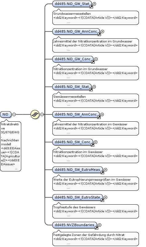
]]></dd3:Methodology><dd3:Version><![CDATA[February 2012]]></dd3:Version><dd3:ShortDescription><![CDATA[Ground- and surface water sampling points to define waterquality based on nitrate concentrations and other parameters]]></dd3:ShortDescription><dd2:Keyword><![CDATA[water quality]]></dd2:Keyword><dd2:Keyword><![CDATA[Eutrophication]]></dd2:Keyword><dd2:Keyword><![CDATA[NO3]]></dd2:Keyword><dd2:Keyword><![CDATA[Surface water]]></dd2:Keyword><dd2:Keyword><![CDATA[Groundwater]]></dd2:Keyword><dd2:Keyword><![CDATA[Article V]]></dd2:Keyword><dd2:Keyword><![CDATA[Water]]></dd2:Keyword><dd2:Name><![CDATA[Evaluation of water quality under the Nitrates Directive.]]></dd2:Name><dd2:Definition><![CDATA[Data on monitoring stations are collected for each reporting period (4 year period). Full details of the data requested on water are presented in this specification by tables and include characteristics on the water monitoring stations, values for the concentrations of NO3 for each station as well as information on the Nitrate Vulnerable Zones.]]></dd2:Definition></xs:documentation></xs:annotation><xs:complexType><xs:sequence><xs:element maxOccurs="1" minOccurs="1" ref="dd485:NiD_GW_Stat"/><xs:element maxOccurs="1" minOccurs="1" ref="dd485:NiD_GW_AnnConc"/><xs:element maxOccurs="1" minOccurs="1" ref="dd485:NiD_GW_Conc"/><xs:element maxOccurs="1" minOccurs="1" ref="dd485:NiD_SW_Stat"/><xs:element maxOccurs="1" minOccurs="1" ref="dd485:NiD_SW_AnnConc"/><xs:element maxOccurs="1" minOccurs="1" ref="dd485:NiD_SW_Conc"/><xs:element maxOccurs="1" minOccurs="1" ref="dd485:NiD_SW_EutroMeas"/><xs:element maxOccurs="1" minOccurs="1" ref="dd485:NiD_SW_EutroState"/><xs:element maxOccurs="1" minOccurs="1" ref="dd485:NVZBoundaries"/></xs:sequence></xs:complexType></xs:element>
<dd2:Keyword><![CDATA[Article V]]></dd2:Keyword><dd2:Keyword><![CDATA[Eutrophication]]></dd2:Keyword><dd2:Keyword><![CDATA[Groundwater]]></dd2:Keyword><dd2:Keyword><![CDATA[NO3]]></dd2:Keyword><dd2:Keyword><![CDATA[Surface water]]></dd2:Keyword><dd2:Keyword><![CDATA[Water]]></dd2:Keyword><dd2:Keyword><![CDATA[water quality]]></dd2:Keyword><dd3:EEAissue><![CDATA[Agriculture]]></dd3:EEAissue><dd3:EEAissue><![CDATA[Eutrophication ]]></dd3:EEAissue><dd3:EEAissue><![CDATA[Soil degradation and pollution]]></dd3:EEAissue><dd3:EEAissue><![CDATA[Water]]></dd3:EEAissue><dd2:Name><![CDATA[List of groundwater monitoring stations]]></dd2:Name><dd2:Definition><![CDATA[Detailed information on the characteristics of the groundwater monitoring stations]]></dd2:Definition><dd3:ShortDescription><![CDATA[Information on the groundwater monitoring stations used to report water quality data under the Nitrates Directive.]]></dd3:ShortDescription><dd3:Methodology><![CDATA[The data requested for Nitrates Directive should be derived from existing national and/or regional monitoring networks within each Member State.
The combination of the elements CountryCode, NationalStationCode and StationType must create a unique record in the table. No duplicate records should exist with this combination.
Please consider the following when compiling your data delivery:
Provide information on the monitoring stations. Station location must represent a point location.
Filling out the tables:
All elements are required to be filled out unless “optional” or "voluntary" has been indicated or unless the element is not applicable (e.g. if a monitoring station is not used for reporting for WFD, the element EU_CD cannot be filled out.)
If “mandatory” or "required" is indicated, the element shall always be filled in. and after submitting the table in Reportnet, the QA in Reportnet will give an error message if the content of the cell will be empty.
]]></dd3:Methodology>
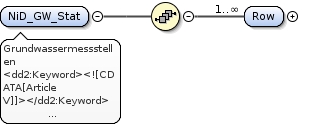
<xs:element name="NiD_GW_Stat"><xs:annotation><xs:documentation xml:lang="de">Grundwassermessstellen</xs:documentation><xs:documentation xml:lang="en"><dd2:Keyword><![CDATA[Article V]]></dd2:Keyword><dd2:Keyword><![CDATA[Eutrophication]]></dd2:Keyword><dd2:Keyword><![CDATA[Groundwater]]></dd2:Keyword><dd2:Keyword><![CDATA[NO3]]></dd2:Keyword><dd2:Keyword><![CDATA[Surface water]]></dd2:Keyword><dd2:Keyword><![CDATA[Water]]></dd2:Keyword><dd2:Keyword><![CDATA[water quality]]></dd2:Keyword><dd3:EEAissue><![CDATA[Agriculture]]></dd3:EEAissue><dd3:EEAissue><![CDATA[Eutrophication ]]></dd3:EEAissue><dd3:EEAissue><![CDATA[Soil degradation and pollution]]></dd3:EEAissue><dd3:EEAissue><![CDATA[Water]]></dd3:EEAissue><dd2:Name><![CDATA[List of groundwater monitoring stations]]></dd2:Name><dd2:Definition><![CDATA[Detailed information on the characteristics of the groundwater monitoring stations]]></dd2:Definition><dd3:ShortDescription><![CDATA[Information on the groundwater monitoring stations used to report water quality data under the Nitrates Directive.]]></dd3:ShortDescription><dd3:Methodology><![CDATA[The data requested for Nitrates Directive should be derived from existing national and/or regional monitoring networks within each Member State.
The combination of the elements CountryCode, NationalStationCode and StationType must create a unique record in the table. No duplicate records should exist with this combination.
Please consider the following when compiling your data delivery:
Provide information on the monitoring stations. Station location must represent a point location.
Filling out the tables:
All elements are required to be filled out unless “optional” or "voluntary" has been indicated or unless the element is not applicable (e.g. if a monitoring station is not used for reporting for WFD, the element EU_CD cannot be filled out.)
If “mandatory” or "required" is indicated, the element shall always be filled in. and after submitting the table in Reportnet, the QA in Reportnet will give an error message if the content of the cell will be empty.
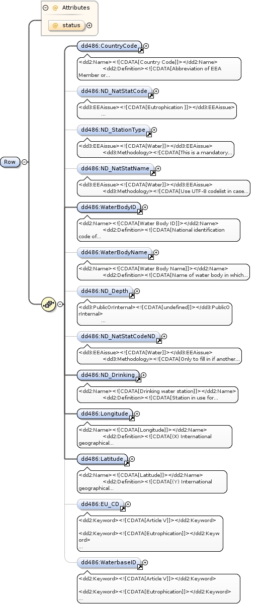
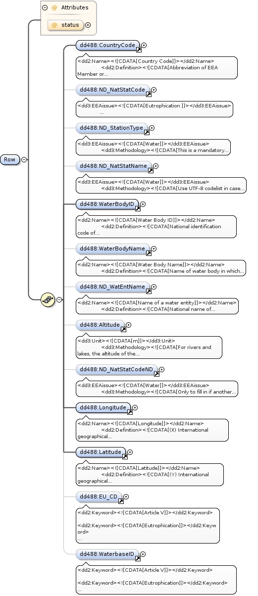
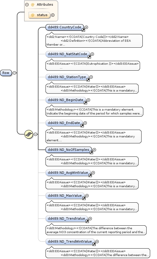
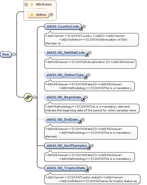
]]></dd3:Methodology></xs:documentation></xs:annotation><xs:complexType><xs:sequence><xs:element maxOccurs="unbounded" minOccurs="1" name="Row"><xs:complexType><xs:sequence><xs:element maxOccurs="1" minOccurs="1" ref="dd486:CountryCode"/><xs:element maxOccurs="1" minOccurs="0" ref="dd486:ND_NatStatCode"/><xs:element maxOccurs="1" minOccurs="0" ref="dd486:ND_StationType"/><xs:element maxOccurs="1" minOccurs="0" ref="dd486:ND_NatStatName"/><xs:element maxOccurs="1" minOccurs="1" ref="dd486:WaterBodyID"/><xs:element maxOccurs="1" minOccurs="0" ref="dd486:WaterBodyName"/><xs:element maxOccurs="1" minOccurs="0" ref="dd486:ND_Depth"/><xs:element maxOccurs="1" minOccurs="0" ref="dd486:ND_NatStatCodeND"/><xs:element maxOccurs="1" minOccurs="1" ref="dd486:ND_Drinking"/><xs:element maxOccurs="1" minOccurs="1" ref="dd486:Longitude"/><xs:element maxOccurs="1" minOccurs="1" ref="dd486:Latitude"/><xs:element maxOccurs="1" minOccurs="0" ref="dd486:EU_CD"/><xs:element maxOccurs="1" minOccurs="0" ref="dd486:WaterbaseID"/></xs:sequence><xs:attribute name="status" type="xs:string" use="optional"/></xs:complexType></xs:element></xs:sequence></xs:complexType></xs:element>
<dd2:Name><![CDATA[Country Code]]></dd2:Name><dd2:Definition><![CDATA[Abbreviation of EEA Member or Collaborating Country, as defined in the codelist.]]></dd2:Definition><dd3:Methodology><![CDATA[This is a required, not null field.
ISO 3166-alpha-2 code elements.]]></dd3:Methodology><dd3:PublicOrInternal><![CDATA[undefined]]></dd3:PublicOrInternal>
<dd3:EEAissue><![CDATA[Eutrophication ]]></dd3:EEAissue><dd3:EEAissue><![CDATA[Water]]></dd3:EEAissue><dd3:Methodology><![CDATA[This is a mandatory element.
The combination of the fields CountryCode, NationalStationCode and StationType must be a unique record in the table. No duplicate records should exist with this combination.]]></dd3:Methodology><dd2:Keyword><![CDATA[water quality]]></dd2:Keyword><dd2:Keyword><![CDATA[Surface water]]></dd2:Keyword><dd2:Keyword><![CDATA[NO3]]></dd2:Keyword><dd2:Keyword><![CDATA[Groundwater]]></dd2:Keyword><dd2:Keyword><![CDATA[Article V]]></dd2:Keyword><dd3:PublicOrInternal><![CDATA[undefined]]></dd3:PublicOrInternal><dd2:Name><![CDATA[National station code]]></dd2:Name><dd2:Definition><![CDATA[Nationally assigned, unique identifier of the groundwater monitoring station or surface water monitoring station (river, lake, transitional, coastal, marine). ]]></dd2:Definition>
<xs:element name="ND_NatStatCode"><xs:annotation><xs:documentation xml:lang="en"><dd3:EEAissue><![CDATA[Eutrophication ]]></dd3:EEAissue><dd3:EEAissue><![CDATA[Water]]></dd3:EEAissue><dd3:Methodology><![CDATA[This is a mandatory element.
The combination of the fields CountryCode, NationalStationCode and StationType must be a unique record in the table. No duplicate records should exist with this combination.]]></dd3:Methodology><dd2:Keyword><![CDATA[water quality]]></dd2:Keyword><dd2:Keyword><![CDATA[Surface water]]></dd2:Keyword><dd2:Keyword><![CDATA[NO3]]></dd2:Keyword><dd2:Keyword><![CDATA[Groundwater]]></dd2:Keyword><dd2:Keyword><![CDATA[Article V]]></dd2:Keyword><dd3:PublicOrInternal><![CDATA[undefined]]></dd3:PublicOrInternal><dd2:Name><![CDATA[National station code]]></dd2:Name><dd2:Definition><![CDATA[Nationally assigned, unique identifier of the groundwater monitoring station or surface water monitoring station (river, lake, transitional, coastal, marine). ]]></dd2:Definition></xs:documentation></xs:annotation><xs:simpleType><xs:restriction base="xs:string"><xs:minLength value="0"/><xs:maxLength value="50"/></xs:restriction></xs:simpleType></xs:element>
<dd3:EEAissue><![CDATA[Water]]></dd3:EEAissue><dd3:Methodology><![CDATA[This is a mandatory element.
For the Station Type use the "station Type" codelist. The combination of the fields CountryCode, NationalStationCode and StationType must be a unique record in the table. No duplicate records should exist with this combination.]]></dd3:Methodology><dd2:Keyword><![CDATA[water quality]]></dd2:Keyword><dd2:Keyword><![CDATA[Surface water]]></dd2:Keyword><dd2:Keyword><![CDATA[NO3]]></dd2:Keyword><dd2:Keyword><![CDATA[Monitoring station]]></dd2:Keyword><dd2:Keyword><![CDATA[Groundwater]]></dd2:Keyword><dd2:Keyword><![CDATA[Water]]></dd2:Keyword><dd2:Keyword><![CDATA[Article V]]></dd2:Keyword><dd3:PublicOrInternal><![CDATA[undefined]]></dd3:PublicOrInternal><dd2:Name><![CDATA[Station type]]></dd2:Name><dd2:Definition><![CDATA[Station Type as defined in the codelist]]></dd2:Definition>
<xs:element name="ND_StationType"><xs:annotation><xs:documentation xml:lang="en"><dd3:EEAissue><![CDATA[Water]]></dd3:EEAissue><dd3:Methodology><![CDATA[This is a mandatory element.
For the Station Type use the "station Type" codelist. The combination of the fields CountryCode, NationalStationCode and StationType must be a unique record in the table. No duplicate records should exist with this combination.]]></dd3:Methodology><dd2:Keyword><![CDATA[water quality]]></dd2:Keyword><dd2:Keyword><![CDATA[Surface water]]></dd2:Keyword><dd2:Keyword><![CDATA[NO3]]></dd2:Keyword><dd2:Keyword><![CDATA[Monitoring station]]></dd2:Keyword><dd2:Keyword><![CDATA[Groundwater]]></dd2:Keyword><dd2:Keyword><![CDATA[Water]]></dd2:Keyword><dd2:Keyword><![CDATA[Article V]]></dd2:Keyword><dd3:PublicOrInternal><![CDATA[undefined]]></dd3:PublicOrInternal><dd2:Name><![CDATA[Station type]]></dd2:Name><dd2:Definition><![CDATA[Station Type as defined in the codelist]]></dd2:Definition></xs:documentation></xs:annotation><xs:simpleType><xs:restriction base="xs:string"><xs:enumeration value="0"/><xs:enumeration value="1a"/><xs:enumeration value="1b"/><xs:enumeration value="1c"/><xs:enumeration value="2"/><xs:enumeration value="3"/><xs:enumeration value="4"/><xs:enumeration value="5"/><xs:enumeration value="6"/><xs:enumeration value="7"/><xs:enumeration value="8"/></xs:restriction></xs:simpleType></xs:element>
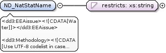
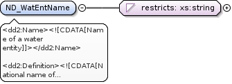
<dd3:EEAissue><![CDATA[Water]]></dd3:EEAissue><dd3:Methodology><![CDATA[Use UTF-8 codelist in case non-ascii characters occur.]]></dd3:Methodology><dd2:Keyword><![CDATA[Surface water]]></dd2:Keyword><dd2:Keyword><![CDATA[NO3]]></dd2:Keyword><dd2:Keyword><![CDATA[Monitoring station]]></dd2:Keyword><dd2:Keyword><![CDATA[Groundwater]]></dd2:Keyword><dd2:Keyword><![CDATA[Article V]]></dd2:Keyword><dd3:PublicOrInternal><![CDATA[undefined]]></dd3:PublicOrInternal><dd2:Name><![CDATA[ND_National station name]]></dd2:Name><dd2:Definition><![CDATA[National name of the monitoring station.]]></dd2:Definition>
<xs:element name="ND_NatStatName"><xs:annotation><xs:documentation xml:lang="en"><dd3:EEAissue><![CDATA[Water]]></dd3:EEAissue><dd3:Methodology><![CDATA[Use UTF-8 codelist in case non-ascii characters occur.]]></dd3:Methodology><dd2:Keyword><![CDATA[Surface water]]></dd2:Keyword><dd2:Keyword><![CDATA[NO3]]></dd2:Keyword><dd2:Keyword><![CDATA[Monitoring station]]></dd2:Keyword><dd2:Keyword><![CDATA[Groundwater]]></dd2:Keyword><dd2:Keyword><![CDATA[Article V]]></dd2:Keyword><dd3:PublicOrInternal><![CDATA[undefined]]></dd3:PublicOrInternal><dd2:Name><![CDATA[ND_National station name]]></dd2:Name><dd2:Definition><![CDATA[National name of the monitoring station.]]></dd2:Definition></xs:documentation></xs:annotation><xs:simpleType><xs:restriction base="xs:string"><xs:minLength value="0"/><xs:maxLength value="255"/></xs:restriction></xs:simpleType></xs:element>
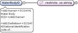
<dd2:Name><![CDATA[Water Body ID]]></dd2:Name><dd2:Definition><![CDATA[National identification code of water body (if available) in which station is located.]]></dd2:Definition><dd3:Methodology><![CDATA[This is a required, not null field for EU countries.
Water body as required/defined by the WFD.
A water body may have more than one station in it.]]></dd3:Methodology><dd3:PublicOrInternal><![CDATA[undefined]]></dd3:PublicOrInternal>
<xs:element name="WaterBodyID"><xs:annotation><xs:documentation xml:lang="en"><dd2:Name><![CDATA[Water Body ID]]></dd2:Name><dd2:Definition><![CDATA[National identification code of water body (if available) in which station is located.]]></dd2:Definition><dd3:Methodology><![CDATA[This is a required, not null field for EU countries.
Water body as required/defined by the WFD.
A water body may have more than one station in it.]]></dd3:Methodology><dd3:PublicOrInternal><![CDATA[undefined]]></dd3:PublicOrInternal></xs:documentation></xs:annotation><xs:simpleType><xs:restriction base="xs:string"><xs:minLength value="0"/><xs:maxLength value="255"/></xs:restriction></xs:simpleType></xs:element>
<dd2:Name><![CDATA[Water Body Name]]></dd2:Name><dd2:Definition><![CDATA[Name of water body in which station is located.]]></dd2:Definition><dd3:Methodology><![CDATA[Water body as required/defined by the WFD.
A water body may have more than one station in it.]]></dd3:Methodology><dd3:PublicOrInternal><![CDATA[undefined]]></dd3:PublicOrInternal>
<xs:element name="WaterBodyName"><xs:annotation><xs:documentation xml:lang="en"><dd2:Name><![CDATA[Water Body Name]]></dd2:Name><dd2:Definition><![CDATA[Name of water body in which station is located.]]></dd2:Definition><dd3:Methodology><![CDATA[Water body as required/defined by the WFD.
A water body may have more than one station in it.]]></dd3:Methodology><dd3:PublicOrInternal><![CDATA[undefined]]></dd3:PublicOrInternal></xs:documentation></xs:annotation><xs:simpleType><xs:restriction base="xs:string"><xs:minLength value="0"/><xs:maxLength value="255"/></xs:restriction></xs:simpleType></xs:element>
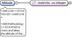
<dd3:PublicOrInternal><![CDATA[undefined]]></dd3:PublicOrInternal><dd3:EEAissue><![CDATA[Water]]></dd3:EEAissue><dd3:Methodology><![CDATA[This is a mandatory element.
Indicate at which depth samples are taken.
It is referred to paragraph 3.1.2.2 on sampling site selection of the Guidelines for the Monitoring required under the Nitrates Directive (EC, 2003). The paragraph gives clarification on monitoring depth for groundwater bodies. Exact depth figures must be indicated. The station type refers only to depth classes but does not indicate the exact depth.]]></dd3:Methodology><dd2:Keyword><![CDATA[water quality]]></dd2:Keyword><dd2:Keyword><![CDATA[NO3]]></dd2:Keyword><dd2:Keyword><![CDATA[Groundwater]]></dd2:Keyword><dd2:Keyword><![CDATA[Water]]></dd2:Keyword><dd2:Keyword><![CDATA[Article V]]></dd2:Keyword><dd2:Name><![CDATA[Depth]]></dd2:Name><dd2:Definition><![CDATA[Depth in meters below soil surface]]></dd2:Definition>
<xs:element name="ND_Depth"><xs:annotation><xs:documentation xml:lang="en"><dd3:PublicOrInternal><![CDATA[undefined]]></dd3:PublicOrInternal><dd3:EEAissue><![CDATA[Water]]></dd3:EEAissue><dd3:Methodology><![CDATA[This is a mandatory element.
Indicate at which depth samples are taken.
It is referred to paragraph 3.1.2.2 on sampling site selection of the Guidelines for the Monitoring required under the Nitrates Directive (EC, 2003). The paragraph gives clarification on monitoring depth for groundwater bodies. Exact depth figures must be indicated. The station type refers only to depth classes but does not indicate the exact depth.]]></dd3:Methodology><dd2:Keyword><![CDATA[water quality]]></dd2:Keyword><dd2:Keyword><![CDATA[NO3]]></dd2:Keyword><dd2:Keyword><![CDATA[Groundwater]]></dd2:Keyword><dd2:Keyword><![CDATA[Water]]></dd2:Keyword><dd2:Keyword><![CDATA[Article V]]></dd2:Keyword><dd2:Name><![CDATA[Depth]]></dd2:Name><dd2:Definition><![CDATA[Depth in meters below soil surface]]></dd2:Definition></xs:documentation></xs:annotation><xs:simpleType><xs:restriction base="xs:decimal"><xs:totalDigits value="5"/><xs:minInclusive value="0"/><xs:maxInclusive value="999"/><xs:fractionDigits value="1"/></xs:restriction></xs:simpleType></xs:element>
<dd3:EEAissue><![CDATA[Water]]></dd3:EEAissue><dd3:Methodology><![CDATA[Only to fill in if another code for this station has been used for the previous reporting (2004-2007) period of ND.]]></dd3:Methodology><dd2:Keyword><![CDATA[Monitoring station]]></dd2:Keyword><dd2:Keyword><![CDATA[Water]]></dd2:Keyword><dd2:Keyword><![CDATA[Article V]]></dd2:Keyword><dd3:PublicOrInternal><![CDATA[undefined]]></dd3:PublicOrInternal><dd2:Name><![CDATA[National station code Nitrates Directive]]></dd2:Name><dd2:Definition><![CDATA[Nationally assigned, unique identifier of the monitoring station used for the previous ND reporting. ]]></dd2:Definition>
<xs:element name="ND_NatStatCodeND"><xs:annotation><xs:documentation xml:lang="en"><dd3:EEAissue><![CDATA[Water]]></dd3:EEAissue><dd3:Methodology><![CDATA[Only to fill in if another code for this station has been used for the previous reporting (2004-2007) period of ND.]]></dd3:Methodology><dd2:Keyword><![CDATA[Monitoring station]]></dd2:Keyword><dd2:Keyword><![CDATA[Water]]></dd2:Keyword><dd2:Keyword><![CDATA[Article V]]></dd2:Keyword><dd3:PublicOrInternal><![CDATA[undefined]]></dd3:PublicOrInternal><dd2:Name><![CDATA[National station code Nitrates Directive]]></dd2:Name><dd2:Definition><![CDATA[Nationally assigned, unique identifier of the monitoring station used for the previous ND reporting. ]]></dd2:Definition></xs:documentation></xs:annotation><xs:simpleType><xs:restriction base="xs:string"><xs:minLength value="0"/><xs:maxLength value="50"/></xs:restriction></xs:simpleType></xs:element>
<dd2:Name><![CDATA[Drinking water station]]></dd2:Name><dd2:Definition><![CDATA[Station in use for Drinking water]]></dd2:Definition><dd2:Keyword><![CDATA[Article V]]></dd2:Keyword><dd2:Keyword><![CDATA[Groundwater]]></dd2:Keyword><dd2:Keyword><![CDATA[Water]]></dd2:Keyword><dd2:Keyword><![CDATA[water quality]]></dd2:Keyword><dd3:Methodology><![CDATA[Indicate "true" if site is in use for drinking water.]]></dd3:Methodology><dd3:PublicOrInternal><![CDATA[undefined]]></dd3:PublicOrInternal><dd3:EEAissue><![CDATA[Water]]></dd3:EEAissue>
<xs:element name="ND_Drinking"><xs:annotation><xs:documentation xml:lang="en"><dd2:Name><![CDATA[Drinking water station]]></dd2:Name><dd2:Definition><![CDATA[Station in use for Drinking water]]></dd2:Definition><dd2:Keyword><![CDATA[Article V]]></dd2:Keyword><dd2:Keyword><![CDATA[Groundwater]]></dd2:Keyword><dd2:Keyword><![CDATA[Water]]></dd2:Keyword><dd2:Keyword><![CDATA[water quality]]></dd2:Keyword><dd3:Methodology><![CDATA[Indicate "true" if site is in use for drinking water.]]></dd3:Methodology><dd3:PublicOrInternal><![CDATA[undefined]]></dd3:PublicOrInternal><dd3:EEAissue><![CDATA[Water]]></dd3:EEAissue></xs:documentation></xs:annotation><xs:simpleType><xs:restriction base="xs:boolean"></xs:restriction></xs:simpleType></xs:element>
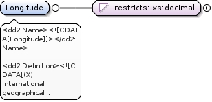
<dd2:Name><![CDATA[Longitude]]></dd2:Name><dd2:Definition><![CDATA[(X) International geographical co-ordinates in decimal degrees format.]]></dd2:Definition><dd3:Methodology><![CDATA[This is a required, not null field.
Use the common geodetic datum ETRS89. WGS84 should be used for overseas areas and can be used for TCM data as well.
Use negative values for coordinates west of the Greenwich Meridian (0°).
Please round the coordinates to 4 - 5 decimal places, depending on your input data precision (0.0001° = about 10 m).
Where TCM stations represent a broader area, the central location of the area should be provided.]]></dd3:Methodology><dd3:PublicOrInternal><![CDATA[undefined]]></dd3:PublicOrInternal><dd3:Unit><![CDATA[decimal degrees]]></dd3:Unit>
<xs:element name="Longitude"><xs:annotation><xs:documentation xml:lang="en"><dd2:Name><![CDATA[Longitude]]></dd2:Name><dd2:Definition><![CDATA[(X) International geographical co-ordinates in decimal degrees format.]]></dd2:Definition><dd3:Methodology><![CDATA[This is a required, not null field.
Use the common geodetic datum ETRS89. WGS84 should be used for overseas areas and can be used for TCM data as well.
Use negative values for coordinates west of the Greenwich Meridian (0°).
Please round the coordinates to 4 - 5 decimal places, depending on your input data precision (0.0001° = about 10 m).
Where TCM stations represent a broader area, the central location of the area should be provided.]]></dd3:Methodology><dd3:PublicOrInternal><![CDATA[undefined]]></dd3:PublicOrInternal><dd3:Unit><![CDATA[decimal degrees]]></dd3:Unit></xs:documentation></xs:annotation><xs:simpleType><xs:restriction base="xs:decimal"><xs:totalDigits value="12"/><xs:minInclusive value="-180"/><xs:maxInclusive value="180"/><xs:fractionDigits value="7"/></xs:restriction></xs:simpleType></xs:element>
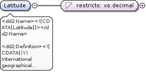
<dd2:Name><![CDATA[Latitude]]></dd2:Name><dd2:Definition><![CDATA[(Y) International geographical co-ordinates in decimal degrees format.]]></dd2:Definition><dd3:Methodology><![CDATA[This is a required, not null field.
Use the common geodetic datum ETRS89. WGS84 should be used for overseas areas and can be used for TCM data as well.
Use negative values for coordinates south of the Equator (0°).
Please round the coordinates to 4 - 5 decimal places, depending on your input data precision (0.0001° = about 10 m).
Where TCM stations represent a broader area, the central location of the area should be provided.]]></dd3:Methodology><dd3:PublicOrInternal><![CDATA[undefined]]></dd3:PublicOrInternal>
<xs:element name="Latitude"><xs:annotation><xs:documentation xml:lang="en"><dd2:Name><![CDATA[Latitude]]></dd2:Name><dd2:Definition><![CDATA[(Y) International geographical co-ordinates in decimal degrees format.]]></dd2:Definition><dd3:Methodology><![CDATA[This is a required, not null field.
Use the common geodetic datum ETRS89. WGS84 should be used for overseas areas and can be used for TCM data as well.
Use negative values for coordinates south of the Equator (0°).
Please round the coordinates to 4 - 5 decimal places, depending on your input data precision (0.0001° = about 10 m).
Where TCM stations represent a broader area, the central location of the area should be provided.]]></dd3:Methodology><dd3:PublicOrInternal><![CDATA[undefined]]></dd3:PublicOrInternal></xs:documentation></xs:annotation><xs:simpleType><xs:restriction base="xs:decimal"><xs:totalDigits value="12"/><xs:minInclusive value="-90"/><xs:maxInclusive value="90"/><xs:fractionDigits value="7"/></xs:restriction></xs:simpleType></xs:element>
<dd2:Keyword><![CDATA[Article V]]></dd2:Keyword><dd2:Keyword><![CDATA[Eutrophication]]></dd2:Keyword><dd2:Keyword><![CDATA[Groundwater]]></dd2:Keyword><dd2:Keyword><![CDATA[NO3]]></dd2:Keyword><dd2:Keyword><![CDATA[Surface water]]></dd2:Keyword><dd2:Keyword><![CDATA[Water]]></dd2:Keyword><dd2:Keyword><![CDATA[water quality]]></dd2:Keyword><dd3:EEAissue><![CDATA[Agriculture]]></dd3:EEAissue><dd3:EEAissue><![CDATA[Eutrophication ]]></dd3:EEAissue><dd3:EEAissue><![CDATA[Soil degradation and pollution]]></dd3:EEAissue><dd3:EEAissue><![CDATA[Water]]></dd3:EEAissue><dd2:Name><![CDATA[WFD station code]]></dd2:Name><dd2:Definition><![CDATA[Station (code) already in WFD database ]]></dd2:Definition><dd3:Methodology><![CDATA[Only to fill in if another code for this station has been reported to WFD.]]></dd3:Methodology><dd3:PublicOrInternal><![CDATA[undefined]]></dd3:PublicOrInternal>
<xs:element name="EU_CD"><xs:annotation><xs:documentation xml:lang="en"><dd2:Keyword><![CDATA[Article V]]></dd2:Keyword><dd2:Keyword><![CDATA[Eutrophication]]></dd2:Keyword><dd2:Keyword><![CDATA[Groundwater]]></dd2:Keyword><dd2:Keyword><![CDATA[NO3]]></dd2:Keyword><dd2:Keyword><![CDATA[Surface water]]></dd2:Keyword><dd2:Keyword><![CDATA[Water]]></dd2:Keyword><dd2:Keyword><![CDATA[water quality]]></dd2:Keyword><dd3:EEAissue><![CDATA[Agriculture]]></dd3:EEAissue><dd3:EEAissue><![CDATA[Eutrophication ]]></dd3:EEAissue><dd3:EEAissue><![CDATA[Soil degradation and pollution]]></dd3:EEAissue><dd3:EEAissue><![CDATA[Water]]></dd3:EEAissue><dd2:Name><![CDATA[WFD station code]]></dd2:Name><dd2:Definition><![CDATA[Station (code) already in WFD database ]]></dd2:Definition><dd3:Methodology><![CDATA[Only to fill in if another code for this station has been reported to WFD.]]></dd3:Methodology><dd3:PublicOrInternal><![CDATA[undefined]]></dd3:PublicOrInternal></xs:documentation></xs:annotation><xs:simpleType><xs:restriction base="xs:string"><xs:minLength value="0"/><xs:maxLength value="50"/></xs:restriction></xs:simpleType></xs:element>
<dd2:Keyword><![CDATA[Article V]]></dd2:Keyword><dd2:Keyword><![CDATA[Eutrophication]]></dd2:Keyword><dd2:Keyword><![CDATA[Groundwater]]></dd2:Keyword><dd2:Keyword><![CDATA[NO3]]></dd2:Keyword><dd2:Keyword><![CDATA[Surface water]]></dd2:Keyword><dd2:Keyword><![CDATA[Water]]></dd2:Keyword><dd2:Keyword><![CDATA[water quality]]></dd2:Keyword><dd3:EEAissue><![CDATA[Agriculture]]></dd3:EEAissue><dd3:EEAissue><![CDATA[Eutrophication ]]></dd3:EEAissue><dd3:EEAissue><![CDATA[Soil degradation and pollution]]></dd3:EEAissue><dd3:EEAissue><![CDATA[Water]]></dd3:EEAissue><dd2:Name><![CDATA[Waterbase station code]]></dd2:Name><dd2:Definition><![CDATA[Station (code) already in WB (WaterBase)]]></dd2:Definition><dd3:Methodology><![CDATA[Only to fill in if another code for this station has been reported under the Eionet/Water or Waterbase.]]></dd3:Methodology><dd3:PublicOrInternal><![CDATA[undefined]]></dd3:PublicOrInternal>
<xs:element name="WaterbaseID"><xs:annotation><xs:documentation xml:lang="en"><dd2:Keyword><![CDATA[Article V]]></dd2:Keyword><dd2:Keyword><![CDATA[Eutrophication]]></dd2:Keyword><dd2:Keyword><![CDATA[Groundwater]]></dd2:Keyword><dd2:Keyword><![CDATA[NO3]]></dd2:Keyword><dd2:Keyword><![CDATA[Surface water]]></dd2:Keyword><dd2:Keyword><![CDATA[Water]]></dd2:Keyword><dd2:Keyword><![CDATA[water quality]]></dd2:Keyword><dd3:EEAissue><![CDATA[Agriculture]]></dd3:EEAissue><dd3:EEAissue><![CDATA[Eutrophication ]]></dd3:EEAissue><dd3:EEAissue><![CDATA[Soil degradation and pollution]]></dd3:EEAissue><dd3:EEAissue><![CDATA[Water]]></dd3:EEAissue><dd2:Name><![CDATA[Waterbase station code]]></dd2:Name><dd2:Definition><![CDATA[Station (code) already in WB (WaterBase)]]></dd2:Definition><dd3:Methodology><![CDATA[Only to fill in if another code for this station has been reported under the Eionet/Water or Waterbase.]]></dd3:Methodology><dd3:PublicOrInternal><![CDATA[undefined]]></dd3:PublicOrInternal></xs:documentation></xs:annotation><xs:simpleType><xs:restriction base="xs:string"><xs:minLength value="0"/><xs:maxLength value="50"/></xs:restriction></xs:simpleType></xs:element>
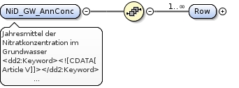
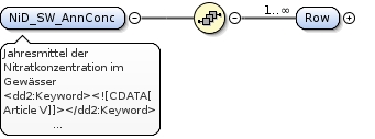
Jahresmittel der Nitratkonzentration im Grundwasser
<dd2:Keyword><![CDATA[Article V]]></dd2:Keyword><dd2:Keyword><![CDATA[Eutrophication]]></dd2:Keyword><dd2:Keyword><![CDATA[Groundwater]]></dd2:Keyword><dd2:Keyword><![CDATA[NO3]]></dd2:Keyword><dd2:Keyword><![CDATA[Surface water]]></dd2:Keyword><dd2:Keyword><![CDATA[Water]]></dd2:Keyword><dd2:Keyword><![CDATA[water quality]]></dd2:Keyword><dd3:EEAissue><![CDATA[Agriculture]]></dd3:EEAissue><dd3:EEAissue><![CDATA[Eutrophication ]]></dd3:EEAissue><dd3:EEAissue><![CDATA[Soil degradation and pollution]]></dd3:EEAissue><dd3:EEAissue><![CDATA[Water]]></dd3:EEAissue><dd2:Name><![CDATA[NO3 average annual concentrations in groundwater]]></dd2:Name><dd2:Definition><![CDATA[NO3 average annual concentrations measured in each groundwater monitoring station.]]></dd2:Definition><dd3:ShortDescription><![CDATA[NO3 average annual values for each groundwater monitoring station]]></dd3:ShortDescription><dd3:Methodology><![CDATA[Data on groundwater monitoring stations are collected for each reporting period (4 year period). For each station the average (mean) annual concentration for NO3 have to be reported.
The combination of the elements CountryCode, NationalStationCode, StationType and ND_Year must create a unique record in the table. No duplicate records should exist with this combination.
Please consider the following when compiling your data delivery:
1. Submit data for each sample site (no aggregation of stations).
2. Submit NO3 concentrations sampled in one station during a period of one year in one record.
3. Individual records should be provided for each year within reporting period (2008 - 2011), i.e. four records for one station with different ND_Year value are allowed.
4. mg/l NO3 is the mandatory measurement unit for Average annual concentration values
Filling out the tables:
All elements are required to be filled out unless “optional” or "voluntary" has been indicated or unless the element is not
applicable (e.g. if a monitoring station is not used for reporting for WFD, the element EU_CD cannot be filled out.)
If “mandatory” or "required" is indicated, the element shall always be filled in. After submitting the table in Reportnet, the QA in Reportnet will give an error message if the content of the cell will be empty.]]></dd3:Methodology>
<xs:element name="NiD_GW_AnnConc"><xs:annotation><xs:documentation xml:lang="de">Jahresmittel der Nitratkonzentration im Grundwasser</xs:documentation><xs:documentation xml:lang="en"><dd2:Keyword><![CDATA[Article V]]></dd2:Keyword><dd2:Keyword><![CDATA[Eutrophication]]></dd2:Keyword><dd2:Keyword><![CDATA[Groundwater]]></dd2:Keyword><dd2:Keyword><![CDATA[NO3]]></dd2:Keyword><dd2:Keyword><![CDATA[Surface water]]></dd2:Keyword><dd2:Keyword><![CDATA[Water]]></dd2:Keyword><dd2:Keyword><![CDATA[water quality]]></dd2:Keyword><dd3:EEAissue><![CDATA[Agriculture]]></dd3:EEAissue><dd3:EEAissue><![CDATA[Eutrophication ]]></dd3:EEAissue><dd3:EEAissue><![CDATA[Soil degradation and pollution]]></dd3:EEAissue><dd3:EEAissue><![CDATA[Water]]></dd3:EEAissue><dd2:Name><![CDATA[NO3 average annual concentrations in groundwater]]></dd2:Name><dd2:Definition><![CDATA[NO3 average annual concentrations measured in each groundwater monitoring station.]]></dd2:Definition><dd3:ShortDescription><![CDATA[NO3 average annual values for each groundwater monitoring station]]></dd3:ShortDescription><dd3:Methodology><![CDATA[Data on groundwater monitoring stations are collected for each reporting period (4 year period). For each station the average (mean) annual concentration for NO3 have to be reported.
The combination of the elements CountryCode, NationalStationCode, StationType and ND_Year must create a unique record in the table. No duplicate records should exist with this combination.
Please consider the following when compiling your data delivery:
1. Submit data for each sample site (no aggregation of stations).
2. Submit NO3 concentrations sampled in one station during a period of one year in one record.
3. Individual records should be provided for each year within reporting period (2008 - 2011), i.e. four records for one station with different ND_Year value are allowed.
4. mg/l NO3 is the mandatory measurement unit for Average annual concentration values
Filling out the tables:
All elements are required to be filled out unless “optional” or "voluntary" has been indicated or unless the element is not
applicable (e.g. if a monitoring station is not used for reporting for WFD, the element EU_CD cannot be filled out.)
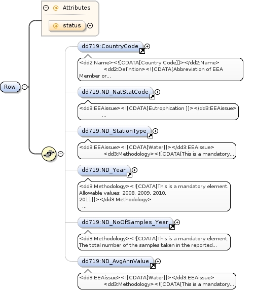
If “mandatory” or "required" is indicated, the element shall always be filled in. After submitting the table in Reportnet, the QA in Reportnet will give an error message if the content of the cell will be empty.]]></dd3:Methodology></xs:documentation></xs:annotation><xs:complexType><xs:sequence><xs:element maxOccurs="unbounded" minOccurs="1" name="Row"><xs:complexType><xs:sequence><xs:element maxOccurs="1" minOccurs="0" ref="dd718:CountryCode"/><xs:element maxOccurs="1" minOccurs="0" ref="dd718:ND_NatStatCode"/><xs:element maxOccurs="1" minOccurs="0" ref="dd718:ND_StationType"/><xs:element maxOccurs="1" minOccurs="0" ref="dd718:ND_Year"/><xs:element maxOccurs="1" minOccurs="0" ref="dd718:ND_NoOfSamples_Year"/><xs:element maxOccurs="1" minOccurs="0" ref="dd718:ND_AvgAnnValue"/></xs:sequence><xs:attribute name="status" type="xs:string" use="optional"/></xs:complexType></xs:element></xs:sequence></xs:complexType></xs:element>
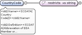
<dd2:Name><![CDATA[Country Code]]></dd2:Name><dd2:Definition><![CDATA[Abbreviation of EEA Member or Collaborating Country, as defined in the codelist.]]></dd2:Definition><dd3:Methodology><![CDATA[This is a required, not null field.
ISO 3166-alpha-2 code elements.]]></dd3:Methodology><dd3:PublicOrInternal><![CDATA[undefined]]></dd3:PublicOrInternal>
<dd3:EEAissue><![CDATA[Eutrophication ]]></dd3:EEAissue><dd3:EEAissue><![CDATA[Water]]></dd3:EEAissue><dd3:Methodology><![CDATA[This is a mandatory element.
The combination of the fields CountryCode, NationalStationCode and StationType must be a unique record in the table. No duplicate records should exist with this combination.]]></dd3:Methodology><dd2:Keyword><![CDATA[water quality]]></dd2:Keyword><dd2:Keyword><![CDATA[Surface water]]></dd2:Keyword><dd2:Keyword><![CDATA[NO3]]></dd2:Keyword><dd2:Keyword><![CDATA[Groundwater]]></dd2:Keyword><dd2:Keyword><![CDATA[Article V]]></dd2:Keyword><dd3:PublicOrInternal><![CDATA[undefined]]></dd3:PublicOrInternal><dd2:Name><![CDATA[National station code]]></dd2:Name><dd2:Definition><![CDATA[Nationally assigned, unique identifier of the groundwater monitoring station or surface water monitoring station (river, lake, transitional, coastal, marine). ]]></dd2:Definition>
<xs:element name="ND_NatStatCode"><xs:annotation><xs:documentation xml:lang="en"><dd3:EEAissue><![CDATA[Eutrophication ]]></dd3:EEAissue><dd3:EEAissue><![CDATA[Water]]></dd3:EEAissue><dd3:Methodology><![CDATA[This is a mandatory element.
The combination of the fields CountryCode, NationalStationCode and StationType must be a unique record in the table. No duplicate records should exist with this combination.]]></dd3:Methodology><dd2:Keyword><![CDATA[water quality]]></dd2:Keyword><dd2:Keyword><![CDATA[Surface water]]></dd2:Keyword><dd2:Keyword><![CDATA[NO3]]></dd2:Keyword><dd2:Keyword><![CDATA[Groundwater]]></dd2:Keyword><dd2:Keyword><![CDATA[Article V]]></dd2:Keyword><dd3:PublicOrInternal><![CDATA[undefined]]></dd3:PublicOrInternal><dd2:Name><![CDATA[National station code]]></dd2:Name><dd2:Definition><![CDATA[Nationally assigned, unique identifier of the groundwater monitoring station or surface water monitoring station (river, lake, transitional, coastal, marine). ]]></dd2:Definition></xs:documentation></xs:annotation><xs:simpleType><xs:restriction base="xs:string"><xs:minLength value="0"/><xs:maxLength value="50"/></xs:restriction></xs:simpleType></xs:element>
<dd3:EEAissue><![CDATA[Water]]></dd3:EEAissue><dd3:Methodology><![CDATA[This is a mandatory element.
For the Station Type use the "station Type" codelist. The combination of the fields CountryCode, NationalStationCode and StationType must be a unique record in the table. No duplicate records should exist with this combination.]]></dd3:Methodology><dd2:Keyword><![CDATA[water quality]]></dd2:Keyword><dd2:Keyword><![CDATA[Surface water]]></dd2:Keyword><dd2:Keyword><![CDATA[NO3]]></dd2:Keyword><dd2:Keyword><![CDATA[Monitoring station]]></dd2:Keyword><dd2:Keyword><![CDATA[Groundwater]]></dd2:Keyword><dd2:Keyword><![CDATA[Water]]></dd2:Keyword><dd2:Keyword><![CDATA[Article V]]></dd2:Keyword><dd3:PublicOrInternal><![CDATA[undefined]]></dd3:PublicOrInternal><dd2:Name><![CDATA[Station type]]></dd2:Name><dd2:Definition><![CDATA[Station Type as defined in the codelist]]></dd2:Definition>
<xs:element name="ND_StationType"><xs:annotation><xs:documentation xml:lang="en"><dd3:EEAissue><![CDATA[Water]]></dd3:EEAissue><dd3:Methodology><![CDATA[This is a mandatory element.
For the Station Type use the "station Type" codelist. The combination of the fields CountryCode, NationalStationCode and StationType must be a unique record in the table. No duplicate records should exist with this combination.]]></dd3:Methodology><dd2:Keyword><![CDATA[water quality]]></dd2:Keyword><dd2:Keyword><![CDATA[Surface water]]></dd2:Keyword><dd2:Keyword><![CDATA[NO3]]></dd2:Keyword><dd2:Keyword><![CDATA[Monitoring station]]></dd2:Keyword><dd2:Keyword><![CDATA[Groundwater]]></dd2:Keyword><dd2:Keyword><![CDATA[Water]]></dd2:Keyword><dd2:Keyword><![CDATA[Article V]]></dd2:Keyword><dd3:PublicOrInternal><![CDATA[undefined]]></dd3:PublicOrInternal><dd2:Name><![CDATA[Station type]]></dd2:Name><dd2:Definition><![CDATA[Station Type as defined in the codelist]]></dd2:Definition></xs:documentation></xs:annotation><xs:simpleType><xs:restriction base="xs:string"><xs:enumeration value="0"/><xs:enumeration value="1a"/><xs:enumeration value="1b"/><xs:enumeration value="1c"/><xs:enumeration value="2"/><xs:enumeration value="3"/><xs:enumeration value="4"/><xs:enumeration value="5"/><xs:enumeration value="6"/><xs:enumeration value="7"/><xs:enumeration value="8"/></xs:restriction></xs:simpleType></xs:element>
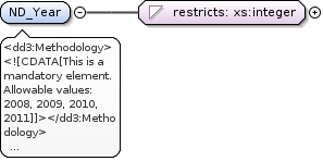
<dd3:Methodology><![CDATA[This is a mandatory element.
Allowable values: 2008, 2009, 2010, 2011]]></dd3:Methodology><dd3:PublicOrInternal><![CDATA[undefined]]></dd3:PublicOrInternal><dd2:Name><![CDATA[Year]]></dd2:Name><dd2:Definition><![CDATA[Year for which Average annual concentration value in given record reported for Nitrate directive is provided]]></dd2:Definition>
<xs:element name="ND_Year"><xs:annotation><xs:documentation xml:lang="en"><dd3:Methodology><![CDATA[This is a mandatory element.
Allowable values: 2008, 2009, 2010, 2011]]></dd3:Methodology><dd3:PublicOrInternal><![CDATA[undefined]]></dd3:PublicOrInternal><dd2:Name><![CDATA[Year]]></dd2:Name><dd2:Definition><![CDATA[Year for which Average annual concentration value in given record reported for Nitrate directive is provided]]></dd2:Definition></xs:documentation></xs:annotation><xs:simpleType><xs:restriction base="xs:integer"><xs:totalDigits value="4"/><xs:minInclusive value="2008"/><xs:maxInclusive value="2011"/></xs:restriction></xs:simpleType></xs:element>
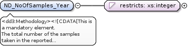
<dd3:Methodology><![CDATA[This is a mandatory element.
The total number of the samples taken in the reported year.]]></dd3:Methodology><dd3:PublicOrInternal><![CDATA[undefined]]></dd3:PublicOrInternal><dd2:Name><![CDATA[Number of samples in year]]></dd2:Name><dd2:Definition><![CDATA[Number of samples taken within the reported year]]></dd2:Definition>
<xs:element name="ND_NoOfSamples_Year"><xs:annotation><xs:documentation xml:lang="en"><dd3:Methodology><![CDATA[This is a mandatory element.
The total number of the samples taken in the reported year.]]></dd3:Methodology><dd3:PublicOrInternal><![CDATA[undefined]]></dd3:PublicOrInternal><dd2:Name><![CDATA[Number of samples in year]]></dd2:Name><dd2:Definition><![CDATA[Number of samples taken within the reported year]]></dd2:Definition></xs:documentation></xs:annotation><xs:simpleType><xs:restriction base="xs:integer"><xs:totalDigits value="4"/><xs:minInclusive value="1"/></xs:restriction></xs:simpleType></xs:element>
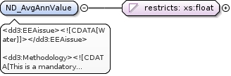
<dd3:EEAissue><![CDATA[Water]]></dd3:EEAissue><dd3:Methodology><![CDATA[This is a mandatory element.
Requested annual concentration measurement unit: mg/l NO3]]></dd3:Methodology><dd2:Keyword><![CDATA[water quality]]></dd2:Keyword><dd2:Keyword><![CDATA[NO3]]></dd2:Keyword><dd3:PublicOrInternal><![CDATA[undefined]]></dd3:PublicOrInternal><dd2:Name><![CDATA[Average annual value]]></dd2:Name><dd2:Definition><![CDATA[Average(mean) annual concentration of NO3 for the measurement period. ]]></dd2:Definition>
<dd2:Keyword><![CDATA[Article V]]></dd2:Keyword><dd2:Keyword><![CDATA[Eutrophication]]></dd2:Keyword><dd2:Keyword><![CDATA[Groundwater]]></dd2:Keyword><dd2:Keyword><![CDATA[NO3]]></dd2:Keyword><dd2:Keyword><![CDATA[Surface water]]></dd2:Keyword><dd2:Keyword><![CDATA[Water]]></dd2:Keyword><dd2:Keyword><![CDATA[water quality]]></dd2:Keyword><dd3:EEAissue><![CDATA[Agriculture]]></dd3:EEAissue><dd3:EEAissue><![CDATA[Eutrophication ]]></dd3:EEAissue><dd3:EEAissue><![CDATA[Soil degradation and pollution]]></dd3:EEAissue><dd3:EEAissue><![CDATA[Water]]></dd3:EEAissue><dd2:Name><![CDATA[NO3 concentrations in groundwater]]></dd2:Name><dd2:Definition><![CDATA[NO3 concentrations measured in each groundwater monitoring station.]]></dd2:Definition><dd3:ShortDescription><![CDATA[NO3 values for each groundwater monitoring station]]></dd3:ShortDescription><dd3:Methodology><![CDATA[Data on groundwater monitoring stations are collected for each reporting period (4 year period). For each station the maximum value for NO3 have to be reported. If the same station (at same depth) has been used for monitoring in the previous period, a trend value (average current reporting period - average previous reporting period) can be indicated.
The combination of the elements CountryCode, NationalStationCode and StationType must create a unique record in the table. No duplicate records should exist with this combination.
Please consider the following when compiling your data delivery:
1. Submit data for each sample site (no aggregation of stations).
2. mg/l NO3 is the mandatory measurement unit for all concentration values provided in this table
Filling out the tables:
All elements are required to be filled out unless “optional” or "voluntary" has been indicated or unless the element is not applicable (e.g. if a monitoring station is not used for reporting for WFD, the element EU_CD cannot be filled out.)
If “mandatory” or "required" is indicated, the element shall always be filled in. and after submitting the table in Reportnet, the QA in Reportnet will give an error message if the content of the cell will be empty.]]></dd3:Methodology>
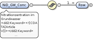
<xs:element name="NiD_GW_Conc"><xs:annotation><xs:documentation xml:lang="de">Nitratkonzentration im Grundwasser</xs:documentation><xs:documentation xml:lang="en"><dd2:Keyword><![CDATA[Article V]]></dd2:Keyword><dd2:Keyword><![CDATA[Eutrophication]]></dd2:Keyword><dd2:Keyword><![CDATA[Groundwater]]></dd2:Keyword><dd2:Keyword><![CDATA[NO3]]></dd2:Keyword><dd2:Keyword><![CDATA[Surface water]]></dd2:Keyword><dd2:Keyword><![CDATA[Water]]></dd2:Keyword><dd2:Keyword><![CDATA[water quality]]></dd2:Keyword><dd3:EEAissue><![CDATA[Agriculture]]></dd3:EEAissue><dd3:EEAissue><![CDATA[Eutrophication ]]></dd3:EEAissue><dd3:EEAissue><![CDATA[Soil degradation and pollution]]></dd3:EEAissue><dd3:EEAissue><![CDATA[Water]]></dd3:EEAissue><dd2:Name><![CDATA[NO3 concentrations in groundwater]]></dd2:Name><dd2:Definition><![CDATA[NO3 concentrations measured in each groundwater monitoring station.]]></dd2:Definition><dd3:ShortDescription><![CDATA[NO3 values for each groundwater monitoring station]]></dd3:ShortDescription><dd3:Methodology><![CDATA[Data on groundwater monitoring stations are collected for each reporting period (4 year period). For each station the maximum value for NO3 have to be reported. If the same station (at same depth) has been used for monitoring in the previous period, a trend value (average current reporting period - average previous reporting period) can be indicated.
The combination of the elements CountryCode, NationalStationCode and StationType must create a unique record in the table. No duplicate records should exist with this combination.
Please consider the following when compiling your data delivery:
1. Submit data for each sample site (no aggregation of stations).
2. mg/l NO3 is the mandatory measurement unit for all concentration values provided in this table
Filling out the tables:
All elements are required to be filled out unless “optional” or "voluntary" has been indicated or unless the element is not applicable (e.g. if a monitoring station is not used for reporting for WFD, the element EU_CD cannot be filled out.)
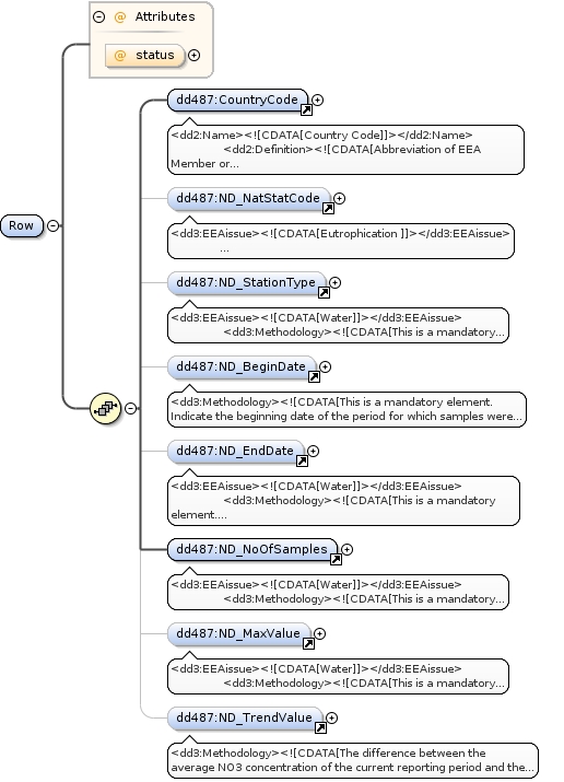
If “mandatory” or "required" is indicated, the element shall always be filled in. and after submitting the table in Reportnet, the QA in Reportnet will give an error message if the content of the cell will be empty.]]></dd3:Methodology></xs:documentation></xs:annotation><xs:complexType><xs:sequence><xs:element maxOccurs="unbounded" minOccurs="1" name="Row"><xs:complexType><xs:sequence><xs:element maxOccurs="1" minOccurs="1" ref="dd487:CountryCode"/><xs:element maxOccurs="1" minOccurs="0" ref="dd487:ND_NatStatCode"/><xs:element maxOccurs="1" minOccurs="0" ref="dd487:ND_StationType"/><xs:element maxOccurs="1" minOccurs="0" ref="dd487:ND_BeginDate"/><xs:element maxOccurs="1" minOccurs="0" ref="dd487:ND_EndDate"/><xs:element maxOccurs="1" minOccurs="1" ref="dd487:ND_NoOfSamples"/><xs:element maxOccurs="1" minOccurs="0" ref="dd487:ND_MaxValue"/><xs:element maxOccurs="1" minOccurs="0" ref="dd487:ND_TrendValue"/></xs:sequence><xs:attribute name="status" type="xs:string" use="optional"/></xs:complexType></xs:element></xs:sequence></xs:complexType></xs:element>
<dd2:Name><![CDATA[Country Code]]></dd2:Name><dd2:Definition><![CDATA[Abbreviation of EEA Member or Collaborating Country, as defined in the codelist.]]></dd2:Definition><dd3:Methodology><![CDATA[This is a required, not null field.
ISO 3166-alpha-2 code elements.]]></dd3:Methodology><dd3:PublicOrInternal><![CDATA[undefined]]></dd3:PublicOrInternal>
<dd3:EEAissue><![CDATA[Eutrophication ]]></dd3:EEAissue><dd3:EEAissue><![CDATA[Water]]></dd3:EEAissue><dd3:Methodology><![CDATA[This is a mandatory element.
The combination of the fields CountryCode, NationalStationCode and StationType must be a unique record in the table. No duplicate records should exist with this combination.]]></dd3:Methodology><dd2:Keyword><![CDATA[water quality]]></dd2:Keyword><dd2:Keyword><![CDATA[Surface water]]></dd2:Keyword><dd2:Keyword><![CDATA[NO3]]></dd2:Keyword><dd2:Keyword><![CDATA[Groundwater]]></dd2:Keyword><dd2:Keyword><![CDATA[Article V]]></dd2:Keyword><dd3:PublicOrInternal><![CDATA[undefined]]></dd3:PublicOrInternal><dd2:Name><![CDATA[National station code]]></dd2:Name><dd2:Definition><![CDATA[Nationally assigned, unique identifier of the groundwater monitoring station or surface water monitoring station (river, lake, transitional, coastal, marine). ]]></dd2:Definition>
<xs:element name="ND_NatStatCode"><xs:annotation><xs:documentation xml:lang="en"><dd3:EEAissue><![CDATA[Eutrophication ]]></dd3:EEAissue><dd3:EEAissue><![CDATA[Water]]></dd3:EEAissue><dd3:Methodology><![CDATA[This is a mandatory element.
The combination of the fields CountryCode, NationalStationCode and StationType must be a unique record in the table. No duplicate records should exist with this combination.]]></dd3:Methodology><dd2:Keyword><![CDATA[water quality]]></dd2:Keyword><dd2:Keyword><![CDATA[Surface water]]></dd2:Keyword><dd2:Keyword><![CDATA[NO3]]></dd2:Keyword><dd2:Keyword><![CDATA[Groundwater]]></dd2:Keyword><dd2:Keyword><![CDATA[Article V]]></dd2:Keyword><dd3:PublicOrInternal><![CDATA[undefined]]></dd3:PublicOrInternal><dd2:Name><![CDATA[National station code]]></dd2:Name><dd2:Definition><![CDATA[Nationally assigned, unique identifier of the groundwater monitoring station or surface water monitoring station (river, lake, transitional, coastal, marine). ]]></dd2:Definition></xs:documentation></xs:annotation><xs:simpleType><xs:restriction base="xs:string"><xs:minLength value="0"/><xs:maxLength value="50"/></xs:restriction></xs:simpleType></xs:element>
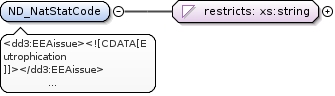
<dd3:EEAissue><![CDATA[Water]]></dd3:EEAissue><dd3:Methodology><![CDATA[This is a mandatory element.
For the Station Type use the "station Type" codelist. The combination of the fields CountryCode, NationalStationCode and StationType must be a unique record in the table. No duplicate records should exist with this combination.]]></dd3:Methodology><dd2:Keyword><![CDATA[water quality]]></dd2:Keyword><dd2:Keyword><![CDATA[Surface water]]></dd2:Keyword><dd2:Keyword><![CDATA[NO3]]></dd2:Keyword><dd2:Keyword><![CDATA[Monitoring station]]></dd2:Keyword><dd2:Keyword><![CDATA[Groundwater]]></dd2:Keyword><dd2:Keyword><![CDATA[Water]]></dd2:Keyword><dd2:Keyword><![CDATA[Article V]]></dd2:Keyword><dd3:PublicOrInternal><![CDATA[undefined]]></dd3:PublicOrInternal><dd2:Name><![CDATA[Station type]]></dd2:Name><dd2:Definition><![CDATA[Station Type as defined in the codelist]]></dd2:Definition>
<xs:element name="ND_StationType"><xs:annotation><xs:documentation xml:lang="en"><dd3:EEAissue><![CDATA[Water]]></dd3:EEAissue><dd3:Methodology><![CDATA[This is a mandatory element.
For the Station Type use the "station Type" codelist. The combination of the fields CountryCode, NationalStationCode and StationType must be a unique record in the table. No duplicate records should exist with this combination.]]></dd3:Methodology><dd2:Keyword><![CDATA[water quality]]></dd2:Keyword><dd2:Keyword><![CDATA[Surface water]]></dd2:Keyword><dd2:Keyword><![CDATA[NO3]]></dd2:Keyword><dd2:Keyword><![CDATA[Monitoring station]]></dd2:Keyword><dd2:Keyword><![CDATA[Groundwater]]></dd2:Keyword><dd2:Keyword><![CDATA[Water]]></dd2:Keyword><dd2:Keyword><![CDATA[Article V]]></dd2:Keyword><dd3:PublicOrInternal><![CDATA[undefined]]></dd3:PublicOrInternal><dd2:Name><![CDATA[Station type]]></dd2:Name><dd2:Definition><![CDATA[Station Type as defined in the codelist]]></dd2:Definition></xs:documentation></xs:annotation><xs:simpleType><xs:restriction base="xs:string"><xs:enumeration value="0"/><xs:enumeration value="1a"/><xs:enumeration value="1b"/><xs:enumeration value="1c"/><xs:enumeration value="2"/><xs:enumeration value="3"/><xs:enumeration value="4"/><xs:enumeration value="5"/><xs:enumeration value="6"/><xs:enumeration value="7"/><xs:enumeration value="8"/></xs:restriction></xs:simpleType></xs:element>
<dd3:Methodology><![CDATA[This is a mandatory element.
Indicate the beginning date of the period for which samples were taken.]]></dd3:Methodology><dd3:PublicOrInternal><![CDATA[undefined]]></dd3:PublicOrInternal><dd2:Name><![CDATA[Beginning date]]></dd2:Name><dd2:Definition><![CDATA[Last date of measurement period in format YYYY-MM-DD. ]]></dd2:Definition>
<xs:element name="ND_BeginDate"><xs:annotation><xs:documentation xml:lang="en"><dd3:Methodology><![CDATA[This is a mandatory element.
Indicate the beginning date of the period for which samples were taken.]]></dd3:Methodology><dd3:PublicOrInternal><![CDATA[undefined]]></dd3:PublicOrInternal><dd2:Name><![CDATA[Beginning date]]></dd2:Name><dd2:Definition><![CDATA[Last date of measurement period in format YYYY-MM-DD. ]]></dd2:Definition></xs:documentation></xs:annotation><xs:simpleType><xs:restriction base="xs:date"></xs:restriction></xs:simpleType></xs:element>
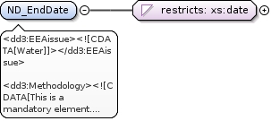
<dd3:EEAissue><![CDATA[Water]]></dd3:EEAissue><dd3:Methodology><![CDATA[This is a mandatory element.
Indicate the end date of the period for which samples were taken.]]></dd3:Methodology><dd2:Keyword><![CDATA[NO3]]></dd2:Keyword><dd2:Keyword><![CDATA[Eutrophication]]></dd2:Keyword><dd2:Keyword><![CDATA[Water]]></dd2:Keyword><dd2:Keyword><![CDATA[Article V]]></dd2:Keyword><dd3:PublicOrInternal><![CDATA[undefined]]></dd3:PublicOrInternal><dd2:Name><![CDATA[End date]]></dd2:Name><dd2:Definition><![CDATA[Last date of measurment period in format YYYY-MM-DD]]></dd2:Definition>
<xs:element name="ND_EndDate"><xs:annotation><xs:documentation xml:lang="en"><dd3:EEAissue><![CDATA[Water]]></dd3:EEAissue><dd3:Methodology><![CDATA[This is a mandatory element.
Indicate the end date of the period for which samples were taken.]]></dd3:Methodology><dd2:Keyword><![CDATA[NO3]]></dd2:Keyword><dd2:Keyword><![CDATA[Eutrophication]]></dd2:Keyword><dd2:Keyword><![CDATA[Water]]></dd2:Keyword><dd2:Keyword><![CDATA[Article V]]></dd2:Keyword><dd3:PublicOrInternal><![CDATA[undefined]]></dd3:PublicOrInternal><dd2:Name><![CDATA[End date]]></dd2:Name><dd2:Definition><![CDATA[Last date of measurment period in format YYYY-MM-DD]]></dd2:Definition></xs:documentation></xs:annotation><xs:simpleType><xs:restriction base="xs:date"></xs:restriction></xs:simpleType></xs:element>
<dd3:EEAissue><![CDATA[Water]]></dd3:EEAissue><dd3:Methodology><![CDATA[This is a mandatory element.
The total number of the samples taken in the whole measurement period.]]></dd3:Methodology><dd2:Keyword><![CDATA[water quality]]></dd2:Keyword><dd2:Keyword><![CDATA[Surface water]]></dd2:Keyword><dd2:Keyword><![CDATA[NO3]]></dd2:Keyword><dd2:Keyword><![CDATA[Eutrophication]]></dd2:Keyword><dd2:Keyword><![CDATA[Groundwater]]></dd2:Keyword><dd2:Keyword><![CDATA[Water]]></dd2:Keyword><dd2:Keyword><![CDATA[Article V]]></dd2:Keyword><dd3:PublicOrInternal><![CDATA[undefined]]></dd3:PublicOrInternal><dd2:Name><![CDATA[Number of samples]]></dd2:Name><dd2:Definition><![CDATA[Number of samples taken within the whole measurement period.]]></dd2:Definition>
<xs:element name="ND_NoOfSamples"><xs:annotation><xs:documentation xml:lang="en"><dd3:EEAissue><![CDATA[Water]]></dd3:EEAissue><dd3:Methodology><![CDATA[This is a mandatory element.
The total number of the samples taken in the whole measurement period.]]></dd3:Methodology><dd2:Keyword><![CDATA[water quality]]></dd2:Keyword><dd2:Keyword><![CDATA[Surface water]]></dd2:Keyword><dd2:Keyword><![CDATA[NO3]]></dd2:Keyword><dd2:Keyword><![CDATA[Eutrophication]]></dd2:Keyword><dd2:Keyword><![CDATA[Groundwater]]></dd2:Keyword><dd2:Keyword><![CDATA[Water]]></dd2:Keyword><dd2:Keyword><![CDATA[Article V]]></dd2:Keyword><dd3:PublicOrInternal><![CDATA[undefined]]></dd3:PublicOrInternal><dd2:Name><![CDATA[Number of samples]]></dd2:Name><dd2:Definition><![CDATA[Number of samples taken within the whole measurement period.]]></dd2:Definition></xs:documentation></xs:annotation><xs:simpleType><xs:restriction base="xs:integer"><xs:totalDigits value="4"/><xs:minInclusive value="1"/></xs:restriction></xs:simpleType></xs:element>
<dd3:EEAissue><![CDATA[Water]]></dd3:EEAissue><dd3:Methodology><![CDATA[This is a mandatory element.
The maximum concentration of NO3 in mg/L measured in the whole measurement period.]]></dd3:Methodology><dd2:Keyword><![CDATA[water quality]]></dd2:Keyword><dd2:Keyword><![CDATA[Surface water]]></dd2:Keyword><dd2:Keyword><![CDATA[NO3]]></dd2:Keyword><dd2:Keyword><![CDATA[Groundwater]]></dd2:Keyword><dd2:Keyword><![CDATA[Water]]></dd2:Keyword><dd2:Keyword><![CDATA[Article V]]></dd2:Keyword><dd3:PublicOrInternal><![CDATA[undefined]]></dd3:PublicOrInternal><dd2:Name><![CDATA[Maximum value]]></dd2:Name><dd2:Definition><![CDATA[Maximum concentration of NO3 for the whole measurement period]]></dd2:Definition>
<xs:element name="ND_MaxValue"><xs:annotation><xs:documentation xml:lang="en"><dd3:EEAissue><![CDATA[Water]]></dd3:EEAissue><dd3:Methodology><![CDATA[This is a mandatory element.
The maximum concentration of NO3 in mg/L measured in the whole measurement period.]]></dd3:Methodology><dd2:Keyword><![CDATA[water quality]]></dd2:Keyword><dd2:Keyword><![CDATA[Surface water]]></dd2:Keyword><dd2:Keyword><![CDATA[NO3]]></dd2:Keyword><dd2:Keyword><![CDATA[Groundwater]]></dd2:Keyword><dd2:Keyword><![CDATA[Water]]></dd2:Keyword><dd2:Keyword><![CDATA[Article V]]></dd2:Keyword><dd3:PublicOrInternal><![CDATA[undefined]]></dd3:PublicOrInternal><dd2:Name><![CDATA[Maximum value]]></dd2:Name><dd2:Definition><![CDATA[Maximum concentration of NO3 for the whole measurement period]]></dd2:Definition></xs:documentation></xs:annotation><xs:simpleType><xs:restriction base="xs:float"><xs:minInclusive value="0"/></xs:restriction></xs:simpleType></xs:element>
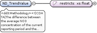
<dd3:Methodology><![CDATA[The difference between the average NO3 concentration of the current reporting period and the average of the previous reporting period (avg. current RP - avg. previous RP) in mg/L.
Trends can only be calculated for monitoring stations at the same location (X,Y) and measurements at the same depth. ]]></dd3:Methodology><dd3:PublicOrInternal><![CDATA[undefined]]></dd3:PublicOrInternal><dd2:Name><![CDATA[Trend Value]]></dd2:Name><dd2:Definition><![CDATA[Trends between the current and previous reporting periods based on annual average (mean) values.]]></dd2:Definition>
<xs:element name="ND_TrendValue"><xs:annotation><xs:documentation xml:lang="en"><dd3:Methodology><![CDATA[The difference between the average NO3 concentration of the current reporting period and the average of the previous reporting period (avg. current RP - avg. previous RP) in mg/L.
Trends can only be calculated for monitoring stations at the same location (X,Y) and measurements at the same depth. ]]></dd3:Methodology><dd3:PublicOrInternal><![CDATA[undefined]]></dd3:PublicOrInternal><dd2:Name><![CDATA[Trend Value]]></dd2:Name><dd2:Definition><![CDATA[Trends between the current and previous reporting periods based on annual average (mean) values.]]></dd2:Definition></xs:documentation></xs:annotation><xs:simpleType><xs:restriction base="xs:float"></xs:restriction></xs:simpleType></xs:element>
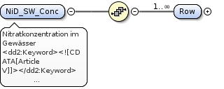
<dd2:Keyword><![CDATA[Article V]]></dd2:Keyword><dd2:Keyword><![CDATA[Eutrophication]]></dd2:Keyword><dd2:Keyword><![CDATA[Groundwater]]></dd2:Keyword><dd2:Keyword><![CDATA[NO3]]></dd2:Keyword><dd2:Keyword><![CDATA[Surface water]]></dd2:Keyword><dd2:Keyword><![CDATA[Water]]></dd2:Keyword><dd2:Keyword><![CDATA[water quality]]></dd2:Keyword><dd3:EEAissue><![CDATA[Agriculture]]></dd3:EEAissue><dd3:EEAissue><![CDATA[Eutrophication ]]></dd3:EEAissue><dd3:EEAissue><![CDATA[Soil degradation and pollution]]></dd3:EEAissue><dd3:EEAissue><![CDATA[Water]]></dd3:EEAissue><dd2:Name><![CDATA[List of surface monitoring stations]]></dd2:Name><dd2:Definition><![CDATA[Detailed information on the properties of the surface water monitoring stations. ]]></dd2:Definition><dd3:ShortDescription><![CDATA[Information on the surface water monitoring stations used to report water quality data under the Nitrates Directive. Data on lakes refer both to natural and artificial basins.]]></dd3:ShortDescription><dd3:Methodology><![CDATA[The data requested for Nitrates Directive should be derived from existing national and/or regional monitoring networks within each Member State.
This table should be used for all surface water monitoring stations. Discrimination between the surface water entities (river, lake, etc.) can be made by indicating the "Station type". The combination of the elements CountryCode, NationalStationCode and StationType must create a unique record in the table. No duplicate records should exist with this combination.
Please consider the following when compiling your data delivery:
Provide information on the monitoring stations. Station location must represent a point location.
Filling out the tables:
All elements are required to be filled out unless “optional” or "voluntary" has been indicated or unless the element is not applicable (e.g. if a monitoring station is not used for reporting for WFD, the element EU_CD cannot be filled out.)
If “mandatory” or "required" is indicated, the element shall always be filled in. and after submitting the table in Reportnet, the QA in Reportnet will give an error message if the content of the cell will be empty.
]]></dd3:Methodology>
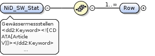
<xs:element name="NiD_SW_Stat"><xs:annotation><xs:documentation xml:lang="de">Gewässermessstellen</xs:documentation><xs:documentation xml:lang="en"><dd2:Keyword><![CDATA[Article V]]></dd2:Keyword><dd2:Keyword><![CDATA[Eutrophication]]></dd2:Keyword><dd2:Keyword><![CDATA[Groundwater]]></dd2:Keyword><dd2:Keyword><![CDATA[NO3]]></dd2:Keyword><dd2:Keyword><![CDATA[Surface water]]></dd2:Keyword><dd2:Keyword><![CDATA[Water]]></dd2:Keyword><dd2:Keyword><![CDATA[water quality]]></dd2:Keyword><dd3:EEAissue><![CDATA[Agriculture]]></dd3:EEAissue><dd3:EEAissue><![CDATA[Eutrophication ]]></dd3:EEAissue><dd3:EEAissue><![CDATA[Soil degradation and pollution]]></dd3:EEAissue><dd3:EEAissue><![CDATA[Water]]></dd3:EEAissue><dd2:Name><![CDATA[List of surface monitoring stations]]></dd2:Name><dd2:Definition><![CDATA[Detailed information on the properties of the surface water monitoring stations. ]]></dd2:Definition><dd3:ShortDescription><![CDATA[Information on the surface water monitoring stations used to report water quality data under the Nitrates Directive. Data on lakes refer both to natural and artificial basins.]]></dd3:ShortDescription><dd3:Methodology><![CDATA[The data requested for Nitrates Directive should be derived from existing national and/or regional monitoring networks within each Member State.
This table should be used for all surface water monitoring stations. Discrimination between the surface water entities (river, lake, etc.) can be made by indicating the "Station type". The combination of the elements CountryCode, NationalStationCode and StationType must create a unique record in the table. No duplicate records should exist with this combination.
Please consider the following when compiling your data delivery:
Provide information on the monitoring stations. Station location must represent a point location.
Filling out the tables:
All elements are required to be filled out unless “optional” or "voluntary" has been indicated or unless the element is not applicable (e.g. if a monitoring station is not used for reporting for WFD, the element EU_CD cannot be filled out.)
If “mandatory” or "required" is indicated, the element shall always be filled in. and after submitting the table in Reportnet, the QA in Reportnet will give an error message if the content of the cell will be empty.
]]></dd3:Methodology></xs:documentation></xs:annotation><xs:complexType><xs:sequence><xs:element maxOccurs="unbounded" minOccurs="1" name="Row"><xs:complexType><xs:sequence><xs:element maxOccurs="1" minOccurs="1" ref="dd488:CountryCode"/><xs:element maxOccurs="1" minOccurs="0" ref="dd488:ND_NatStatCode"/><xs:element maxOccurs="1" minOccurs="0" ref="dd488:ND_StationType"/><xs:element maxOccurs="1" minOccurs="0" ref="dd488:ND_NatStatName"/><xs:element maxOccurs="1" minOccurs="1" ref="dd488:WaterBodyID"/><xs:element maxOccurs="1" minOccurs="0" ref="dd488:WaterBodyName"/><xs:element maxOccurs="1" minOccurs="0" ref="dd488:ND_WatEntName"/><xs:element maxOccurs="1" minOccurs="0" ref="dd488:Altitude"/><xs:element maxOccurs="1" minOccurs="0" ref="dd488:ND_NatStatCodeND"/><xs:element maxOccurs="1" minOccurs="1" ref="dd488:Longitude"/><xs:element maxOccurs="1" minOccurs="1" ref="dd488:Latitude"/><xs:element maxOccurs="1" minOccurs="0" ref="dd488:EU_CD"/><xs:element maxOccurs="1" minOccurs="0" ref="dd488:WaterbaseID"/></xs:sequence><xs:attribute name="status" type="xs:string" use="optional"/></xs:complexType></xs:element></xs:sequence></xs:complexType></xs:element>
<dd2:Name><![CDATA[Country Code]]></dd2:Name><dd2:Definition><![CDATA[Abbreviation of EEA Member or Collaborating Country, as defined in the codelist.]]></dd2:Definition><dd3:Methodology><![CDATA[This is a required, not null field.
ISO 3166-alpha-2 code elements.]]></dd3:Methodology><dd3:PublicOrInternal><![CDATA[undefined]]></dd3:PublicOrInternal>
<dd3:EEAissue><![CDATA[Eutrophication ]]></dd3:EEAissue><dd3:EEAissue><![CDATA[Water]]></dd3:EEAissue><dd3:Methodology><![CDATA[This is a mandatory element.
The combination of the fields CountryCode, NationalStationCode and StationType must be a unique record in the table. No duplicate records should exist with this combination.]]></dd3:Methodology><dd2:Keyword><![CDATA[water quality]]></dd2:Keyword><dd2:Keyword><![CDATA[Surface water]]></dd2:Keyword><dd2:Keyword><![CDATA[NO3]]></dd2:Keyword><dd2:Keyword><![CDATA[Groundwater]]></dd2:Keyword><dd2:Keyword><![CDATA[Article V]]></dd2:Keyword><dd3:PublicOrInternal><![CDATA[undefined]]></dd3:PublicOrInternal><dd2:Name><![CDATA[National station code]]></dd2:Name><dd2:Definition><![CDATA[Nationally assigned, unique identifier of the groundwater monitoring station or surface water monitoring station (river, lake, transitional, coastal, marine). ]]></dd2:Definition>
<xs:element name="ND_NatStatCode"><xs:annotation><xs:documentation xml:lang="en"><dd3:EEAissue><![CDATA[Eutrophication ]]></dd3:EEAissue><dd3:EEAissue><![CDATA[Water]]></dd3:EEAissue><dd3:Methodology><![CDATA[This is a mandatory element.
The combination of the fields CountryCode, NationalStationCode and StationType must be a unique record in the table. No duplicate records should exist with this combination.]]></dd3:Methodology><dd2:Keyword><![CDATA[water quality]]></dd2:Keyword><dd2:Keyword><![CDATA[Surface water]]></dd2:Keyword><dd2:Keyword><![CDATA[NO3]]></dd2:Keyword><dd2:Keyword><![CDATA[Groundwater]]></dd2:Keyword><dd2:Keyword><![CDATA[Article V]]></dd2:Keyword><dd3:PublicOrInternal><![CDATA[undefined]]></dd3:PublicOrInternal><dd2:Name><![CDATA[National station code]]></dd2:Name><dd2:Definition><![CDATA[Nationally assigned, unique identifier of the groundwater monitoring station or surface water monitoring station (river, lake, transitional, coastal, marine). ]]></dd2:Definition></xs:documentation></xs:annotation><xs:simpleType><xs:restriction base="xs:string"><xs:minLength value="0"/><xs:maxLength value="50"/></xs:restriction></xs:simpleType></xs:element>
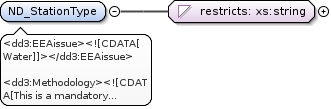
<dd3:EEAissue><![CDATA[Water]]></dd3:EEAissue><dd3:Methodology><![CDATA[This is a mandatory element.
For the Station Type use the "station Type" codelist. The combination of the fields CountryCode, NationalStationCode and StationType must be a unique record in the table. No duplicate records should exist with this combination.]]></dd3:Methodology><dd2:Keyword><![CDATA[water quality]]></dd2:Keyword><dd2:Keyword><![CDATA[Surface water]]></dd2:Keyword><dd2:Keyword><![CDATA[NO3]]></dd2:Keyword><dd2:Keyword><![CDATA[Monitoring station]]></dd2:Keyword><dd2:Keyword><![CDATA[Groundwater]]></dd2:Keyword><dd2:Keyword><![CDATA[Water]]></dd2:Keyword><dd2:Keyword><![CDATA[Article V]]></dd2:Keyword><dd3:PublicOrInternal><![CDATA[undefined]]></dd3:PublicOrInternal><dd2:Name><![CDATA[Station type]]></dd2:Name><dd2:Definition><![CDATA[Station Type as defined in the codelist]]></dd2:Definition>
<xs:element name="ND_StationType"><xs:annotation><xs:documentation xml:lang="en"><dd3:EEAissue><![CDATA[Water]]></dd3:EEAissue><dd3:Methodology><![CDATA[This is a mandatory element.
For the Station Type use the "station Type" codelist. The combination of the fields CountryCode, NationalStationCode and StationType must be a unique record in the table. No duplicate records should exist with this combination.]]></dd3:Methodology><dd2:Keyword><![CDATA[water quality]]></dd2:Keyword><dd2:Keyword><![CDATA[Surface water]]></dd2:Keyword><dd2:Keyword><![CDATA[NO3]]></dd2:Keyword><dd2:Keyword><![CDATA[Monitoring station]]></dd2:Keyword><dd2:Keyword><![CDATA[Groundwater]]></dd2:Keyword><dd2:Keyword><![CDATA[Water]]></dd2:Keyword><dd2:Keyword><![CDATA[Article V]]></dd2:Keyword><dd3:PublicOrInternal><![CDATA[undefined]]></dd3:PublicOrInternal><dd2:Name><![CDATA[Station type]]></dd2:Name><dd2:Definition><![CDATA[Station Type as defined in the codelist]]></dd2:Definition></xs:documentation></xs:annotation><xs:simpleType><xs:restriction base="xs:string"><xs:enumeration value="0"/><xs:enumeration value="1a"/><xs:enumeration value="1b"/><xs:enumeration value="1c"/><xs:enumeration value="2"/><xs:enumeration value="3"/><xs:enumeration value="4"/><xs:enumeration value="5"/><xs:enumeration value="6"/><xs:enumeration value="7"/><xs:enumeration value="8"/></xs:restriction></xs:simpleType></xs:element>
<dd3:EEAissue><![CDATA[Water]]></dd3:EEAissue><dd3:Methodology><![CDATA[Use UTF-8 codelist in case non-ascii characters occur.]]></dd3:Methodology><dd2:Keyword><![CDATA[Surface water]]></dd2:Keyword><dd2:Keyword><![CDATA[NO3]]></dd2:Keyword><dd2:Keyword><![CDATA[Monitoring station]]></dd2:Keyword><dd2:Keyword><![CDATA[Groundwater]]></dd2:Keyword><dd2:Keyword><![CDATA[Article V]]></dd2:Keyword><dd3:PublicOrInternal><![CDATA[undefined]]></dd3:PublicOrInternal><dd2:Name><![CDATA[ND_National station name]]></dd2:Name><dd2:Definition><![CDATA[National name of the monitoring station.]]></dd2:Definition>
<xs:element name="ND_NatStatName"><xs:annotation><xs:documentation xml:lang="en"><dd3:EEAissue><![CDATA[Water]]></dd3:EEAissue><dd3:Methodology><![CDATA[Use UTF-8 codelist in case non-ascii characters occur.]]></dd3:Methodology><dd2:Keyword><![CDATA[Surface water]]></dd2:Keyword><dd2:Keyword><![CDATA[NO3]]></dd2:Keyword><dd2:Keyword><![CDATA[Monitoring station]]></dd2:Keyword><dd2:Keyword><![CDATA[Groundwater]]></dd2:Keyword><dd2:Keyword><![CDATA[Article V]]></dd2:Keyword><dd3:PublicOrInternal><![CDATA[undefined]]></dd3:PublicOrInternal><dd2:Name><![CDATA[ND_National station name]]></dd2:Name><dd2:Definition><![CDATA[National name of the monitoring station.]]></dd2:Definition></xs:documentation></xs:annotation><xs:simpleType><xs:restriction base="xs:string"><xs:minLength value="0"/><xs:maxLength value="255"/></xs:restriction></xs:simpleType></xs:element>
<dd2:Name><![CDATA[Water Body ID]]></dd2:Name><dd2:Definition><![CDATA[National identification code of water body (if available) in which station is located.]]></dd2:Definition><dd3:Methodology><![CDATA[This is a required, not null field for EU countries.
Water body as required/defined by the WFD.
A water body may have more than one station in it.]]></dd3:Methodology><dd3:PublicOrInternal><![CDATA[undefined]]></dd3:PublicOrInternal>
<xs:element name="WaterBodyID"><xs:annotation><xs:documentation xml:lang="en"><dd2:Name><![CDATA[Water Body ID]]></dd2:Name><dd2:Definition><![CDATA[National identification code of water body (if available) in which station is located.]]></dd2:Definition><dd3:Methodology><![CDATA[This is a required, not null field for EU countries.
Water body as required/defined by the WFD.
A water body may have more than one station in it.]]></dd3:Methodology><dd3:PublicOrInternal><![CDATA[undefined]]></dd3:PublicOrInternal></xs:documentation></xs:annotation><xs:simpleType><xs:restriction base="xs:string"><xs:minLength value="0"/><xs:maxLength value="255"/></xs:restriction></xs:simpleType></xs:element>
<dd2:Name><![CDATA[Water Body Name]]></dd2:Name><dd2:Definition><![CDATA[Name of water body in which station is located.]]></dd2:Definition><dd3:Methodology><![CDATA[Water body as required/defined by the WFD.
A water body may have more than one station in it.]]></dd3:Methodology><dd3:PublicOrInternal><![CDATA[undefined]]></dd3:PublicOrInternal>
<xs:element name="WaterBodyName"><xs:annotation><xs:documentation xml:lang="en"><dd2:Name><![CDATA[Water Body Name]]></dd2:Name><dd2:Definition><![CDATA[Name of water body in which station is located.]]></dd2:Definition><dd3:Methodology><![CDATA[Water body as required/defined by the WFD.
A water body may have more than one station in it.]]></dd3:Methodology><dd3:PublicOrInternal><![CDATA[undefined]]></dd3:PublicOrInternal></xs:documentation></xs:annotation><xs:simpleType><xs:restriction base="xs:string"><xs:minLength value="0"/><xs:maxLength value="255"/></xs:restriction></xs:simpleType></xs:element>
<dd2:Name><![CDATA[Name of a water entity]]></dd2:Name><dd2:Definition><![CDATA[National name of river, lake, transitional, coastal or marine water in which the monitoring station is located.
]]></dd2:Definition><dd2:Keyword><![CDATA[Article V]]></dd2:Keyword><dd2:Keyword><![CDATA[Lake]]></dd2:Keyword><dd2:Keyword><![CDATA[Marine]]></dd2:Keyword><dd2:Keyword><![CDATA[River]]></dd2:Keyword><dd2:Keyword><![CDATA[Surface water]]></dd2:Keyword><dd2:Keyword><![CDATA[Water]]></dd2:Keyword><dd3:Methodology><![CDATA[Indicate the national name of river, lake, transitional, coastal or marine water in which the monitoring station is located.
]]></dd3:Methodology><dd3:PublicOrInternal><![CDATA[undefined]]></dd3:PublicOrInternal><dd3:EEAissue><![CDATA[Water]]></dd3:EEAissue>
<xs:element name="ND_WatEntName"><xs:annotation><xs:documentation xml:lang="en"><dd2:Name><![CDATA[Name of a water entity]]></dd2:Name><dd2:Definition><![CDATA[National name of river, lake, transitional, coastal or marine water in which the monitoring station is located.
]]></dd2:Definition><dd2:Keyword><![CDATA[Article V]]></dd2:Keyword><dd2:Keyword><![CDATA[Lake]]></dd2:Keyword><dd2:Keyword><![CDATA[Marine]]></dd2:Keyword><dd2:Keyword><![CDATA[River]]></dd2:Keyword><dd2:Keyword><![CDATA[Surface water]]></dd2:Keyword><dd2:Keyword><![CDATA[Water]]></dd2:Keyword><dd3:Methodology><![CDATA[Indicate the national name of river, lake, transitional, coastal or marine water in which the monitoring station is located.
]]></dd3:Methodology><dd3:PublicOrInternal><![CDATA[undefined]]></dd3:PublicOrInternal><dd3:EEAissue><![CDATA[Water]]></dd3:EEAissue></xs:documentation></xs:annotation><xs:simpleType><xs:restriction base="xs:string"><xs:minLength value="0"/><xs:maxLength value="255"/></xs:restriction></xs:simpleType></xs:element>
<dd3:Unit><![CDATA[m]]></dd3:Unit><dd3:Methodology><![CDATA[For rivers and lakes, the altitude of the monitoring station should be provided.]]></dd3:Methodology><dd3:PublicOrInternal><![CDATA[undefined]]></dd3:PublicOrInternal><dd2:Name><![CDATA[Altitude]]></dd2:Name><dd2:Definition><![CDATA[Altitude of river or lake monitoring station in metres above sea level.]]></dd2:Definition>
<xs:element name="Altitude"><xs:annotation><xs:documentation xml:lang="en"><dd3:Unit><![CDATA[m]]></dd3:Unit><dd3:Methodology><![CDATA[For rivers and lakes, the altitude of the monitoring station should be provided.]]></dd3:Methodology><dd3:PublicOrInternal><![CDATA[undefined]]></dd3:PublicOrInternal><dd2:Name><![CDATA[Altitude]]></dd2:Name><dd2:Definition><![CDATA[Altitude of river or lake monitoring station in metres above sea level.]]></dd2:Definition></xs:documentation></xs:annotation><xs:simpleType><xs:restriction base="xs:integer"><xs:totalDigits value="4"/><xs:minInclusive value="0"/><xs:maxInclusive value="5000"/></xs:restriction></xs:simpleType></xs:element>
<dd3:EEAissue><![CDATA[Water]]></dd3:EEAissue><dd3:Methodology><![CDATA[Only to fill in if another code for this station has been used for the previous reporting (2004-2007) period of ND.]]></dd3:Methodology><dd2:Keyword><![CDATA[Monitoring station]]></dd2:Keyword><dd2:Keyword><![CDATA[Water]]></dd2:Keyword><dd2:Keyword><![CDATA[Article V]]></dd2:Keyword><dd3:PublicOrInternal><![CDATA[undefined]]></dd3:PublicOrInternal><dd2:Name><![CDATA[National station code Nitrates Directive]]></dd2:Name><dd2:Definition><![CDATA[Nationally assigned, unique identifier of the monitoring station used for the previous ND reporting. ]]></dd2:Definition>
<xs:element name="ND_NatStatCodeND"><xs:annotation><xs:documentation xml:lang="en"><dd3:EEAissue><![CDATA[Water]]></dd3:EEAissue><dd3:Methodology><![CDATA[Only to fill in if another code for this station has been used for the previous reporting (2004-2007) period of ND.]]></dd3:Methodology><dd2:Keyword><![CDATA[Monitoring station]]></dd2:Keyword><dd2:Keyword><![CDATA[Water]]></dd2:Keyword><dd2:Keyword><![CDATA[Article V]]></dd2:Keyword><dd3:PublicOrInternal><![CDATA[undefined]]></dd3:PublicOrInternal><dd2:Name><![CDATA[National station code Nitrates Directive]]></dd2:Name><dd2:Definition><![CDATA[Nationally assigned, unique identifier of the monitoring station used for the previous ND reporting. ]]></dd2:Definition></xs:documentation></xs:annotation><xs:simpleType><xs:restriction base="xs:string"><xs:minLength value="0"/><xs:maxLength value="50"/></xs:restriction></xs:simpleType></xs:element>
<dd2:Name><![CDATA[Longitude]]></dd2:Name><dd2:Definition><![CDATA[(X) International geographical co-ordinates in decimal degrees format.]]></dd2:Definition><dd3:Methodology><![CDATA[This is a required, not null field.
Use the common geodetic datum ETRS89. WGS84 should be used for overseas areas and can be used for TCM data as well.
Use negative values for coordinates west of the Greenwich Meridian (0°).
Please round the coordinates to 4 - 5 decimal places, depending on your input data precision (0.0001° = about 10 m).
Where TCM stations represent a broader area, the central location of the area should be provided.]]></dd3:Methodology><dd3:PublicOrInternal><![CDATA[undefined]]></dd3:PublicOrInternal><dd3:Unit><![CDATA[decimal degrees]]></dd3:Unit>
<xs:element name="Longitude"><xs:annotation><xs:documentation xml:lang="en"><dd2:Name><![CDATA[Longitude]]></dd2:Name><dd2:Definition><![CDATA[(X) International geographical co-ordinates in decimal degrees format.]]></dd2:Definition><dd3:Methodology><![CDATA[This is a required, not null field.
Use the common geodetic datum ETRS89. WGS84 should be used for overseas areas and can be used for TCM data as well.
Use negative values for coordinates west of the Greenwich Meridian (0°).
Please round the coordinates to 4 - 5 decimal places, depending on your input data precision (0.0001° = about 10 m).
Where TCM stations represent a broader area, the central location of the area should be provided.]]></dd3:Methodology><dd3:PublicOrInternal><![CDATA[undefined]]></dd3:PublicOrInternal><dd3:Unit><![CDATA[decimal degrees]]></dd3:Unit></xs:documentation></xs:annotation><xs:simpleType><xs:restriction base="xs:decimal"><xs:totalDigits value="12"/><xs:minInclusive value="-180"/><xs:maxInclusive value="180"/><xs:fractionDigits value="7"/></xs:restriction></xs:simpleType></xs:element>
<dd2:Name><![CDATA[Latitude]]></dd2:Name><dd2:Definition><![CDATA[(Y) International geographical co-ordinates in decimal degrees format.]]></dd2:Definition><dd3:Methodology><![CDATA[This is a required, not null field.
Use the common geodetic datum ETRS89. WGS84 should be used for overseas areas and can be used for TCM data as well.
Use negative values for coordinates south of the Equator (0°).
Please round the coordinates to 4 - 5 decimal places, depending on your input data precision (0.0001° = about 10 m).
Where TCM stations represent a broader area, the central location of the area should be provided.]]></dd3:Methodology><dd3:PublicOrInternal><![CDATA[undefined]]></dd3:PublicOrInternal>
<xs:element name="Latitude"><xs:annotation><xs:documentation xml:lang="en"><dd2:Name><![CDATA[Latitude]]></dd2:Name><dd2:Definition><![CDATA[(Y) International geographical co-ordinates in decimal degrees format.]]></dd2:Definition><dd3:Methodology><![CDATA[This is a required, not null field.
Use the common geodetic datum ETRS89. WGS84 should be used for overseas areas and can be used for TCM data as well.
Use negative values for coordinates south of the Equator (0°).
Please round the coordinates to 4 - 5 decimal places, depending on your input data precision (0.0001° = about 10 m).
Where TCM stations represent a broader area, the central location of the area should be provided.]]></dd3:Methodology><dd3:PublicOrInternal><![CDATA[undefined]]></dd3:PublicOrInternal></xs:documentation></xs:annotation><xs:simpleType><xs:restriction base="xs:decimal"><xs:totalDigits value="12"/><xs:minInclusive value="-90"/><xs:maxInclusive value="90"/><xs:fractionDigits value="7"/></xs:restriction></xs:simpleType></xs:element>
<dd2:Keyword><![CDATA[Article V]]></dd2:Keyword><dd2:Keyword><![CDATA[Eutrophication]]></dd2:Keyword><dd2:Keyword><![CDATA[Groundwater]]></dd2:Keyword><dd2:Keyword><![CDATA[NO3]]></dd2:Keyword><dd2:Keyword><![CDATA[Surface water]]></dd2:Keyword><dd2:Keyword><![CDATA[Water]]></dd2:Keyword><dd2:Keyword><![CDATA[water quality]]></dd2:Keyword><dd3:EEAissue><![CDATA[Agriculture]]></dd3:EEAissue><dd3:EEAissue><![CDATA[Eutrophication ]]></dd3:EEAissue><dd3:EEAissue><![CDATA[Soil degradation and pollution]]></dd3:EEAissue><dd3:EEAissue><![CDATA[Water]]></dd3:EEAissue><dd2:Name><![CDATA[WFD station code]]></dd2:Name><dd2:Definition><![CDATA[Station (code) already in WFD database ]]></dd2:Definition><dd3:Methodology><![CDATA[Only to fill in if another code for this station has been reported to WFD.]]></dd3:Methodology><dd3:PublicOrInternal><![CDATA[undefined]]></dd3:PublicOrInternal>
<xs:element name="EU_CD"><xs:annotation><xs:documentation xml:lang="en"><dd2:Keyword><![CDATA[Article V]]></dd2:Keyword><dd2:Keyword><![CDATA[Eutrophication]]></dd2:Keyword><dd2:Keyword><![CDATA[Groundwater]]></dd2:Keyword><dd2:Keyword><![CDATA[NO3]]></dd2:Keyword><dd2:Keyword><![CDATA[Surface water]]></dd2:Keyword><dd2:Keyword><![CDATA[Water]]></dd2:Keyword><dd2:Keyword><![CDATA[water quality]]></dd2:Keyword><dd3:EEAissue><![CDATA[Agriculture]]></dd3:EEAissue><dd3:EEAissue><![CDATA[Eutrophication ]]></dd3:EEAissue><dd3:EEAissue><![CDATA[Soil degradation and pollution]]></dd3:EEAissue><dd3:EEAissue><![CDATA[Water]]></dd3:EEAissue><dd2:Name><![CDATA[WFD station code]]></dd2:Name><dd2:Definition><![CDATA[Station (code) already in WFD database ]]></dd2:Definition><dd3:Methodology><![CDATA[Only to fill in if another code for this station has been reported to WFD.]]></dd3:Methodology><dd3:PublicOrInternal><![CDATA[undefined]]></dd3:PublicOrInternal></xs:documentation></xs:annotation><xs:simpleType><xs:restriction base="xs:string"><xs:minLength value="0"/><xs:maxLength value="50"/></xs:restriction></xs:simpleType></xs:element>
<dd2:Keyword><![CDATA[Article V]]></dd2:Keyword><dd2:Keyword><![CDATA[Eutrophication]]></dd2:Keyword><dd2:Keyword><![CDATA[Groundwater]]></dd2:Keyword><dd2:Keyword><![CDATA[NO3]]></dd2:Keyword><dd2:Keyword><![CDATA[Surface water]]></dd2:Keyword><dd2:Keyword><![CDATA[Water]]></dd2:Keyword><dd2:Keyword><![CDATA[water quality]]></dd2:Keyword><dd3:EEAissue><![CDATA[Agriculture]]></dd3:EEAissue><dd3:EEAissue><![CDATA[Eutrophication ]]></dd3:EEAissue><dd3:EEAissue><![CDATA[Soil degradation and pollution]]></dd3:EEAissue><dd3:EEAissue><![CDATA[Water]]></dd3:EEAissue><dd2:Name><![CDATA[Waterbase station code]]></dd2:Name><dd2:Definition><![CDATA[Station (code) already in WB (WaterBase)]]></dd2:Definition><dd3:Methodology><![CDATA[Only to fill in if another code for this station has been reported under the Eionet/Water or Waterbase.]]></dd3:Methodology><dd3:PublicOrInternal><![CDATA[undefined]]></dd3:PublicOrInternal>
<xs:element name="WaterbaseID"><xs:annotation><xs:documentation xml:lang="en"><dd2:Keyword><![CDATA[Article V]]></dd2:Keyword><dd2:Keyword><![CDATA[Eutrophication]]></dd2:Keyword><dd2:Keyword><![CDATA[Groundwater]]></dd2:Keyword><dd2:Keyword><![CDATA[NO3]]></dd2:Keyword><dd2:Keyword><![CDATA[Surface water]]></dd2:Keyword><dd2:Keyword><![CDATA[Water]]></dd2:Keyword><dd2:Keyword><![CDATA[water quality]]></dd2:Keyword><dd3:EEAissue><![CDATA[Agriculture]]></dd3:EEAissue><dd3:EEAissue><![CDATA[Eutrophication ]]></dd3:EEAissue><dd3:EEAissue><![CDATA[Soil degradation and pollution]]></dd3:EEAissue><dd3:EEAissue><![CDATA[Water]]></dd3:EEAissue><dd2:Name><![CDATA[Waterbase station code]]></dd2:Name><dd2:Definition><![CDATA[Station (code) already in WB (WaterBase)]]></dd2:Definition><dd3:Methodology><![CDATA[Only to fill in if another code for this station has been reported under the Eionet/Water or Waterbase.]]></dd3:Methodology><dd3:PublicOrInternal><![CDATA[undefined]]></dd3:PublicOrInternal></xs:documentation></xs:annotation><xs:simpleType><xs:restriction base="xs:string"><xs:minLength value="0"/><xs:maxLength value="50"/></xs:restriction></xs:simpleType></xs:element>
<dd2:Keyword><![CDATA[Article V]]></dd2:Keyword><dd2:Keyword><![CDATA[Eutrophication]]></dd2:Keyword><dd2:Keyword><![CDATA[Groundwater]]></dd2:Keyword><dd2:Keyword><![CDATA[NO3]]></dd2:Keyword><dd2:Keyword><![CDATA[Surface water]]></dd2:Keyword><dd2:Keyword><![CDATA[Water]]></dd2:Keyword><dd2:Keyword><![CDATA[water quality]]></dd2:Keyword><dd3:EEAissue><![CDATA[Agriculture]]></dd3:EEAissue><dd3:EEAissue><![CDATA[Eutrophication ]]></dd3:EEAissue><dd3:EEAissue><![CDATA[Soil degradation and pollution]]></dd3:EEAissue><dd3:EEAissue><![CDATA[Water]]></dd3:EEAissue><dd2:Name><![CDATA[NO3 average annual concentrations in surface water ]]></dd2:Name><dd2:Definition><![CDATA[NO3 average annual concentrations measured in each surface water monitoring station. ]]></dd2:Definition><dd3:ShortDescription><![CDATA[NO3 average annual values for each surface water monitoring station ]]></dd3:ShortDescription><dd3:Methodology><![CDATA[Data on surface water monitoring stations are collected for each reporting period (4 year period). For each station the average (mean) annual concentration for NO3 over one year have to be reported. This table should be used for all surface water monitoring stations. Discrimination between the surface water entities (river, lake, etc.) can be made by indicating the "Station type"
The combination of the elements CountryCode, NationalStationCode, StationType and ND_Year must create a unique record in the table. No duplicate records should exist with this combination.
Please consider the following when compiling your data delivery:
1. Submit data for each sample site (no aggregation of stations).
2. Submit NO3 concentrations sampled in one station during a period of one year in one record.
3. Individual records should be provided for each year within reporting period (2008 - 2011), i.e. four records for one station with different ND_Year value are allowed.
4. mg/l NO3 is the mandatory measurement unit for Average annual concentration values
Filling out the tables:
All elements are required to be filled out unless “optional” or "voluntary" has been indicated or unless the element is not
applicable (e.g. if a monitoring station is not used for reporting for WFD, the element EU_CD cannot be filled out.)
If “mandatory” or "required" is indicated, the element shall always be filled in. After submitting the table in Reportnet, the QA in Reportnet will give an error message if the content of the cell will be empty. ]]></dd3:Methodology>
<xs:element name="NiD_SW_AnnConc"><xs:annotation><xs:documentation xml:lang="de">Jahresmittel der Nitratkonzentration im Gewässer</xs:documentation><xs:documentation xml:lang="en"><dd2:Keyword><![CDATA[Article V]]></dd2:Keyword><dd2:Keyword><![CDATA[Eutrophication]]></dd2:Keyword><dd2:Keyword><![CDATA[Groundwater]]></dd2:Keyword><dd2:Keyword><![CDATA[NO3]]></dd2:Keyword><dd2:Keyword><![CDATA[Surface water]]></dd2:Keyword><dd2:Keyword><![CDATA[Water]]></dd2:Keyword><dd2:Keyword><![CDATA[water quality]]></dd2:Keyword><dd3:EEAissue><![CDATA[Agriculture]]></dd3:EEAissue><dd3:EEAissue><![CDATA[Eutrophication ]]></dd3:EEAissue><dd3:EEAissue><![CDATA[Soil degradation and pollution]]></dd3:EEAissue><dd3:EEAissue><![CDATA[Water]]></dd3:EEAissue><dd2:Name><![CDATA[NO3 average annual concentrations in surface water ]]></dd2:Name><dd2:Definition><![CDATA[NO3 average annual concentrations measured in each surface water monitoring station. ]]></dd2:Definition><dd3:ShortDescription><![CDATA[NO3 average annual values for each surface water monitoring station ]]></dd3:ShortDescription><dd3:Methodology><![CDATA[Data on surface water monitoring stations are collected for each reporting period (4 year period). For each station the average (mean) annual concentration for NO3 over one year have to be reported. This table should be used for all surface water monitoring stations. Discrimination between the surface water entities (river, lake, etc.) can be made by indicating the "Station type"
The combination of the elements CountryCode, NationalStationCode, StationType and ND_Year must create a unique record in the table. No duplicate records should exist with this combination.
Please consider the following when compiling your data delivery:
1. Submit data for each sample site (no aggregation of stations).
2. Submit NO3 concentrations sampled in one station during a period of one year in one record.
3. Individual records should be provided for each year within reporting period (2008 - 2011), i.e. four records for one station with different ND_Year value are allowed.
4. mg/l NO3 is the mandatory measurement unit for Average annual concentration values
Filling out the tables:
All elements are required to be filled out unless “optional” or "voluntary" has been indicated or unless the element is not
applicable (e.g. if a monitoring station is not used for reporting for WFD, the element EU_CD cannot be filled out.)
If “mandatory” or "required" is indicated, the element shall always be filled in. After submitting the table in Reportnet, the QA in Reportnet will give an error message if the content of the cell will be empty. ]]></dd3:Methodology></xs:documentation></xs:annotation><xs:complexType><xs:sequence><xs:element maxOccurs="unbounded" minOccurs="1" name="Row"><xs:complexType><xs:sequence><xs:element maxOccurs="1" minOccurs="0" ref="dd719:CountryCode"/><xs:element maxOccurs="1" minOccurs="0" ref="dd719:ND_NatStatCode"/><xs:element maxOccurs="1" minOccurs="0" ref="dd719:ND_StationType"/><xs:element maxOccurs="1" minOccurs="0" ref="dd719:ND_Year"/><xs:element maxOccurs="1" minOccurs="0" ref="dd719:ND_NoOfSamples_Year"/><xs:element maxOccurs="1" minOccurs="0" ref="dd719:ND_AvgAnnValue"/></xs:sequence><xs:attribute name="status" type="xs:string" use="optional"/></xs:complexType></xs:element></xs:sequence></xs:complexType></xs:element>
<dd2:Name><![CDATA[Country Code]]></dd2:Name><dd2:Definition><![CDATA[Abbreviation of EEA Member or Collaborating Country, as defined in the codelist.]]></dd2:Definition><dd3:Methodology><![CDATA[This is a required, not null field.
ISO 3166-alpha-2 code elements.]]></dd3:Methodology><dd3:PublicOrInternal><![CDATA[undefined]]></dd3:PublicOrInternal>
<dd3:EEAissue><![CDATA[Eutrophication ]]></dd3:EEAissue><dd3:EEAissue><![CDATA[Water]]></dd3:EEAissue><dd3:Methodology><![CDATA[This is a mandatory element.
The combination of the fields CountryCode, NationalStationCode and StationType must be a unique record in the table. No duplicate records should exist with this combination.]]></dd3:Methodology><dd2:Keyword><![CDATA[water quality]]></dd2:Keyword><dd2:Keyword><![CDATA[Surface water]]></dd2:Keyword><dd2:Keyword><![CDATA[NO3]]></dd2:Keyword><dd2:Keyword><![CDATA[Groundwater]]></dd2:Keyword><dd2:Keyword><![CDATA[Article V]]></dd2:Keyword><dd3:PublicOrInternal><![CDATA[undefined]]></dd3:PublicOrInternal><dd2:Name><![CDATA[National station code]]></dd2:Name><dd2:Definition><![CDATA[Nationally assigned, unique identifier of the groundwater monitoring station or surface water monitoring station (river, lake, transitional, coastal, marine). ]]></dd2:Definition>
<xs:element name="ND_NatStatCode"><xs:annotation><xs:documentation xml:lang="en"><dd3:EEAissue><![CDATA[Eutrophication ]]></dd3:EEAissue><dd3:EEAissue><![CDATA[Water]]></dd3:EEAissue><dd3:Methodology><![CDATA[This is a mandatory element.
The combination of the fields CountryCode, NationalStationCode and StationType must be a unique record in the table. No duplicate records should exist with this combination.]]></dd3:Methodology><dd2:Keyword><![CDATA[water quality]]></dd2:Keyword><dd2:Keyword><![CDATA[Surface water]]></dd2:Keyword><dd2:Keyword><![CDATA[NO3]]></dd2:Keyword><dd2:Keyword><![CDATA[Groundwater]]></dd2:Keyword><dd2:Keyword><![CDATA[Article V]]></dd2:Keyword><dd3:PublicOrInternal><![CDATA[undefined]]></dd3:PublicOrInternal><dd2:Name><![CDATA[National station code]]></dd2:Name><dd2:Definition><![CDATA[Nationally assigned, unique identifier of the groundwater monitoring station or surface water monitoring station (river, lake, transitional, coastal, marine). ]]></dd2:Definition></xs:documentation></xs:annotation><xs:simpleType><xs:restriction base="xs:string"><xs:minLength value="0"/><xs:maxLength value="50"/></xs:restriction></xs:simpleType></xs:element>
<dd3:EEAissue><![CDATA[Water]]></dd3:EEAissue><dd3:Methodology><![CDATA[This is a mandatory element.
For the Station Type use the "station Type" codelist. The combination of the fields CountryCode, NationalStationCode and StationType must be a unique record in the table. No duplicate records should exist with this combination.]]></dd3:Methodology><dd2:Keyword><![CDATA[water quality]]></dd2:Keyword><dd2:Keyword><![CDATA[Surface water]]></dd2:Keyword><dd2:Keyword><![CDATA[NO3]]></dd2:Keyword><dd2:Keyword><![CDATA[Monitoring station]]></dd2:Keyword><dd2:Keyword><![CDATA[Groundwater]]></dd2:Keyword><dd2:Keyword><![CDATA[Water]]></dd2:Keyword><dd2:Keyword><![CDATA[Article V]]></dd2:Keyword><dd3:PublicOrInternal><![CDATA[undefined]]></dd3:PublicOrInternal><dd2:Name><![CDATA[Station type]]></dd2:Name><dd2:Definition><![CDATA[Station Type as defined in the codelist]]></dd2:Definition>
<xs:element name="ND_StationType"><xs:annotation><xs:documentation xml:lang="en"><dd3:EEAissue><![CDATA[Water]]></dd3:EEAissue><dd3:Methodology><![CDATA[This is a mandatory element.
For the Station Type use the "station Type" codelist. The combination of the fields CountryCode, NationalStationCode and StationType must be a unique record in the table. No duplicate records should exist with this combination.]]></dd3:Methodology><dd2:Keyword><![CDATA[water quality]]></dd2:Keyword><dd2:Keyword><![CDATA[Surface water]]></dd2:Keyword><dd2:Keyword><![CDATA[NO3]]></dd2:Keyword><dd2:Keyword><![CDATA[Monitoring station]]></dd2:Keyword><dd2:Keyword><![CDATA[Groundwater]]></dd2:Keyword><dd2:Keyword><![CDATA[Water]]></dd2:Keyword><dd2:Keyword><![CDATA[Article V]]></dd2:Keyword><dd3:PublicOrInternal><![CDATA[undefined]]></dd3:PublicOrInternal><dd2:Name><![CDATA[Station type]]></dd2:Name><dd2:Definition><![CDATA[Station Type as defined in the codelist]]></dd2:Definition></xs:documentation></xs:annotation><xs:simpleType><xs:restriction base="xs:string"><xs:enumeration value="0"/><xs:enumeration value="1a"/><xs:enumeration value="1b"/><xs:enumeration value="1c"/><xs:enumeration value="2"/><xs:enumeration value="3"/><xs:enumeration value="4"/><xs:enumeration value="5"/><xs:enumeration value="6"/><xs:enumeration value="7"/><xs:enumeration value="8"/></xs:restriction></xs:simpleType></xs:element>
<dd3:Methodology><![CDATA[This is a mandatory element.
Allowable values: 2008, 2009, 2010, 2011]]></dd3:Methodology><dd3:PublicOrInternal><![CDATA[undefined]]></dd3:PublicOrInternal><dd2:Name><![CDATA[Year]]></dd2:Name><dd2:Definition><![CDATA[Year for which Average annual concentration value in given record reported for Nitrate directive is provided]]></dd2:Definition>
<xs:element name="ND_Year"><xs:annotation><xs:documentation xml:lang="en"><dd3:Methodology><![CDATA[This is a mandatory element.
Allowable values: 2008, 2009, 2010, 2011]]></dd3:Methodology><dd3:PublicOrInternal><![CDATA[undefined]]></dd3:PublicOrInternal><dd2:Name><![CDATA[Year]]></dd2:Name><dd2:Definition><![CDATA[Year for which Average annual concentration value in given record reported for Nitrate directive is provided]]></dd2:Definition></xs:documentation></xs:annotation><xs:simpleType><xs:restriction base="xs:integer"><xs:totalDigits value="4"/><xs:minInclusive value="2008"/><xs:maxInclusive value="2011"/></xs:restriction></xs:simpleType></xs:element>
<dd3:Methodology><![CDATA[This is a mandatory element.
The total number of the samples taken in the reported year.]]></dd3:Methodology><dd3:PublicOrInternal><![CDATA[undefined]]></dd3:PublicOrInternal><dd2:Name><![CDATA[Number of samples in year]]></dd2:Name><dd2:Definition><![CDATA[Number of samples taken within the reported year]]></dd2:Definition>
<xs:element name="ND_NoOfSamples_Year"><xs:annotation><xs:documentation xml:lang="en"><dd3:Methodology><![CDATA[This is a mandatory element.
The total number of the samples taken in the reported year.]]></dd3:Methodology><dd3:PublicOrInternal><![CDATA[undefined]]></dd3:PublicOrInternal><dd2:Name><![CDATA[Number of samples in year]]></dd2:Name><dd2:Definition><![CDATA[Number of samples taken within the reported year]]></dd2:Definition></xs:documentation></xs:annotation><xs:simpleType><xs:restriction base="xs:integer"><xs:totalDigits value="4"/><xs:minInclusive value="1"/></xs:restriction></xs:simpleType></xs:element>
<dd3:EEAissue><![CDATA[Water]]></dd3:EEAissue><dd3:Methodology><![CDATA[This is a mandatory element.
Requested annual concentration measurement unit: mg/l NO3]]></dd3:Methodology><dd2:Keyword><![CDATA[water quality]]></dd2:Keyword><dd2:Keyword><![CDATA[NO3]]></dd2:Keyword><dd3:PublicOrInternal><![CDATA[undefined]]></dd3:PublicOrInternal><dd2:Name><![CDATA[Average annual value]]></dd2:Name><dd2:Definition><![CDATA[Average(mean) annual concentration of NO3 for the measurement period. ]]></dd2:Definition>
<dd2:Keyword><![CDATA[Article V]]></dd2:Keyword><dd2:Keyword><![CDATA[Eutrophication]]></dd2:Keyword><dd2:Keyword><![CDATA[Groundwater]]></dd2:Keyword><dd2:Keyword><![CDATA[NO3]]></dd2:Keyword><dd2:Keyword><![CDATA[Surface water]]></dd2:Keyword><dd2:Keyword><![CDATA[Water]]></dd2:Keyword><dd2:Keyword><![CDATA[water quality]]></dd2:Keyword><dd3:EEAissue><![CDATA[Agriculture]]></dd3:EEAissue><dd3:EEAissue><![CDATA[Eutrophication ]]></dd3:EEAissue><dd3:EEAissue><![CDATA[Soil degradation and pollution]]></dd3:EEAissue><dd3:EEAissue><![CDATA[Water]]></dd3:EEAissue><dd2:Name><![CDATA[NO3 concentrations in surface water]]></dd2:Name><dd2:Definition><![CDATA[NO3 concentrations measured in each surface water monitoring station.]]></dd2:Definition><dd3:ShortDescription><![CDATA[NO3 values for each surface water monitoring station]]></dd3:ShortDescription><dd3:Methodology><![CDATA[Data on surface water monitoring stations are collected for each reporting period (4 year period). For each station the average winter concentration and the maximum value for NO3 in the whole measurement period have to be reported. If the same station has been used for monitoring in the previous period, a trend value (average current reporting period - average previous reporting period) can be indicated. This table should be used for all surface water monitoring stations. Discrimination between the surface water entities (river, lake, etc.) can be made by indicating the "Station type"
The combination of the elements CountryCode, NationalStationCode and StationType must create a unique record in the table.
Please consider the following when compiling your data delivery:
1. Submit data for each sample site (no aggregation of stations).
2. mg/l NO3 is the mandatory measurement unit for all concentration values provided in this table.
Measuring period for winter data:
Rivers and lakes: sampled for the months October to March.
TCM waters: October to March, or alternatively for the winter period as defined for particular EU regions e.g. October-March, October-April, December-February and December-March for the Baltic, Central European, Atlantic and Mediterranean area, respectively; in case different period is used than October-March please include this information.
Filling out the tables:
All elements are required to be filled out unless “optional” or "voluntary" has been indicated or unless the element is not applicable (e.g. if a monitoring station is not used for reporting for WFD, the element EU_CD cannot be filled out.)
If “mandatory” or "required" is indicated, the element shall always be filled in. After submitting the table in Reportnet, the QA in Reportnet will give an error message if the content of the cell will be empty.]]></dd3:Methodology>
<xs:element name="NiD_SW_Conc"><xs:annotation><xs:documentation xml:lang="de">Nitratkonzentration im Gewässer</xs:documentation><xs:documentation xml:lang="en"><dd2:Keyword><![CDATA[Article V]]></dd2:Keyword><dd2:Keyword><![CDATA[Eutrophication]]></dd2:Keyword><dd2:Keyword><![CDATA[Groundwater]]></dd2:Keyword><dd2:Keyword><![CDATA[NO3]]></dd2:Keyword><dd2:Keyword><![CDATA[Surface water]]></dd2:Keyword><dd2:Keyword><![CDATA[Water]]></dd2:Keyword><dd2:Keyword><![CDATA[water quality]]></dd2:Keyword><dd3:EEAissue><![CDATA[Agriculture]]></dd3:EEAissue><dd3:EEAissue><![CDATA[Eutrophication ]]></dd3:EEAissue><dd3:EEAissue><![CDATA[Soil degradation and pollution]]></dd3:EEAissue><dd3:EEAissue><![CDATA[Water]]></dd3:EEAissue><dd2:Name><![CDATA[NO3 concentrations in surface water]]></dd2:Name><dd2:Definition><![CDATA[NO3 concentrations measured in each surface water monitoring station.]]></dd2:Definition><dd3:ShortDescription><![CDATA[NO3 values for each surface water monitoring station]]></dd3:ShortDescription><dd3:Methodology><![CDATA[Data on surface water monitoring stations are collected for each reporting period (4 year period). For each station the average winter concentration and the maximum value for NO3 in the whole measurement period have to be reported. If the same station has been used for monitoring in the previous period, a trend value (average current reporting period - average previous reporting period) can be indicated. This table should be used for all surface water monitoring stations. Discrimination between the surface water entities (river, lake, etc.) can be made by indicating the "Station type"
The combination of the elements CountryCode, NationalStationCode and StationType must create a unique record in the table.
Please consider the following when compiling your data delivery:
1. Submit data for each sample site (no aggregation of stations).
2. mg/l NO3 is the mandatory measurement unit for all concentration values provided in this table.
Measuring period for winter data:
Rivers and lakes: sampled for the months October to March.
TCM waters: October to March, or alternatively for the winter period as defined for particular EU regions e.g. October-March, October-April, December-February and December-March for the Baltic, Central European, Atlantic and Mediterranean area, respectively; in case different period is used than October-March please include this information.
Filling out the tables:
All elements are required to be filled out unless “optional” or "voluntary" has been indicated or unless the element is not applicable (e.g. if a monitoring station is not used for reporting for WFD, the element EU_CD cannot be filled out.)
If “mandatory” or "required" is indicated, the element shall always be filled in. After submitting the table in Reportnet, the QA in Reportnet will give an error message if the content of the cell will be empty.]]></dd3:Methodology></xs:documentation></xs:annotation><xs:complexType><xs:sequence><xs:element maxOccurs="unbounded" minOccurs="1" name="Row"><xs:complexType><xs:sequence><xs:element maxOccurs="1" minOccurs="1" ref="dd489:CountryCode"/><xs:element maxOccurs="1" minOccurs="0" ref="dd489:ND_NatStatCode"/><xs:element maxOccurs="1" minOccurs="0" ref="dd489:ND_StationType"/><xs:element maxOccurs="1" minOccurs="0" ref="dd489:ND_BeginDate"/><xs:element maxOccurs="1" minOccurs="0" ref="dd489:ND_EndDate"/><xs:element maxOccurs="1" minOccurs="1" ref="dd489:ND_NoOfSamples"/><xs:element maxOccurs="1" minOccurs="0" ref="dd489:ND_AvgWintValue"/><xs:element maxOccurs="1" minOccurs="0" ref="dd489:ND_MaxValue"/><xs:element maxOccurs="1" minOccurs="0" ref="dd489:ND_TrendValue"/><xs:element maxOccurs="1" minOccurs="0" ref="dd489:ND_TrendWintValue"/></xs:sequence><xs:attribute name="status" type="xs:string" use="optional"/></xs:complexType></xs:element></xs:sequence></xs:complexType></xs:element>
<dd2:Name><![CDATA[Country Code]]></dd2:Name><dd2:Definition><![CDATA[Abbreviation of EEA Member or Collaborating Country, as defined in the codelist.]]></dd2:Definition><dd3:Methodology><![CDATA[This is a required, not null field.
ISO 3166-alpha-2 code elements.]]></dd3:Methodology><dd3:PublicOrInternal><![CDATA[undefined]]></dd3:PublicOrInternal>
<dd3:EEAissue><![CDATA[Eutrophication ]]></dd3:EEAissue><dd3:EEAissue><![CDATA[Water]]></dd3:EEAissue><dd3:Methodology><![CDATA[This is a mandatory element.
The combination of the fields CountryCode, NationalStationCode and StationType must be a unique record in the table. No duplicate records should exist with this combination.]]></dd3:Methodology><dd2:Keyword><![CDATA[water quality]]></dd2:Keyword><dd2:Keyword><![CDATA[Surface water]]></dd2:Keyword><dd2:Keyword><![CDATA[NO3]]></dd2:Keyword><dd2:Keyword><![CDATA[Groundwater]]></dd2:Keyword><dd2:Keyword><![CDATA[Article V]]></dd2:Keyword><dd3:PublicOrInternal><![CDATA[undefined]]></dd3:PublicOrInternal><dd2:Name><![CDATA[National station code]]></dd2:Name><dd2:Definition><![CDATA[Nationally assigned, unique identifier of the groundwater monitoring station or surface water monitoring station (river, lake, transitional, coastal, marine). ]]></dd2:Definition>
<xs:element name="ND_NatStatCode"><xs:annotation><xs:documentation xml:lang="en"><dd3:EEAissue><![CDATA[Eutrophication ]]></dd3:EEAissue><dd3:EEAissue><![CDATA[Water]]></dd3:EEAissue><dd3:Methodology><![CDATA[This is a mandatory element.
The combination of the fields CountryCode, NationalStationCode and StationType must be a unique record in the table. No duplicate records should exist with this combination.]]></dd3:Methodology><dd2:Keyword><![CDATA[water quality]]></dd2:Keyword><dd2:Keyword><![CDATA[Surface water]]></dd2:Keyword><dd2:Keyword><![CDATA[NO3]]></dd2:Keyword><dd2:Keyword><![CDATA[Groundwater]]></dd2:Keyword><dd2:Keyword><![CDATA[Article V]]></dd2:Keyword><dd3:PublicOrInternal><![CDATA[undefined]]></dd3:PublicOrInternal><dd2:Name><![CDATA[National station code]]></dd2:Name><dd2:Definition><![CDATA[Nationally assigned, unique identifier of the groundwater monitoring station or surface water monitoring station (river, lake, transitional, coastal, marine). ]]></dd2:Definition></xs:documentation></xs:annotation><xs:simpleType><xs:restriction base="xs:string"><xs:minLength value="0"/><xs:maxLength value="50"/></xs:restriction></xs:simpleType></xs:element>
<dd3:EEAissue><![CDATA[Water]]></dd3:EEAissue><dd3:Methodology><![CDATA[This is a mandatory element.
For the Station Type use the "station Type" codelist. The combination of the fields CountryCode, NationalStationCode and StationType must be a unique record in the table. No duplicate records should exist with this combination.]]></dd3:Methodology><dd2:Keyword><![CDATA[water quality]]></dd2:Keyword><dd2:Keyword><![CDATA[Surface water]]></dd2:Keyword><dd2:Keyword><![CDATA[NO3]]></dd2:Keyword><dd2:Keyword><![CDATA[Monitoring station]]></dd2:Keyword><dd2:Keyword><![CDATA[Groundwater]]></dd2:Keyword><dd2:Keyword><![CDATA[Water]]></dd2:Keyword><dd2:Keyword><![CDATA[Article V]]></dd2:Keyword><dd3:PublicOrInternal><![CDATA[undefined]]></dd3:PublicOrInternal><dd2:Name><![CDATA[Station type]]></dd2:Name><dd2:Definition><![CDATA[Station Type as defined in the codelist]]></dd2:Definition>
<xs:element name="ND_StationType"><xs:annotation><xs:documentation xml:lang="en"><dd3:EEAissue><![CDATA[Water]]></dd3:EEAissue><dd3:Methodology><![CDATA[This is a mandatory element.
For the Station Type use the "station Type" codelist. The combination of the fields CountryCode, NationalStationCode and StationType must be a unique record in the table. No duplicate records should exist with this combination.]]></dd3:Methodology><dd2:Keyword><![CDATA[water quality]]></dd2:Keyword><dd2:Keyword><![CDATA[Surface water]]></dd2:Keyword><dd2:Keyword><![CDATA[NO3]]></dd2:Keyword><dd2:Keyword><![CDATA[Monitoring station]]></dd2:Keyword><dd2:Keyword><![CDATA[Groundwater]]></dd2:Keyword><dd2:Keyword><![CDATA[Water]]></dd2:Keyword><dd2:Keyword><![CDATA[Article V]]></dd2:Keyword><dd3:PublicOrInternal><![CDATA[undefined]]></dd3:PublicOrInternal><dd2:Name><![CDATA[Station type]]></dd2:Name><dd2:Definition><![CDATA[Station Type as defined in the codelist]]></dd2:Definition></xs:documentation></xs:annotation><xs:simpleType><xs:restriction base="xs:string"><xs:enumeration value="0"/><xs:enumeration value="1a"/><xs:enumeration value="1b"/><xs:enumeration value="1c"/><xs:enumeration value="2"/><xs:enumeration value="3"/><xs:enumeration value="4"/><xs:enumeration value="5"/><xs:enumeration value="6"/><xs:enumeration value="7"/><xs:enumeration value="8"/></xs:restriction></xs:simpleType></xs:element>
<dd3:Methodology><![CDATA[This is a mandatory element.
Indicate the beginning date of the period for which samples were taken.]]></dd3:Methodology><dd3:PublicOrInternal><![CDATA[undefined]]></dd3:PublicOrInternal><dd2:Name><![CDATA[Beginning date]]></dd2:Name><dd2:Definition><![CDATA[Last date of measurement period in format YYYY-MM-DD. ]]></dd2:Definition>
<xs:element name="ND_BeginDate"><xs:annotation><xs:documentation xml:lang="en"><dd3:Methodology><![CDATA[This is a mandatory element.
Indicate the beginning date of the period for which samples were taken.]]></dd3:Methodology><dd3:PublicOrInternal><![CDATA[undefined]]></dd3:PublicOrInternal><dd2:Name><![CDATA[Beginning date]]></dd2:Name><dd2:Definition><![CDATA[Last date of measurement period in format YYYY-MM-DD. ]]></dd2:Definition></xs:documentation></xs:annotation><xs:simpleType><xs:restriction base="xs:date"></xs:restriction></xs:simpleType></xs:element>
<dd3:EEAissue><![CDATA[Water]]></dd3:EEAissue><dd3:Methodology><![CDATA[This is a mandatory element.
Indicate the end date of the period for which samples were taken.]]></dd3:Methodology><dd2:Keyword><![CDATA[NO3]]></dd2:Keyword><dd2:Keyword><![CDATA[Eutrophication]]></dd2:Keyword><dd2:Keyword><![CDATA[Water]]></dd2:Keyword><dd2:Keyword><![CDATA[Article V]]></dd2:Keyword><dd3:PublicOrInternal><![CDATA[undefined]]></dd3:PublicOrInternal><dd2:Name><![CDATA[End date]]></dd2:Name><dd2:Definition><![CDATA[Last date of measurment period in format YYYY-MM-DD]]></dd2:Definition>
<xs:element name="ND_EndDate"><xs:annotation><xs:documentation xml:lang="en"><dd3:EEAissue><![CDATA[Water]]></dd3:EEAissue><dd3:Methodology><![CDATA[This is a mandatory element.
Indicate the end date of the period for which samples were taken.]]></dd3:Methodology><dd2:Keyword><![CDATA[NO3]]></dd2:Keyword><dd2:Keyword><![CDATA[Eutrophication]]></dd2:Keyword><dd2:Keyword><![CDATA[Water]]></dd2:Keyword><dd2:Keyword><![CDATA[Article V]]></dd2:Keyword><dd3:PublicOrInternal><![CDATA[undefined]]></dd3:PublicOrInternal><dd2:Name><![CDATA[End date]]></dd2:Name><dd2:Definition><![CDATA[Last date of measurment period in format YYYY-MM-DD]]></dd2:Definition></xs:documentation></xs:annotation><xs:simpleType><xs:restriction base="xs:date"></xs:restriction></xs:simpleType></xs:element>
<dd3:EEAissue><![CDATA[Water]]></dd3:EEAissue><dd3:Methodology><![CDATA[This is a mandatory element.
The total number of the samples taken in the whole measurement period.]]></dd3:Methodology><dd2:Keyword><![CDATA[water quality]]></dd2:Keyword><dd2:Keyword><![CDATA[Surface water]]></dd2:Keyword><dd2:Keyword><![CDATA[NO3]]></dd2:Keyword><dd2:Keyword><![CDATA[Eutrophication]]></dd2:Keyword><dd2:Keyword><![CDATA[Groundwater]]></dd2:Keyword><dd2:Keyword><![CDATA[Water]]></dd2:Keyword><dd2:Keyword><![CDATA[Article V]]></dd2:Keyword><dd3:PublicOrInternal><![CDATA[undefined]]></dd3:PublicOrInternal><dd2:Name><![CDATA[Number of samples]]></dd2:Name><dd2:Definition><![CDATA[Number of samples taken within the whole measurement period.]]></dd2:Definition>
<xs:element name="ND_NoOfSamples"><xs:annotation><xs:documentation xml:lang="en"><dd3:EEAissue><![CDATA[Water]]></dd3:EEAissue><dd3:Methodology><![CDATA[This is a mandatory element.
The total number of the samples taken in the whole measurement period.]]></dd3:Methodology><dd2:Keyword><![CDATA[water quality]]></dd2:Keyword><dd2:Keyword><![CDATA[Surface water]]></dd2:Keyword><dd2:Keyword><![CDATA[NO3]]></dd2:Keyword><dd2:Keyword><![CDATA[Eutrophication]]></dd2:Keyword><dd2:Keyword><![CDATA[Groundwater]]></dd2:Keyword><dd2:Keyword><![CDATA[Water]]></dd2:Keyword><dd2:Keyword><![CDATA[Article V]]></dd2:Keyword><dd3:PublicOrInternal><![CDATA[undefined]]></dd3:PublicOrInternal><dd2:Name><![CDATA[Number of samples]]></dd2:Name><dd2:Definition><![CDATA[Number of samples taken within the whole measurement period.]]></dd2:Definition></xs:documentation></xs:annotation><xs:simpleType><xs:restriction base="xs:integer"><xs:totalDigits value="4"/><xs:minInclusive value="1"/></xs:restriction></xs:simpleType></xs:element>
<dd3:EEAissue><![CDATA[Water]]></dd3:EEAissue><dd3:Methodology><![CDATA[This is a mandatory element.
Average value of NO3 in mg/L sampled over the winter periods October to March. ]]></dd3:Methodology><dd2:Keyword><![CDATA[water quality]]></dd2:Keyword><dd2:Keyword><![CDATA[Surface water]]></dd2:Keyword><dd2:Keyword><![CDATA[NO3]]></dd2:Keyword><dd2:Keyword><![CDATA[Article V]]></dd2:Keyword><dd3:PublicOrInternal><![CDATA[undefined]]></dd3:PublicOrInternal><dd2:Name><![CDATA[Average winter value]]></dd2:Name><dd2:Definition><![CDATA[Average (mean) winter concentration of NO3 for the measurement period. ]]></dd2:Definition>
<xs:element name="ND_AvgWintValue"><xs:annotation><xs:documentation xml:lang="en"><dd3:EEAissue><![CDATA[Water]]></dd3:EEAissue><dd3:Methodology><![CDATA[This is a mandatory element.
Average value of NO3 in mg/L sampled over the winter periods October to March. ]]></dd3:Methodology><dd2:Keyword><![CDATA[water quality]]></dd2:Keyword><dd2:Keyword><![CDATA[Surface water]]></dd2:Keyword><dd2:Keyword><![CDATA[NO3]]></dd2:Keyword><dd2:Keyword><![CDATA[Article V]]></dd2:Keyword><dd3:PublicOrInternal><![CDATA[undefined]]></dd3:PublicOrInternal><dd2:Name><![CDATA[Average winter value]]></dd2:Name><dd2:Definition><![CDATA[Average (mean) winter concentration of NO3 for the measurement period. ]]></dd2:Definition></xs:documentation></xs:annotation><xs:simpleType><xs:restriction base="xs:float"><xs:minInclusive value="0"/></xs:restriction></xs:simpleType></xs:element>
<dd3:EEAissue><![CDATA[Water]]></dd3:EEAissue><dd3:Methodology><![CDATA[This is a mandatory element.
The maximum concentration of NO3 in mg/L measured in the whole measurement period.]]></dd3:Methodology><dd2:Keyword><![CDATA[water quality]]></dd2:Keyword><dd2:Keyword><![CDATA[Surface water]]></dd2:Keyword><dd2:Keyword><![CDATA[NO3]]></dd2:Keyword><dd2:Keyword><![CDATA[Groundwater]]></dd2:Keyword><dd2:Keyword><![CDATA[Water]]></dd2:Keyword><dd2:Keyword><![CDATA[Article V]]></dd2:Keyword><dd3:PublicOrInternal><![CDATA[undefined]]></dd3:PublicOrInternal><dd2:Name><![CDATA[Maximum value]]></dd2:Name><dd2:Definition><![CDATA[Maximum concentration of NO3 for the whole measurement period]]></dd2:Definition>
<xs:element name="ND_MaxValue"><xs:annotation><xs:documentation xml:lang="en"><dd3:EEAissue><![CDATA[Water]]></dd3:EEAissue><dd3:Methodology><![CDATA[This is a mandatory element.
The maximum concentration of NO3 in mg/L measured in the whole measurement period.]]></dd3:Methodology><dd2:Keyword><![CDATA[water quality]]></dd2:Keyword><dd2:Keyword><![CDATA[Surface water]]></dd2:Keyword><dd2:Keyword><![CDATA[NO3]]></dd2:Keyword><dd2:Keyword><![CDATA[Groundwater]]></dd2:Keyword><dd2:Keyword><![CDATA[Water]]></dd2:Keyword><dd2:Keyword><![CDATA[Article V]]></dd2:Keyword><dd3:PublicOrInternal><![CDATA[undefined]]></dd3:PublicOrInternal><dd2:Name><![CDATA[Maximum value]]></dd2:Name><dd2:Definition><![CDATA[Maximum concentration of NO3 for the whole measurement period]]></dd2:Definition></xs:documentation></xs:annotation><xs:simpleType><xs:restriction base="xs:float"><xs:minInclusive value="0"/></xs:restriction></xs:simpleType></xs:element>
<dd3:Methodology><![CDATA[The difference between the average NO3 concentration of the current reporting period and the average of the previous reporting period (avg. current RP - avg. previous RP) in mg/L.
Trends can only be calculated for monitoring stations at the same location (X,Y) and measurements at the same depth. ]]></dd3:Methodology><dd3:PublicOrInternal><![CDATA[undefined]]></dd3:PublicOrInternal><dd2:Name><![CDATA[Trend Value]]></dd2:Name><dd2:Definition><![CDATA[Trends between the current and previous reporting periods based on annual average (mean) values.]]></dd2:Definition>
<xs:element name="ND_TrendValue"><xs:annotation><xs:documentation xml:lang="en"><dd3:Methodology><![CDATA[The difference between the average NO3 concentration of the current reporting period and the average of the previous reporting period (avg. current RP - avg. previous RP) in mg/L.
Trends can only be calculated for monitoring stations at the same location (X,Y) and measurements at the same depth. ]]></dd3:Methodology><dd3:PublicOrInternal><![CDATA[undefined]]></dd3:PublicOrInternal><dd2:Name><![CDATA[Trend Value]]></dd2:Name><dd2:Definition><![CDATA[Trends between the current and previous reporting periods based on annual average (mean) values.]]></dd2:Definition></xs:documentation></xs:annotation><xs:simpleType><xs:restriction base="xs:float"></xs:restriction></xs:simpleType></xs:element>
<dd3:EEAissue><![CDATA[Water]]></dd3:EEAissue><dd3:Methodology><![CDATA[The difference between the average winter NO3 concentration of the current reporting period and the average of the previous reporting period. (avg. winter current reporting period - avg. winter previous reporting period) in mg/L.
Trends can only be calculated for monitoring stations at the same location (X,Y) and measurements at the same depth.]]></dd3:Methodology><dd2:Keyword><![CDATA[water quality]]></dd2:Keyword><dd2:Keyword><![CDATA[Marine]]></dd2:Keyword><dd2:Keyword><![CDATA[Surface water]]></dd2:Keyword><dd2:Keyword><![CDATA[NO3]]></dd2:Keyword><dd2:Keyword><![CDATA[Lake]]></dd2:Keyword><dd2:Keyword><![CDATA[River]]></dd2:Keyword><dd2:Keyword><![CDATA[Water]]></dd2:Keyword><dd2:Keyword><![CDATA[Article V]]></dd2:Keyword><dd3:PublicOrInternal><![CDATA[undefined]]></dd3:PublicOrInternal><dd2:Name><![CDATA[Trend winter value]]></dd2:Name><dd2:Definition><![CDATA[Trend between the current and previous reporting period based on winter average (mean) values.]]></dd2:Definition>
<xs:element name="ND_TrendWintValue"><xs:annotation><xs:documentation xml:lang="en"><dd3:EEAissue><![CDATA[Water]]></dd3:EEAissue><dd3:Methodology><![CDATA[The difference between the average winter NO3 concentration of the current reporting period and the average of the previous reporting period. (avg. winter current reporting period - avg. winter previous reporting period) in mg/L.
Trends can only be calculated for monitoring stations at the same location (X,Y) and measurements at the same depth.]]></dd3:Methodology><dd2:Keyword><![CDATA[water quality]]></dd2:Keyword><dd2:Keyword><![CDATA[Marine]]></dd2:Keyword><dd2:Keyword><![CDATA[Surface water]]></dd2:Keyword><dd2:Keyword><![CDATA[NO3]]></dd2:Keyword><dd2:Keyword><![CDATA[Lake]]></dd2:Keyword><dd2:Keyword><![CDATA[River]]></dd2:Keyword><dd2:Keyword><![CDATA[Water]]></dd2:Keyword><dd2:Keyword><![CDATA[Article V]]></dd2:Keyword><dd3:PublicOrInternal><![CDATA[undefined]]></dd3:PublicOrInternal><dd2:Name><![CDATA[Trend winter value]]></dd2:Name><dd2:Definition><![CDATA[Trend between the current and previous reporting period based on winter average (mean) values.]]></dd2:Definition></xs:documentation></xs:annotation><xs:simpleType><xs:restriction base="xs:float"></xs:restriction></xs:simpleType></xs:element>
<dd2:Keyword><![CDATA[Article V]]></dd2:Keyword><dd2:Keyword><![CDATA[Eutrophication]]></dd2:Keyword><dd2:Keyword><![CDATA[Groundwater]]></dd2:Keyword><dd2:Keyword><![CDATA[NO3]]></dd2:Keyword><dd2:Keyword><![CDATA[Surface water]]></dd2:Keyword><dd2:Keyword><![CDATA[Water]]></dd2:Keyword><dd2:Keyword><![CDATA[water quality]]></dd2:Keyword><dd3:EEAissue><![CDATA[Agriculture]]></dd3:EEAissue><dd3:EEAissue><![CDATA[Eutrophication ]]></dd3:EEAissue><dd3:EEAissue><![CDATA[Soil degradation and pollution]]></dd3:EEAissue><dd3:EEAissue><![CDATA[Water]]></dd3:EEAissue><dd2:Name><![CDATA[Eutrophication parameters in surface water]]></dd2:Name><dd2:Definition><![CDATA[Eutrophication parameters measured in each surface water monitoring station. The eutrophication parameters used for rivers, lakes/reservoirs and TCM waters can be different.]]></dd2:Definition><dd3:Methodology><![CDATA[Different criteria to evaluate the eutrophication status exist in the various EU-Member States. Member States are requested to report on methodology and on those eutrophication parameters which were used to do the assessment. Reporting has to be done separately for rivers, lakes, transitional, coastal and marine waters.
This table should be used for all surface water monitoring stations and all measured parameters and should be repeated for each reported year. Discrimination between the surface water entities (river, lake, etc.) can be made by indicating the "Station type", discrimination between the parameters by entering the "Name of parameter". The combination of the elements CountryCode, NationalStationCode and StationType must create a unique record in the table. No duplicate records should exist with this combination.
Please consider the following when compiling your data delivery:
1. Submit data on trophic state and/or eutrophication parameters
2. Submit data for each sample site (no aggregation of stations).
Filling out the tables:
All elements are required to be filled out unless “optional” or "voluntary" has been indicated or unless the element is not applicable (e.g. if a monitoring station is not used for reporting for WFD, the element EU_CD cannot be filled out.)
If “mandatory” or "required" is indicated, the element shall always be filled in. and after submitting the table in Reportnet, the QA in Reportnet will give an error message if the content of the cell will be empty.]]></dd3:Methodology>
<xs:element name="NiD_SW_EutroMeas"><xs:annotation><xs:documentation xml:lang="de">Werte der Eutrophierungsmessgrößen im Gewässer</xs:documentation><xs:documentation xml:lang="en"><dd2:Keyword><![CDATA[Article V]]></dd2:Keyword><dd2:Keyword><![CDATA[Eutrophication]]></dd2:Keyword><dd2:Keyword><![CDATA[Groundwater]]></dd2:Keyword><dd2:Keyword><![CDATA[NO3]]></dd2:Keyword><dd2:Keyword><![CDATA[Surface water]]></dd2:Keyword><dd2:Keyword><![CDATA[Water]]></dd2:Keyword><dd2:Keyword><![CDATA[water quality]]></dd2:Keyword><dd3:EEAissue><![CDATA[Agriculture]]></dd3:EEAissue><dd3:EEAissue><![CDATA[Eutrophication ]]></dd3:EEAissue><dd3:EEAissue><![CDATA[Soil degradation and pollution]]></dd3:EEAissue><dd3:EEAissue><![CDATA[Water]]></dd3:EEAissue><dd2:Name><![CDATA[Eutrophication parameters in surface water]]></dd2:Name><dd2:Definition><![CDATA[Eutrophication parameters measured in each surface water monitoring station. The eutrophication parameters used for rivers, lakes/reservoirs and TCM waters can be different.]]></dd2:Definition><dd3:Methodology><![CDATA[Different criteria to evaluate the eutrophication status exist in the various EU-Member States. Member States are requested to report on methodology and on those eutrophication parameters which were used to do the assessment. Reporting has to be done separately for rivers, lakes, transitional, coastal and marine waters.
This table should be used for all surface water monitoring stations and all measured parameters and should be repeated for each reported year. Discrimination between the surface water entities (river, lake, etc.) can be made by indicating the "Station type", discrimination between the parameters by entering the "Name of parameter". The combination of the elements CountryCode, NationalStationCode and StationType must create a unique record in the table. No duplicate records should exist with this combination.
Please consider the following when compiling your data delivery:
1. Submit data on trophic state and/or eutrophication parameters
2. Submit data for each sample site (no aggregation of stations).
Filling out the tables:
All elements are required to be filled out unless “optional” or "voluntary" has been indicated or unless the element is not applicable (e.g. if a monitoring station is not used for reporting for WFD, the element EU_CD cannot be filled out.)
If “mandatory” or "required" is indicated, the element shall always be filled in. and after submitting the table in Reportnet, the QA in Reportnet will give an error message if the content of the cell will be empty.]]></dd3:Methodology></xs:documentation></xs:annotation><xs:complexType><xs:sequence><xs:element maxOccurs="unbounded" minOccurs="1" name="Row"><xs:complexType><xs:sequence><xs:element maxOccurs="1" minOccurs="1" ref="dd490:CountryCode"/><xs:element maxOccurs="1" minOccurs="0" ref="dd490:ND_NatStatCode"/><xs:element maxOccurs="1" minOccurs="0" ref="dd490:ND_StationType"/><xs:element maxOccurs="1" minOccurs="0" ref="dd490:ND_BeginDate"/><xs:element maxOccurs="1" minOccurs="0" ref="dd490:ND_EndDate"/><xs:element maxOccurs="1" minOccurs="0" ref="dd490:ND_ParameterName"/><xs:element maxOccurs="1" minOccurs="0" ref="dd490:ND_MeasUnit"/><xs:element maxOccurs="1" minOccurs="1" ref="dd490:ND_NoOfSamples"/><xs:element maxOccurs="1" minOccurs="1" ref="dd490:ND_AvgValue"/></xs:sequence><xs:attribute name="status" type="xs:string" use="optional"/></xs:complexType></xs:element></xs:sequence></xs:complexType></xs:element>
<dd2:Name><![CDATA[Country Code]]></dd2:Name><dd2:Definition><![CDATA[Abbreviation of EEA Member or Collaborating Country, as defined in the codelist.]]></dd2:Definition><dd3:Methodology><![CDATA[This is a required, not null field.
ISO 3166-alpha-2 code elements.]]></dd3:Methodology><dd3:PublicOrInternal><![CDATA[undefined]]></dd3:PublicOrInternal>
<dd3:EEAissue><![CDATA[Eutrophication ]]></dd3:EEAissue><dd3:EEAissue><![CDATA[Water]]></dd3:EEAissue><dd3:Methodology><![CDATA[This is a mandatory element.
The combination of the fields CountryCode, NationalStationCode and StationType must be a unique record in the table. No duplicate records should exist with this combination.]]></dd3:Methodology><dd2:Keyword><![CDATA[water quality]]></dd2:Keyword><dd2:Keyword><![CDATA[Surface water]]></dd2:Keyword><dd2:Keyword><![CDATA[NO3]]></dd2:Keyword><dd2:Keyword><![CDATA[Groundwater]]></dd2:Keyword><dd2:Keyword><![CDATA[Article V]]></dd2:Keyword><dd3:PublicOrInternal><![CDATA[undefined]]></dd3:PublicOrInternal><dd2:Name><![CDATA[National station code]]></dd2:Name><dd2:Definition><![CDATA[Nationally assigned, unique identifier of the groundwater monitoring station or surface water monitoring station (river, lake, transitional, coastal, marine). ]]></dd2:Definition>
<xs:element name="ND_NatStatCode"><xs:annotation><xs:documentation xml:lang="en"><dd3:EEAissue><![CDATA[Eutrophication ]]></dd3:EEAissue><dd3:EEAissue><![CDATA[Water]]></dd3:EEAissue><dd3:Methodology><![CDATA[This is a mandatory element.
The combination of the fields CountryCode, NationalStationCode and StationType must be a unique record in the table. No duplicate records should exist with this combination.]]></dd3:Methodology><dd2:Keyword><![CDATA[water quality]]></dd2:Keyword><dd2:Keyword><![CDATA[Surface water]]></dd2:Keyword><dd2:Keyword><![CDATA[NO3]]></dd2:Keyword><dd2:Keyword><![CDATA[Groundwater]]></dd2:Keyword><dd2:Keyword><![CDATA[Article V]]></dd2:Keyword><dd3:PublicOrInternal><![CDATA[undefined]]></dd3:PublicOrInternal><dd2:Name><![CDATA[National station code]]></dd2:Name><dd2:Definition><![CDATA[Nationally assigned, unique identifier of the groundwater monitoring station or surface water monitoring station (river, lake, transitional, coastal, marine). ]]></dd2:Definition></xs:documentation></xs:annotation><xs:simpleType><xs:restriction base="xs:string"><xs:minLength value="0"/><xs:maxLength value="50"/></xs:restriction></xs:simpleType></xs:element>
<dd3:EEAissue><![CDATA[Water]]></dd3:EEAissue><dd3:Methodology><![CDATA[This is a mandatory element.
For the Station Type use the "station Type" codelist. The combination of the fields CountryCode, NationalStationCode and StationType must be a unique record in the table. No duplicate records should exist with this combination.]]></dd3:Methodology><dd2:Keyword><![CDATA[water quality]]></dd2:Keyword><dd2:Keyword><![CDATA[Surface water]]></dd2:Keyword><dd2:Keyword><![CDATA[NO3]]></dd2:Keyword><dd2:Keyword><![CDATA[Monitoring station]]></dd2:Keyword><dd2:Keyword><![CDATA[Groundwater]]></dd2:Keyword><dd2:Keyword><![CDATA[Water]]></dd2:Keyword><dd2:Keyword><![CDATA[Article V]]></dd2:Keyword><dd3:PublicOrInternal><![CDATA[undefined]]></dd3:PublicOrInternal><dd2:Name><![CDATA[Station type]]></dd2:Name><dd2:Definition><![CDATA[Station Type as defined in the codelist]]></dd2:Definition>
<xs:element name="ND_StationType"><xs:annotation><xs:documentation xml:lang="en"><dd3:EEAissue><![CDATA[Water]]></dd3:EEAissue><dd3:Methodology><![CDATA[This is a mandatory element.
For the Station Type use the "station Type" codelist. The combination of the fields CountryCode, NationalStationCode and StationType must be a unique record in the table. No duplicate records should exist with this combination.]]></dd3:Methodology><dd2:Keyword><![CDATA[water quality]]></dd2:Keyword><dd2:Keyword><![CDATA[Surface water]]></dd2:Keyword><dd2:Keyword><![CDATA[NO3]]></dd2:Keyword><dd2:Keyword><![CDATA[Monitoring station]]></dd2:Keyword><dd2:Keyword><![CDATA[Groundwater]]></dd2:Keyword><dd2:Keyword><![CDATA[Water]]></dd2:Keyword><dd2:Keyword><![CDATA[Article V]]></dd2:Keyword><dd3:PublicOrInternal><![CDATA[undefined]]></dd3:PublicOrInternal><dd2:Name><![CDATA[Station type]]></dd2:Name><dd2:Definition><![CDATA[Station Type as defined in the codelist]]></dd2:Definition></xs:documentation></xs:annotation><xs:simpleType><xs:restriction base="xs:string"><xs:enumeration value="0"/><xs:enumeration value="1a"/><xs:enumeration value="1b"/><xs:enumeration value="1c"/><xs:enumeration value="2"/><xs:enumeration value="3"/><xs:enumeration value="4"/><xs:enumeration value="5"/><xs:enumeration value="6"/><xs:enumeration value="7"/><xs:enumeration value="8"/></xs:restriction></xs:simpleType></xs:element>
<dd3:Methodology><![CDATA[This is a mandatory element.
Indicate the beginning date of the period for which samples were taken.]]></dd3:Methodology><dd3:PublicOrInternal><![CDATA[undefined]]></dd3:PublicOrInternal><dd2:Name><![CDATA[Beginning date]]></dd2:Name><dd2:Definition><![CDATA[Last date of measurement period in format YYYY-MM-DD. ]]></dd2:Definition>
<xs:element name="ND_BeginDate"><xs:annotation><xs:documentation xml:lang="en"><dd3:Methodology><![CDATA[This is a mandatory element.
Indicate the beginning date of the period for which samples were taken.]]></dd3:Methodology><dd3:PublicOrInternal><![CDATA[undefined]]></dd3:PublicOrInternal><dd2:Name><![CDATA[Beginning date]]></dd2:Name><dd2:Definition><![CDATA[Last date of measurement period in format YYYY-MM-DD. ]]></dd2:Definition></xs:documentation></xs:annotation><xs:simpleType><xs:restriction base="xs:date"></xs:restriction></xs:simpleType></xs:element>
<dd3:EEAissue><![CDATA[Water]]></dd3:EEAissue><dd3:Methodology><![CDATA[This is a mandatory element.
Indicate the end date of the period for which samples were taken.]]></dd3:Methodology><dd2:Keyword><![CDATA[NO3]]></dd2:Keyword><dd2:Keyword><![CDATA[Eutrophication]]></dd2:Keyword><dd2:Keyword><![CDATA[Water]]></dd2:Keyword><dd2:Keyword><![CDATA[Article V]]></dd2:Keyword><dd3:PublicOrInternal><![CDATA[undefined]]></dd3:PublicOrInternal><dd2:Name><![CDATA[End date]]></dd2:Name><dd2:Definition><![CDATA[Last date of measurment period in format YYYY-MM-DD]]></dd2:Definition>
<xs:element name="ND_EndDate"><xs:annotation><xs:documentation xml:lang="en"><dd3:EEAissue><![CDATA[Water]]></dd3:EEAissue><dd3:Methodology><![CDATA[This is a mandatory element.
Indicate the end date of the period for which samples were taken.]]></dd3:Methodology><dd2:Keyword><![CDATA[NO3]]></dd2:Keyword><dd2:Keyword><![CDATA[Eutrophication]]></dd2:Keyword><dd2:Keyword><![CDATA[Water]]></dd2:Keyword><dd2:Keyword><![CDATA[Article V]]></dd2:Keyword><dd3:PublicOrInternal><![CDATA[undefined]]></dd3:PublicOrInternal><dd2:Name><![CDATA[End date]]></dd2:Name><dd2:Definition><![CDATA[Last date of measurment period in format YYYY-MM-DD]]></dd2:Definition></xs:documentation></xs:annotation><xs:simpleType><xs:restriction base="xs:date"></xs:restriction></xs:simpleType></xs:element>
<dd3:EEAissue><![CDATA[Water]]></dd3:EEAissue><dd3:Methodology><![CDATA[This is a mandatory element.
For name of nutrient or other parameter determinand use list of fixed values. ]]></dd3:Methodology><dd2:Keyword><![CDATA[water quality]]></dd2:Keyword><dd2:Keyword><![CDATA[Surface water]]></dd2:Keyword><dd2:Keyword><![CDATA[Eutrophication]]></dd2:Keyword><dd2:Keyword><![CDATA[Water]]></dd2:Keyword><dd2:Keyword><![CDATA[Article V]]></dd2:Keyword><dd3:PublicOrInternal><![CDATA[undefined]]></dd3:PublicOrInternal><dd2:Name><![CDATA[Name of parameter]]></dd2:Name><dd2:Definition><![CDATA[Name of nutrient or other parameter determinand, as defined in the "Name of parameter" codelist.]]></dd2:Definition>
<xs:element name="ND_ParameterName"><xs:annotation><xs:documentation xml:lang="en"><dd3:EEAissue><![CDATA[Water]]></dd3:EEAissue><dd3:Methodology><![CDATA[This is a mandatory element.
For name of nutrient or other parameter determinand use list of fixed values. ]]></dd3:Methodology><dd2:Keyword><![CDATA[water quality]]></dd2:Keyword><dd2:Keyword><![CDATA[Surface water]]></dd2:Keyword><dd2:Keyword><![CDATA[Eutrophication]]></dd2:Keyword><dd2:Keyword><![CDATA[Water]]></dd2:Keyword><dd2:Keyword><![CDATA[Article V]]></dd2:Keyword><dd3:PublicOrInternal><![CDATA[undefined]]></dd3:PublicOrInternal><dd2:Name><![CDATA[Name of parameter]]></dd2:Name><dd2:Definition><![CDATA[Name of nutrient or other parameter determinand, as defined in the "Name of parameter" codelist.]]></dd2:Definition></xs:documentation></xs:annotation><xs:simpleType><xs:restriction base="xs:string"><xs:enumeration value="BOD5"/><xs:enumeration value="BOD7"/><xs:enumeration value="Chl-a"/><xs:enumeration value="DIN"/><xs:enumeration value="DIP"/><xs:enumeration value="DO"/><xs:enumeration value="N-tot"/><xs:enumeration value="NO2"/><xs:enumeration value="NO3"/><xs:enumeration value="P-PO4"/><xs:enumeration value="P-tot"/><xs:enumeration value="Secchi depth"/></xs:restriction></xs:simpleType></xs:element>
<dd3:EEAissue><![CDATA[Water]]></dd3:EEAissue><dd3:Methodology><![CDATA[This is a mandatory element.
Use the unit of measurement for the parmeter as listed in the codelist.]]></dd3:Methodology><dd2:Keyword><![CDATA[water quality]]></dd2:Keyword><dd2:Keyword><![CDATA[Surface water]]></dd2:Keyword><dd2:Keyword><![CDATA[NO3]]></dd2:Keyword><dd2:Keyword><![CDATA[Eutrophication]]></dd2:Keyword><dd2:Keyword><![CDATA[Groundwater]]></dd2:Keyword><dd2:Keyword><![CDATA[Article V]]></dd2:Keyword><dd3:PublicOrInternal><![CDATA[undefined]]></dd3:PublicOrInternal><dd2:Name><![CDATA[Unit of measurement]]></dd2:Name><dd2:Definition><![CDATA[Unit of measurement for the parameter.]]></dd2:Definition>
<xs:element name="ND_MeasUnit"><xs:annotation><xs:documentation xml:lang="en"><dd3:EEAissue><![CDATA[Water]]></dd3:EEAissue><dd3:Methodology><![CDATA[This is a mandatory element.
Use the unit of measurement for the parmeter as listed in the codelist.]]></dd3:Methodology><dd2:Keyword><![CDATA[water quality]]></dd2:Keyword><dd2:Keyword><![CDATA[Surface water]]></dd2:Keyword><dd2:Keyword><![CDATA[NO3]]></dd2:Keyword><dd2:Keyword><![CDATA[Eutrophication]]></dd2:Keyword><dd2:Keyword><![CDATA[Groundwater]]></dd2:Keyword><dd2:Keyword><![CDATA[Article V]]></dd2:Keyword><dd3:PublicOrInternal><![CDATA[undefined]]></dd3:PublicOrInternal><dd2:Name><![CDATA[Unit of measurement]]></dd2:Name><dd2:Definition><![CDATA[Unit of measurement for the parameter.]]></dd2:Definition></xs:documentation></xs:annotation><xs:simpleType><xs:restriction base="xs:string"><xs:enumeration value="m"/><xs:enumeration value="mg/l N"/><xs:enumeration value="mg/l NO2"/><xs:enumeration value="mg/l NO3"/><xs:enumeration value="mg/l O2"/><xs:enumeration value="mg/l P"/><xs:enumeration value="mg/l PO4"/><xs:enumeration value="µg/l"/></xs:restriction></xs:simpleType></xs:element>
<dd3:EEAissue><![CDATA[Water]]></dd3:EEAissue><dd3:Methodology><![CDATA[This is a mandatory element.
The total number of the samples taken in the whole measurement period.]]></dd3:Methodology><dd2:Keyword><![CDATA[water quality]]></dd2:Keyword><dd2:Keyword><![CDATA[Surface water]]></dd2:Keyword><dd2:Keyword><![CDATA[NO3]]></dd2:Keyword><dd2:Keyword><![CDATA[Eutrophication]]></dd2:Keyword><dd2:Keyword><![CDATA[Groundwater]]></dd2:Keyword><dd2:Keyword><![CDATA[Water]]></dd2:Keyword><dd2:Keyword><![CDATA[Article V]]></dd2:Keyword><dd3:PublicOrInternal><![CDATA[undefined]]></dd3:PublicOrInternal><dd2:Name><![CDATA[Number of samples]]></dd2:Name><dd2:Definition><![CDATA[Number of samples taken within the whole measurement period.]]></dd2:Definition>
<xs:element name="ND_NoOfSamples"><xs:annotation><xs:documentation xml:lang="en"><dd3:EEAissue><![CDATA[Water]]></dd3:EEAissue><dd3:Methodology><![CDATA[This is a mandatory element.
The total number of the samples taken in the whole measurement period.]]></dd3:Methodology><dd2:Keyword><![CDATA[water quality]]></dd2:Keyword><dd2:Keyword><![CDATA[Surface water]]></dd2:Keyword><dd2:Keyword><![CDATA[NO3]]></dd2:Keyword><dd2:Keyword><![CDATA[Eutrophication]]></dd2:Keyword><dd2:Keyword><![CDATA[Groundwater]]></dd2:Keyword><dd2:Keyword><![CDATA[Water]]></dd2:Keyword><dd2:Keyword><![CDATA[Article V]]></dd2:Keyword><dd3:PublicOrInternal><![CDATA[undefined]]></dd3:PublicOrInternal><dd2:Name><![CDATA[Number of samples]]></dd2:Name><dd2:Definition><![CDATA[Number of samples taken within the whole measurement period.]]></dd2:Definition></xs:documentation></xs:annotation><xs:simpleType><xs:restriction base="xs:integer"><xs:totalDigits value="4"/><xs:minInclusive value="1"/></xs:restriction></xs:simpleType></xs:element>
<dd3:EEAissue><![CDATA[Water]]></dd3:EEAissue><dd3:Methodology><![CDATA[This is a mandatory element.
For the measured parameter an average (mean) value has to be calculated. If the parameter is Chl-a the summer average has to be indicated.]]></dd3:Methodology><dd2:Keyword><![CDATA[water quality]]></dd2:Keyword><dd2:Keyword><![CDATA[Surface water]]></dd2:Keyword><dd2:Keyword><![CDATA[NO3]]></dd2:Keyword><dd2:Keyword><![CDATA[Eutrophication]]></dd2:Keyword><dd2:Keyword><![CDATA[Article V]]></dd2:Keyword><dd3:PublicOrInternal><![CDATA[undefined]]></dd3:PublicOrInternal><dd2:Name><![CDATA[Average value]]></dd2:Name><dd2:Definition><![CDATA[Average (mean) concentration of the nutrient or other parameter determinand for the measurement period.
For Chl-a summer average has to be indicated]]></dd2:Definition>
<xs:element name="ND_AvgValue"><xs:annotation><xs:documentation xml:lang="en"><dd3:EEAissue><![CDATA[Water]]></dd3:EEAissue><dd3:Methodology><![CDATA[This is a mandatory element.
For the measured parameter an average (mean) value has to be calculated. If the parameter is Chl-a the summer average has to be indicated.]]></dd3:Methodology><dd2:Keyword><![CDATA[water quality]]></dd2:Keyword><dd2:Keyword><![CDATA[Surface water]]></dd2:Keyword><dd2:Keyword><![CDATA[NO3]]></dd2:Keyword><dd2:Keyword><![CDATA[Eutrophication]]></dd2:Keyword><dd2:Keyword><![CDATA[Article V]]></dd2:Keyword><dd3:PublicOrInternal><![CDATA[undefined]]></dd3:PublicOrInternal><dd2:Name><![CDATA[Average value]]></dd2:Name><dd2:Definition><![CDATA[Average (mean) concentration of the nutrient or other parameter determinand for the measurement period.
For Chl-a summer average has to be indicated]]></dd2:Definition></xs:documentation></xs:annotation><xs:simpleType><xs:restriction base="xs:float"><xs:minInclusive value="0"/></xs:restriction></xs:simpleType></xs:element>
<dd2:Keyword><![CDATA[Article V]]></dd2:Keyword><dd2:Keyword><![CDATA[Eutrophication]]></dd2:Keyword><dd2:Keyword><![CDATA[Groundwater]]></dd2:Keyword><dd2:Keyword><![CDATA[NO3]]></dd2:Keyword><dd2:Keyword><![CDATA[Surface water]]></dd2:Keyword><dd2:Keyword><![CDATA[Water]]></dd2:Keyword><dd2:Keyword><![CDATA[water quality]]></dd2:Keyword><dd3:EEAissue><![CDATA[Agriculture]]></dd3:EEAissue><dd3:EEAissue><![CDATA[Eutrophication ]]></dd3:EEAissue><dd3:EEAissue><![CDATA[Soil degradation and pollution]]></dd3:EEAissue><dd3:EEAissue><![CDATA[Water]]></dd3:EEAissue><dd2:Name><![CDATA[Trophic state of surface water]]></dd2:Name><dd2:Definition><![CDATA[Trophic state in each surface water monitoring station.]]></dd2:Definition><dd3:ShortDescription><![CDATA[Trophic state in each surface water monitoring station.]]></dd3:ShortDescription><dd3:Methodology><![CDATA[Different criteria to evaluate the eutrophication status exist in different EU-Member States. Member States are requested to report on methodology and to qualify eutrophication separately for rivers, lakes and coastal waters according to the fixed values list.
This table should be used for all surface water monitoring stations. Discrimination between the surface water entities (river, lake, etc.) can be made by indicating the "Station type". The combination of the elements CountryCode, NationalStationCode and StationType must create a unique record in the table. No duplicate records should exist with this combination.]]></dd3:Methodology>
<xs:element name="NiD_SW_EutroState"><xs:annotation><xs:documentation xml:lang="de">Trophiestufe des Gewässers</xs:documentation><xs:documentation xml:lang="en"><dd2:Keyword><![CDATA[Article V]]></dd2:Keyword><dd2:Keyword><![CDATA[Eutrophication]]></dd2:Keyword><dd2:Keyword><![CDATA[Groundwater]]></dd2:Keyword><dd2:Keyword><![CDATA[NO3]]></dd2:Keyword><dd2:Keyword><![CDATA[Surface water]]></dd2:Keyword><dd2:Keyword><![CDATA[Water]]></dd2:Keyword><dd2:Keyword><![CDATA[water quality]]></dd2:Keyword><dd3:EEAissue><![CDATA[Agriculture]]></dd3:EEAissue><dd3:EEAissue><![CDATA[Eutrophication ]]></dd3:EEAissue><dd3:EEAissue><![CDATA[Soil degradation and pollution]]></dd3:EEAissue><dd3:EEAissue><![CDATA[Water]]></dd3:EEAissue><dd2:Name><![CDATA[Trophic state of surface water]]></dd2:Name><dd2:Definition><![CDATA[Trophic state in each surface water monitoring station.]]></dd2:Definition><dd3:ShortDescription><![CDATA[Trophic state in each surface water monitoring station.]]></dd3:ShortDescription><dd3:Methodology><![CDATA[Different criteria to evaluate the eutrophication status exist in different EU-Member States. Member States are requested to report on methodology and to qualify eutrophication separately for rivers, lakes and coastal waters according to the fixed values list.
This table should be used for all surface water monitoring stations. Discrimination between the surface water entities (river, lake, etc.) can be made by indicating the "Station type". The combination of the elements CountryCode, NationalStationCode and StationType must create a unique record in the table. No duplicate records should exist with this combination.]]></dd3:Methodology></xs:documentation></xs:annotation><xs:complexType><xs:sequence><xs:element maxOccurs="unbounded" minOccurs="1" name="Row"><xs:complexType><xs:sequence><xs:element maxOccurs="1" minOccurs="1" ref="dd491:CountryCode"/><xs:element maxOccurs="1" minOccurs="0" ref="dd491:ND_NatStatCode"/><xs:element maxOccurs="1" minOccurs="0" ref="dd491:ND_StationType"/><xs:element maxOccurs="1" minOccurs="0" ref="dd491:ND_BeginDate"/><xs:element maxOccurs="1" minOccurs="0" ref="dd491:ND_EndDate"/><xs:element maxOccurs="1" minOccurs="1" ref="dd491:ND_NoOfSamples"/><xs:element maxOccurs="1" minOccurs="1" ref="dd491:ND_TrophicState"/></xs:sequence><xs:attribute name="status" type="xs:string" use="optional"/></xs:complexType></xs:element></xs:sequence></xs:complexType></xs:element>
<dd2:Name><![CDATA[Country Code]]></dd2:Name><dd2:Definition><![CDATA[Abbreviation of EEA Member or Collaborating Country, as defined in the codelist.]]></dd2:Definition><dd3:Methodology><![CDATA[This is a required, not null field.
ISO 3166-alpha-2 code elements.]]></dd3:Methodology><dd3:PublicOrInternal><![CDATA[undefined]]></dd3:PublicOrInternal>
<dd3:EEAissue><![CDATA[Eutrophication ]]></dd3:EEAissue><dd3:EEAissue><![CDATA[Water]]></dd3:EEAissue><dd3:Methodology><![CDATA[This is a mandatory element.
The combination of the fields CountryCode, NationalStationCode and StationType must be a unique record in the table. No duplicate records should exist with this combination.]]></dd3:Methodology><dd2:Keyword><![CDATA[water quality]]></dd2:Keyword><dd2:Keyword><![CDATA[Surface water]]></dd2:Keyword><dd2:Keyword><![CDATA[NO3]]></dd2:Keyword><dd2:Keyword><![CDATA[Groundwater]]></dd2:Keyword><dd2:Keyword><![CDATA[Article V]]></dd2:Keyword><dd3:PublicOrInternal><![CDATA[undefined]]></dd3:PublicOrInternal><dd2:Name><![CDATA[National station code]]></dd2:Name><dd2:Definition><![CDATA[Nationally assigned, unique identifier of the groundwater monitoring station or surface water monitoring station (river, lake, transitional, coastal, marine). ]]></dd2:Definition>
<xs:element name="ND_NatStatCode"><xs:annotation><xs:documentation xml:lang="en"><dd3:EEAissue><![CDATA[Eutrophication ]]></dd3:EEAissue><dd3:EEAissue><![CDATA[Water]]></dd3:EEAissue><dd3:Methodology><![CDATA[This is a mandatory element.
The combination of the fields CountryCode, NationalStationCode and StationType must be a unique record in the table. No duplicate records should exist with this combination.]]></dd3:Methodology><dd2:Keyword><![CDATA[water quality]]></dd2:Keyword><dd2:Keyword><![CDATA[Surface water]]></dd2:Keyword><dd2:Keyword><![CDATA[NO3]]></dd2:Keyword><dd2:Keyword><![CDATA[Groundwater]]></dd2:Keyword><dd2:Keyword><![CDATA[Article V]]></dd2:Keyword><dd3:PublicOrInternal><![CDATA[undefined]]></dd3:PublicOrInternal><dd2:Name><![CDATA[National station code]]></dd2:Name><dd2:Definition><![CDATA[Nationally assigned, unique identifier of the groundwater monitoring station or surface water monitoring station (river, lake, transitional, coastal, marine). ]]></dd2:Definition></xs:documentation></xs:annotation><xs:simpleType><xs:restriction base="xs:string"><xs:minLength value="0"/><xs:maxLength value="50"/></xs:restriction></xs:simpleType></xs:element>
<dd3:EEAissue><![CDATA[Water]]></dd3:EEAissue><dd3:Methodology><![CDATA[This is a mandatory element.
For the Station Type use the "station Type" codelist. The combination of the fields CountryCode, NationalStationCode and StationType must be a unique record in the table. No duplicate records should exist with this combination.]]></dd3:Methodology><dd2:Keyword><![CDATA[water quality]]></dd2:Keyword><dd2:Keyword><![CDATA[Surface water]]></dd2:Keyword><dd2:Keyword><![CDATA[NO3]]></dd2:Keyword><dd2:Keyword><![CDATA[Monitoring station]]></dd2:Keyword><dd2:Keyword><![CDATA[Groundwater]]></dd2:Keyword><dd2:Keyword><![CDATA[Water]]></dd2:Keyword><dd2:Keyword><![CDATA[Article V]]></dd2:Keyword><dd3:PublicOrInternal><![CDATA[undefined]]></dd3:PublicOrInternal><dd2:Name><![CDATA[Station type]]></dd2:Name><dd2:Definition><![CDATA[Station Type as defined in the codelist]]></dd2:Definition>
<xs:element name="ND_StationType"><xs:annotation><xs:documentation xml:lang="en"><dd3:EEAissue><![CDATA[Water]]></dd3:EEAissue><dd3:Methodology><![CDATA[This is a mandatory element.
For the Station Type use the "station Type" codelist. The combination of the fields CountryCode, NationalStationCode and StationType must be a unique record in the table. No duplicate records should exist with this combination.]]></dd3:Methodology><dd2:Keyword><![CDATA[water quality]]></dd2:Keyword><dd2:Keyword><![CDATA[Surface water]]></dd2:Keyword><dd2:Keyword><![CDATA[NO3]]></dd2:Keyword><dd2:Keyword><![CDATA[Monitoring station]]></dd2:Keyword><dd2:Keyword><![CDATA[Groundwater]]></dd2:Keyword><dd2:Keyword><![CDATA[Water]]></dd2:Keyword><dd2:Keyword><![CDATA[Article V]]></dd2:Keyword><dd3:PublicOrInternal><![CDATA[undefined]]></dd3:PublicOrInternal><dd2:Name><![CDATA[Station type]]></dd2:Name><dd2:Definition><![CDATA[Station Type as defined in the codelist]]></dd2:Definition></xs:documentation></xs:annotation><xs:simpleType><xs:restriction base="xs:string"><xs:enumeration value="0"/><xs:enumeration value="1a"/><xs:enumeration value="1b"/><xs:enumeration value="1c"/><xs:enumeration value="2"/><xs:enumeration value="3"/><xs:enumeration value="4"/><xs:enumeration value="5"/><xs:enumeration value="6"/><xs:enumeration value="7"/><xs:enumeration value="8"/></xs:restriction></xs:simpleType></xs:element>
<dd3:Methodology><![CDATA[This is a mandatory element.
Indicate the beginning date of the period for which samples were taken.]]></dd3:Methodology><dd3:PublicOrInternal><![CDATA[undefined]]></dd3:PublicOrInternal><dd2:Name><![CDATA[Beginning date]]></dd2:Name><dd2:Definition><![CDATA[Last date of measurement period in format YYYY-MM-DD. ]]></dd2:Definition>
<xs:element name="ND_BeginDate"><xs:annotation><xs:documentation xml:lang="en"><dd3:Methodology><![CDATA[This is a mandatory element.
Indicate the beginning date of the period for which samples were taken.]]></dd3:Methodology><dd3:PublicOrInternal><![CDATA[undefined]]></dd3:PublicOrInternal><dd2:Name><![CDATA[Beginning date]]></dd2:Name><dd2:Definition><![CDATA[Last date of measurement period in format YYYY-MM-DD. ]]></dd2:Definition></xs:documentation></xs:annotation><xs:simpleType><xs:restriction base="xs:date"></xs:restriction></xs:simpleType></xs:element>
<dd3:EEAissue><![CDATA[Water]]></dd3:EEAissue><dd3:Methodology><![CDATA[This is a mandatory element.
Indicate the end date of the period for which samples were taken.]]></dd3:Methodology><dd2:Keyword><![CDATA[NO3]]></dd2:Keyword><dd2:Keyword><![CDATA[Eutrophication]]></dd2:Keyword><dd2:Keyword><![CDATA[Water]]></dd2:Keyword><dd2:Keyword><![CDATA[Article V]]></dd2:Keyword><dd3:PublicOrInternal><![CDATA[undefined]]></dd3:PublicOrInternal><dd2:Name><![CDATA[End date]]></dd2:Name><dd2:Definition><![CDATA[Last date of measurment period in format YYYY-MM-DD]]></dd2:Definition>
<xs:element name="ND_EndDate"><xs:annotation><xs:documentation xml:lang="en"><dd3:EEAissue><![CDATA[Water]]></dd3:EEAissue><dd3:Methodology><![CDATA[This is a mandatory element.
Indicate the end date of the period for which samples were taken.]]></dd3:Methodology><dd2:Keyword><![CDATA[NO3]]></dd2:Keyword><dd2:Keyword><![CDATA[Eutrophication]]></dd2:Keyword><dd2:Keyword><![CDATA[Water]]></dd2:Keyword><dd2:Keyword><![CDATA[Article V]]></dd2:Keyword><dd3:PublicOrInternal><![CDATA[undefined]]></dd3:PublicOrInternal><dd2:Name><![CDATA[End date]]></dd2:Name><dd2:Definition><![CDATA[Last date of measurment period in format YYYY-MM-DD]]></dd2:Definition></xs:documentation></xs:annotation><xs:simpleType><xs:restriction base="xs:date"></xs:restriction></xs:simpleType></xs:element>
<dd3:EEAissue><![CDATA[Water]]></dd3:EEAissue><dd3:Methodology><![CDATA[This is a mandatory element.
The total number of the samples taken in the whole measurement period.]]></dd3:Methodology><dd2:Keyword><![CDATA[water quality]]></dd2:Keyword><dd2:Keyword><![CDATA[Surface water]]></dd2:Keyword><dd2:Keyword><![CDATA[NO3]]></dd2:Keyword><dd2:Keyword><![CDATA[Eutrophication]]></dd2:Keyword><dd2:Keyword><![CDATA[Groundwater]]></dd2:Keyword><dd2:Keyword><![CDATA[Water]]></dd2:Keyword><dd2:Keyword><![CDATA[Article V]]></dd2:Keyword><dd3:PublicOrInternal><![CDATA[undefined]]></dd3:PublicOrInternal><dd2:Name><![CDATA[Number of samples]]></dd2:Name><dd2:Definition><![CDATA[Number of samples taken within the whole measurement period.]]></dd2:Definition>
<xs:element name="ND_NoOfSamples"><xs:annotation><xs:documentation xml:lang="en"><dd3:EEAissue><![CDATA[Water]]></dd3:EEAissue><dd3:Methodology><![CDATA[This is a mandatory element.
The total number of the samples taken in the whole measurement period.]]></dd3:Methodology><dd2:Keyword><![CDATA[water quality]]></dd2:Keyword><dd2:Keyword><![CDATA[Surface water]]></dd2:Keyword><dd2:Keyword><![CDATA[NO3]]></dd2:Keyword><dd2:Keyword><![CDATA[Eutrophication]]></dd2:Keyword><dd2:Keyword><![CDATA[Groundwater]]></dd2:Keyword><dd2:Keyword><![CDATA[Water]]></dd2:Keyword><dd2:Keyword><![CDATA[Article V]]></dd2:Keyword><dd3:PublicOrInternal><![CDATA[undefined]]></dd3:PublicOrInternal><dd2:Name><![CDATA[Number of samples]]></dd2:Name><dd2:Definition><![CDATA[Number of samples taken within the whole measurement period.]]></dd2:Definition></xs:documentation></xs:annotation><xs:simpleType><xs:restriction base="xs:integer"><xs:totalDigits value="4"/><xs:minInclusive value="1"/></xs:restriction></xs:simpleType></xs:element>
<dd2:Name><![CDATA[Trophic state]]></dd2:Name><dd2:Definition><![CDATA[Name for trophic status as defined in the "Trophic state" codelist.]]></dd2:Definition><dd2:Keyword><![CDATA[Article V]]></dd2:Keyword><dd2:Keyword><![CDATA[Eutrophication]]></dd2:Keyword><dd2:Keyword><![CDATA[Surface water]]></dd2:Keyword><dd2:Keyword><![CDATA[Water]]></dd2:Keyword><dd2:Keyword><![CDATA[water quality]]></dd2:Keyword><dd3:Methodology><![CDATA[This is a mandatory element. To indicate the trophic status of the surface water use the list of fixed values.]]></dd3:Methodology><dd3:PublicOrInternal><![CDATA[undefined]]></dd3:PublicOrInternal><dd3:EEAissue><![CDATA[Eutrophication ]]></dd3:EEAissue><dd3:EEAissue><![CDATA[Water]]></dd3:EEAissue>
<xs:element name="ND_TrophicState"><xs:annotation><xs:documentation xml:lang="en"><dd2:Name><![CDATA[Trophic state]]></dd2:Name><dd2:Definition><![CDATA[Name for trophic status as defined in the "Trophic state" codelist.]]></dd2:Definition><dd2:Keyword><![CDATA[Article V]]></dd2:Keyword><dd2:Keyword><![CDATA[Eutrophication]]></dd2:Keyword><dd2:Keyword><![CDATA[Surface water]]></dd2:Keyword><dd2:Keyword><![CDATA[Water]]></dd2:Keyword><dd2:Keyword><![CDATA[water quality]]></dd2:Keyword><dd3:Methodology><![CDATA[This is a mandatory element. To indicate the trophic status of the surface water use the list of fixed values.]]></dd3:Methodology><dd3:PublicOrInternal><![CDATA[undefined]]></dd3:PublicOrInternal><dd3:EEAissue><![CDATA[Eutrophication ]]></dd3:EEAissue><dd3:EEAissue><![CDATA[Water]]></dd3:EEAissue></xs:documentation></xs:annotation><xs:simpleType><xs:restriction base="xs:string"><xs:enumeration value="Eutrophic"/><xs:enumeration value="Hypertrophic"/><xs:enumeration value="Mesotrophic"/><xs:enumeration value="Oligotrophic"/><xs:enumeration value="Ultra-oligotrophic"/></xs:restriction></xs:simpleType></xs:element>
<dd2:Keyword><![CDATA[Article V]]></dd2:Keyword><dd2:Keyword><![CDATA[Eutrophication]]></dd2:Keyword><dd2:Keyword><![CDATA[Groundwater]]></dd2:Keyword><dd2:Keyword><![CDATA[NO3]]></dd2:Keyword><dd2:Keyword><![CDATA[Surface water]]></dd2:Keyword><dd2:Keyword><![CDATA[Water]]></dd2:Keyword><dd2:Keyword><![CDATA[water quality]]></dd2:Keyword><dd2:Keyword><![CDATA[Nitrate Vulnerable Zones]]></dd2:Keyword><dd3:EEAissue><![CDATA[Agriculture]]></dd3:EEAissue><dd3:EEAissue><![CDATA[Eutrophication ]]></dd3:EEAissue><dd3:EEAissue><![CDATA[Soil degradation and pollution]]></dd3:EEAissue><dd3:EEAissue><![CDATA[Water]]></dd3:EEAissue><dd2:Name><![CDATA[Designated Nitrate Vulnerable Zones GIS boundaries]]></dd2:Name><dd2:Definition><![CDATA[Attribute data referring to geographical data sets of NVZ areas are requested to update the NVZ database hosted by JRC.]]></dd2:Definition><dd3:ShortDescription><![CDATA[Geographical information on the Designated Nitrate Vulnerable Zones]]></dd3:ShortDescription><dd3:Methodology><![CDATA[Digital geographical data sets and their geographical coordinates should be provided in ETRS89 coordinate system (European Terrestrial Reference System 89).
The geographical data sets for the creation and updating of the NVZ database should be submitted in shapefile or geodatabase formats. Please provide polygons only.
Member States that apply a whole territory approach according to article 3 §5 of the directive are exempted to identify specific vulnerable zones.]]></dd3:Methodology>
<xs:element name="NVZBoundaries"><xs:annotation><xs:documentation xml:lang="de">Festgelegte Zonen der Gefährdung durch Nitrat</xs:documentation><xs:documentation xml:lang="en"><dd2:Keyword><![CDATA[Article V]]></dd2:Keyword><dd2:Keyword><![CDATA[Eutrophication]]></dd2:Keyword><dd2:Keyword><![CDATA[Groundwater]]></dd2:Keyword><dd2:Keyword><![CDATA[NO3]]></dd2:Keyword><dd2:Keyword><![CDATA[Surface water]]></dd2:Keyword><dd2:Keyword><![CDATA[Water]]></dd2:Keyword><dd2:Keyword><![CDATA[water quality]]></dd2:Keyword><dd2:Keyword><![CDATA[Nitrate Vulnerable Zones]]></dd2:Keyword><dd3:EEAissue><![CDATA[Agriculture]]></dd3:EEAissue><dd3:EEAissue><![CDATA[Eutrophication ]]></dd3:EEAissue><dd3:EEAissue><![CDATA[Soil degradation and pollution]]></dd3:EEAissue><dd3:EEAissue><![CDATA[Water]]></dd3:EEAissue><dd2:Name><![CDATA[Designated Nitrate Vulnerable Zones GIS boundaries]]></dd2:Name><dd2:Definition><![CDATA[Attribute data referring to geographical data sets of NVZ areas are requested to update the NVZ database hosted by JRC.]]></dd2:Definition><dd3:ShortDescription><![CDATA[Geographical information on the Designated Nitrate Vulnerable Zones]]></dd3:ShortDescription><dd3:Methodology><![CDATA[Digital geographical data sets and their geographical coordinates should be provided in ETRS89 coordinate system (European Terrestrial Reference System 89).
The geographical data sets for the creation and updating of the NVZ database should be submitted in shapefile or geodatabase formats. Please provide polygons only.
Member States that apply a whole territory approach according to article 3 §5 of the directive are exempted to identify specific vulnerable zones.]]></dd3:Methodology></xs:documentation></xs:annotation><xs:complexType><xs:sequence><xs:element maxOccurs="unbounded" minOccurs="1" name="Row"><xs:complexType><xs:sequence><xs:element maxOccurs="1" minOccurs="1" ref="dd492:CountryCode"/><xs:element maxOccurs="1" minOccurs="0" ref="dd492:ND_InsertedWhen"/><xs:element maxOccurs="1" minOccurs="0" ref="dd492:ND_InsertedBy"/><xs:element maxOccurs="1" minOccurs="0" ref="dd492:NameNVZ"/><xs:element maxOccurs="1" minOccurs="0" ref="dd492:ZoneID"/><xs:element maxOccurs="1" minOccurs="0" ref="dd492:NameCoher"/><xs:element maxOccurs="1" minOccurs="0" ref="dd492:Type"/><xs:element maxOccurs="1" minOccurs="1" ref="dd492:BegindateNVZ"/><xs:element maxOccurs="1" minOccurs="0" ref="dd492:EnddateNVZ"/><xs:element maxOccurs="1" minOccurs="1" ref="dd492:Validity"/><xs:element maxOccurs="1" minOccurs="0" ref="dd492:Areakm2"/><xs:element maxOccurs="1" minOccurs="0" ref="dd492:AreaDeclared"/></xs:sequence><xs:attribute name="status" type="xs:string" use="optional"/></xs:complexType></xs:element></xs:sequence></xs:complexType></xs:element>
<dd2:Name><![CDATA[Country Code]]></dd2:Name><dd2:Definition><![CDATA[Abbreviation of EEA Member or Collaborating Country, as defined in the codelist.]]></dd2:Definition><dd3:Methodology><![CDATA[This is a required, not null field.
ISO 3166-alpha-2 code elements.]]></dd3:Methodology><dd3:PublicOrInternal><![CDATA[undefined]]></dd3:PublicOrInternal>
<dd2:Name><![CDATA[InsertedWhen]]></dd2:Name><dd2:Definition><![CDATA[Timestamp of edition in format YYYY-MM-DD]]></dd2:Definition><dd2:Keyword><![CDATA[Nitrate Vulnerable Zones]]></dd2:Keyword><dd2:Keyword><![CDATA[water quality]]></dd2:Keyword><dd3:Methodology><![CDATA[Date on which the data were entered]]></dd3:Methodology><dd3:PublicOrInternal><![CDATA[undefined]]></dd3:PublicOrInternal><dd3:EEAissue><![CDATA[Water]]></dd3:EEAissue>
<xs:element name="ND_InsertedWhen"><xs:annotation><xs:documentation xml:lang="en"><dd2:Name><![CDATA[InsertedWhen]]></dd2:Name><dd2:Definition><![CDATA[Timestamp of edition in format YYYY-MM-DD]]></dd2:Definition><dd2:Keyword><![CDATA[Nitrate Vulnerable Zones]]></dd2:Keyword><dd2:Keyword><![CDATA[water quality]]></dd2:Keyword><dd3:Methodology><![CDATA[Date on which the data were entered]]></dd3:Methodology><dd3:PublicOrInternal><![CDATA[undefined]]></dd3:PublicOrInternal><dd3:EEAissue><![CDATA[Water]]></dd3:EEAissue></xs:documentation></xs:annotation><xs:simpleType><xs:restriction base="xs:date"></xs:restriction></xs:simpleType></xs:element>
<dd2:Name><![CDATA[Inserted By]]></dd2:Name><dd2:Definition><![CDATA[Editor]]></dd2:Definition><dd2:Keyword><![CDATA[Nitrate Vulnerable Zones]]></dd2:Keyword><dd2:Keyword><![CDATA[water quality]]></dd2:Keyword><dd3:Methodology><![CDATA[The editor of the data]]></dd3:Methodology><dd3:PublicOrInternal><![CDATA[undefined]]></dd3:PublicOrInternal><dd3:EEAissue><![CDATA[Water]]></dd3:EEAissue>
<dd2:Keyword><![CDATA[Article V]]></dd2:Keyword><dd2:Keyword><![CDATA[Eutrophication]]></dd2:Keyword><dd2:Keyword><![CDATA[Groundwater]]></dd2:Keyword><dd2:Keyword><![CDATA[NO3]]></dd2:Keyword><dd2:Keyword><![CDATA[Surface water]]></dd2:Keyword><dd2:Keyword><![CDATA[Water]]></dd2:Keyword><dd2:Keyword><![CDATA[water quality]]></dd2:Keyword><dd2:Keyword><![CDATA[Nitrate Vulnerable Zones]]></dd2:Keyword><dd3:EEAissue><![CDATA[Agriculture]]></dd3:EEAissue><dd3:EEAissue><![CDATA[Eutrophication ]]></dd3:EEAissue><dd3:EEAissue><![CDATA[Soil degradation and pollution]]></dd3:EEAissue><dd3:EEAissue><![CDATA[Water]]></dd3:EEAissue><dd2:Name><![CDATA[ZoneID]]></dd2:Name><dd2:Definition><![CDATA[ID zone number (if present)]]></dd2:Definition><dd3:Methodology><![CDATA[Indicate ID of zone number if present]]></dd3:Methodology><dd3:PublicOrInternal><![CDATA[undefined]]></dd3:PublicOrInternal>
<xs:element name="ZoneID"><xs:annotation><xs:documentation xml:lang="en"><dd2:Keyword><![CDATA[Article V]]></dd2:Keyword><dd2:Keyword><![CDATA[Eutrophication]]></dd2:Keyword><dd2:Keyword><![CDATA[Groundwater]]></dd2:Keyword><dd2:Keyword><![CDATA[NO3]]></dd2:Keyword><dd2:Keyword><![CDATA[Surface water]]></dd2:Keyword><dd2:Keyword><![CDATA[Water]]></dd2:Keyword><dd2:Keyword><![CDATA[water quality]]></dd2:Keyword><dd2:Keyword><![CDATA[Nitrate Vulnerable Zones]]></dd2:Keyword><dd3:EEAissue><![CDATA[Agriculture]]></dd3:EEAissue><dd3:EEAissue><![CDATA[Eutrophication ]]></dd3:EEAissue><dd3:EEAissue><![CDATA[Soil degradation and pollution]]></dd3:EEAissue><dd3:EEAissue><![CDATA[Water]]></dd3:EEAissue><dd2:Name><![CDATA[ZoneID]]></dd2:Name><dd2:Definition><![CDATA[ID zone number (if present)]]></dd2:Definition><dd3:Methodology><![CDATA[Indicate ID of zone number if present]]></dd3:Methodology><dd3:PublicOrInternal><![CDATA[undefined]]></dd3:PublicOrInternal></xs:documentation></xs:annotation><xs:simpleType><xs:restriction base="xs:string"><xs:minLength value="0"/><xs:maxLength value="50"/></xs:restriction></xs:simpleType></xs:element>
<dd2:Keyword><![CDATA[Article V]]></dd2:Keyword><dd2:Keyword><![CDATA[Eutrophication]]></dd2:Keyword><dd2:Keyword><![CDATA[Groundwater]]></dd2:Keyword><dd2:Keyword><![CDATA[NO3]]></dd2:Keyword><dd2:Keyword><![CDATA[Surface water]]></dd2:Keyword><dd2:Keyword><![CDATA[Water]]></dd2:Keyword><dd2:Keyword><![CDATA[water quality]]></dd2:Keyword><dd2:Keyword><![CDATA[Nitrate Vulnerable Zones]]></dd2:Keyword><dd3:EEAissue><![CDATA[Agriculture]]></dd3:EEAissue><dd3:EEAissue><![CDATA[Eutrophication ]]></dd3:EEAissue><dd3:EEAissue><![CDATA[Soil degradation and pollution]]></dd3:EEAissue><dd3:EEAissue><![CDATA[Water]]></dd3:EEAissue><dd2:Name><![CDATA[Name of coherent group]]></dd2:Name><dd2:Definition><![CDATA[Name of coherent group of vulnerable zones]]></dd2:Definition><dd3:Methodology><![CDATA[To be filled in if relevant.]]></dd3:Methodology><dd3:PublicOrInternal><![CDATA[undefined]]></dd3:PublicOrInternal>
<xs:element name="NameCoher"><xs:annotation><xs:documentation xml:lang="en"><dd2:Keyword><![CDATA[Article V]]></dd2:Keyword><dd2:Keyword><![CDATA[Eutrophication]]></dd2:Keyword><dd2:Keyword><![CDATA[Groundwater]]></dd2:Keyword><dd2:Keyword><![CDATA[NO3]]></dd2:Keyword><dd2:Keyword><![CDATA[Surface water]]></dd2:Keyword><dd2:Keyword><![CDATA[Water]]></dd2:Keyword><dd2:Keyword><![CDATA[water quality]]></dd2:Keyword><dd2:Keyword><![CDATA[Nitrate Vulnerable Zones]]></dd2:Keyword><dd3:EEAissue><![CDATA[Agriculture]]></dd3:EEAissue><dd3:EEAissue><![CDATA[Eutrophication ]]></dd3:EEAissue><dd3:EEAissue><![CDATA[Soil degradation and pollution]]></dd3:EEAissue><dd3:EEAissue><![CDATA[Water]]></dd3:EEAissue><dd2:Name><![CDATA[Name of coherent group]]></dd2:Name><dd2:Definition><![CDATA[Name of coherent group of vulnerable zones]]></dd2:Definition><dd3:Methodology><![CDATA[To be filled in if relevant.]]></dd3:Methodology><dd3:PublicOrInternal><![CDATA[undefined]]></dd3:PublicOrInternal></xs:documentation></xs:annotation><xs:simpleType><xs:restriction base="xs:string"><xs:minLength value="0"/><xs:maxLength value="50"/></xs:restriction></xs:simpleType></xs:element>
<dd2:Keyword><![CDATA[Article V]]></dd2:Keyword><dd2:Keyword><![CDATA[Eutrophication]]></dd2:Keyword><dd2:Keyword><![CDATA[Groundwater]]></dd2:Keyword><dd2:Keyword><![CDATA[NO3]]></dd2:Keyword><dd2:Keyword><![CDATA[Surface water]]></dd2:Keyword><dd2:Keyword><![CDATA[Water]]></dd2:Keyword><dd2:Keyword><![CDATA[water quality]]></dd2:Keyword><dd2:Keyword><![CDATA[Nitrate Vulnerable Zones]]></dd2:Keyword><dd3:EEAissue><![CDATA[Agriculture]]></dd3:EEAissue><dd3:EEAissue><![CDATA[Eutrophication ]]></dd3:EEAissue><dd3:EEAissue><![CDATA[Soil degradation and pollution]]></dd3:EEAissue><dd3:EEAissue><![CDATA[Water]]></dd3:EEAissue><dd2:Name><![CDATA[Type]]></dd2:Name><dd2:Definition><![CDATA[Designated year of drafted zone]]></dd2:Definition><dd3:PublicOrInternal><![CDATA[undefined]]></dd3:PublicOrInternal>
<dd2:Keyword><![CDATA[Article V]]></dd2:Keyword><dd2:Keyword><![CDATA[Eutrophication]]></dd2:Keyword><dd2:Keyword><![CDATA[Groundwater]]></dd2:Keyword><dd2:Keyword><![CDATA[NO3]]></dd2:Keyword><dd2:Keyword><![CDATA[Surface water]]></dd2:Keyword><dd2:Keyword><![CDATA[Water]]></dd2:Keyword><dd2:Keyword><![CDATA[water quality]]></dd2:Keyword><dd2:Keyword><![CDATA[Nitrate Vulnerable Zones]]></dd2:Keyword><dd3:EEAissue><![CDATA[Agriculture]]></dd3:EEAissue><dd3:EEAissue><![CDATA[Eutrophication ]]></dd3:EEAissue><dd3:EEAissue><![CDATA[Soil degradation and pollution]]></dd3:EEAissue><dd3:EEAissue><![CDATA[Water]]></dd3:EEAissue><dd2:Name><![CDATA[Beginning date NVZ]]></dd2:Name><dd2:Definition><![CDATA[Beginning date of validity in format YYYY-MM-DD]]></dd2:Definition><dd3:Methodology><![CDATA[This is a mandatory element.
Indicate the begining date of the validity of the NVZ area]]></dd3:Methodology><dd3:PublicOrInternal><![CDATA[undefined]]></dd3:PublicOrInternal>
<xs:element name="BegindateNVZ"><xs:annotation><xs:documentation xml:lang="en"><dd2:Keyword><![CDATA[Article V]]></dd2:Keyword><dd2:Keyword><![CDATA[Eutrophication]]></dd2:Keyword><dd2:Keyword><![CDATA[Groundwater]]></dd2:Keyword><dd2:Keyword><![CDATA[NO3]]></dd2:Keyword><dd2:Keyword><![CDATA[Surface water]]></dd2:Keyword><dd2:Keyword><![CDATA[Water]]></dd2:Keyword><dd2:Keyword><![CDATA[water quality]]></dd2:Keyword><dd2:Keyword><![CDATA[Nitrate Vulnerable Zones]]></dd2:Keyword><dd3:EEAissue><![CDATA[Agriculture]]></dd3:EEAissue><dd3:EEAissue><![CDATA[Eutrophication ]]></dd3:EEAissue><dd3:EEAissue><![CDATA[Soil degradation and pollution]]></dd3:EEAissue><dd3:EEAissue><![CDATA[Water]]></dd3:EEAissue><dd2:Name><![CDATA[Beginning date NVZ]]></dd2:Name><dd2:Definition><![CDATA[Beginning date of validity in format YYYY-MM-DD]]></dd2:Definition><dd3:Methodology><![CDATA[This is a mandatory element.
Indicate the begining date of the validity of the NVZ area]]></dd3:Methodology><dd3:PublicOrInternal><![CDATA[undefined]]></dd3:PublicOrInternal></xs:documentation></xs:annotation><xs:simpleType><xs:restriction base="xs:date"></xs:restriction></xs:simpleType></xs:element>
<dd2:Keyword><![CDATA[Article V]]></dd2:Keyword><dd2:Keyword><![CDATA[Eutrophication]]></dd2:Keyword><dd2:Keyword><![CDATA[Groundwater]]></dd2:Keyword><dd2:Keyword><![CDATA[NO3]]></dd2:Keyword><dd2:Keyword><![CDATA[Surface water]]></dd2:Keyword><dd2:Keyword><![CDATA[Water]]></dd2:Keyword><dd2:Keyword><![CDATA[water quality]]></dd2:Keyword><dd2:Keyword><![CDATA[Nitrate Vulnerable Zones]]></dd2:Keyword><dd3:EEAissue><![CDATA[Agriculture]]></dd3:EEAissue><dd3:EEAissue><![CDATA[Eutrophication ]]></dd3:EEAissue><dd3:EEAissue><![CDATA[Soil degradation and pollution]]></dd3:EEAissue><dd3:EEAissue><![CDATA[Water]]></dd3:EEAissue><dd2:Name><![CDATA[End date NVZ]]></dd2:Name><dd2:Definition><![CDATA[End date of the validity in format YYYY-MM-DD
]]></dd2:Definition><dd3:Methodology><![CDATA[Indicate the end date of the validity of the NVZ area if applicable.]]></dd3:Methodology><dd3:PublicOrInternal><![CDATA[undefined]]></dd3:PublicOrInternal>
<xs:element name="EnddateNVZ"><xs:annotation><xs:documentation xml:lang="en"><dd2:Keyword><![CDATA[Article V]]></dd2:Keyword><dd2:Keyword><![CDATA[Eutrophication]]></dd2:Keyword><dd2:Keyword><![CDATA[Groundwater]]></dd2:Keyword><dd2:Keyword><![CDATA[NO3]]></dd2:Keyword><dd2:Keyword><![CDATA[Surface water]]></dd2:Keyword><dd2:Keyword><![CDATA[Water]]></dd2:Keyword><dd2:Keyword><![CDATA[water quality]]></dd2:Keyword><dd2:Keyword><![CDATA[Nitrate Vulnerable Zones]]></dd2:Keyword><dd3:EEAissue><![CDATA[Agriculture]]></dd3:EEAissue><dd3:EEAissue><![CDATA[Eutrophication ]]></dd3:EEAissue><dd3:EEAissue><![CDATA[Soil degradation and pollution]]></dd3:EEAissue><dd3:EEAissue><![CDATA[Water]]></dd3:EEAissue><dd2:Name><![CDATA[End date NVZ]]></dd2:Name><dd2:Definition><![CDATA[End date of the validity in format YYYY-MM-DD
]]></dd2:Definition><dd3:Methodology><![CDATA[Indicate the end date of the validity of the NVZ area if applicable.]]></dd3:Methodology><dd3:PublicOrInternal><![CDATA[undefined]]></dd3:PublicOrInternal></xs:documentation></xs:annotation><xs:simpleType><xs:restriction base="xs:date"></xs:restriction></xs:simpleType></xs:element>
<dd2:Keyword><![CDATA[Article V]]></dd2:Keyword><dd2:Keyword><![CDATA[Eutrophication]]></dd2:Keyword><dd2:Keyword><![CDATA[Groundwater]]></dd2:Keyword><dd2:Keyword><![CDATA[NO3]]></dd2:Keyword><dd2:Keyword><![CDATA[Surface water]]></dd2:Keyword><dd2:Keyword><![CDATA[Water]]></dd2:Keyword><dd2:Keyword><![CDATA[water quality]]></dd2:Keyword><dd2:Keyword><![CDATA[Nitrate Vulnerable Zones]]></dd2:Keyword><dd3:EEAissue><![CDATA[Agriculture]]></dd3:EEAissue><dd3:EEAissue><![CDATA[Eutrophication ]]></dd3:EEAissue><dd3:EEAissue><![CDATA[Soil degradation and pollution]]></dd3:EEAissue><dd3:EEAissue><![CDATA[Water]]></dd3:EEAissue><dd2:Name><![CDATA[Validity]]></dd2:Name><dd2:Definition><![CDATA[The validity for the Nitrate Vulnerable Zones as defined in the codelist.
]]></dd2:Definition><dd3:Methodology><![CDATA[This is a mandatory element.]]></dd3:Methodology><dd3:PublicOrInternal><![CDATA[undefined]]></dd3:PublicOrInternal>
<xs:element name="Validity"><xs:annotation><xs:documentation xml:lang="en"><dd2:Keyword><![CDATA[Article V]]></dd2:Keyword><dd2:Keyword><![CDATA[Eutrophication]]></dd2:Keyword><dd2:Keyword><![CDATA[Groundwater]]></dd2:Keyword><dd2:Keyword><![CDATA[NO3]]></dd2:Keyword><dd2:Keyword><![CDATA[Surface water]]></dd2:Keyword><dd2:Keyword><![CDATA[Water]]></dd2:Keyword><dd2:Keyword><![CDATA[water quality]]></dd2:Keyword><dd2:Keyword><![CDATA[Nitrate Vulnerable Zones]]></dd2:Keyword><dd3:EEAissue><![CDATA[Agriculture]]></dd3:EEAissue><dd3:EEAissue><![CDATA[Eutrophication ]]></dd3:EEAissue><dd3:EEAissue><![CDATA[Soil degradation and pollution]]></dd3:EEAissue><dd3:EEAissue><![CDATA[Water]]></dd3:EEAissue><dd2:Name><![CDATA[Validity]]></dd2:Name><dd2:Definition><![CDATA[The validity for the Nitrate Vulnerable Zones as defined in the codelist.
]]></dd2:Definition><dd3:Methodology><![CDATA[This is a mandatory element.]]></dd3:Methodology><dd3:PublicOrInternal><![CDATA[undefined]]></dd3:PublicOrInternal></xs:documentation></xs:annotation><xs:simpleType><xs:restriction base="xs:string"><xs:enumeration value="1"/><xs:enumeration value="2"/><xs:enumeration value="3"/><xs:enumeration value="4"/></xs:restriction></xs:simpleType></xs:element>
<dd2:Keyword><![CDATA[Article V]]></dd2:Keyword><dd2:Keyword><![CDATA[Eutrophication]]></dd2:Keyword><dd2:Keyword><![CDATA[Groundwater]]></dd2:Keyword><dd2:Keyword><![CDATA[NO3]]></dd2:Keyword><dd2:Keyword><![CDATA[Surface water]]></dd2:Keyword><dd2:Keyword><![CDATA[Water]]></dd2:Keyword><dd2:Keyword><![CDATA[water quality]]></dd2:Keyword><dd2:Keyword><![CDATA[Nitrate Vulnerable Zones]]></dd2:Keyword><dd3:EEAissue><![CDATA[Agriculture]]></dd3:EEAissue><dd3:EEAissue><![CDATA[Eutrophication ]]></dd3:EEAissue><dd3:EEAissue><![CDATA[Soil degradation and pollution]]></dd3:EEAissue><dd3:EEAissue><![CDATA[Water]]></dd3:EEAissue><dd2:Name><![CDATA[Area KM2]]></dd2:Name><dd2:Definition><![CDATA[Area computed by the GIS software]]></dd2:Definition><dd3:Methodology><![CDATA[This element will be computed by the GIS software]]></dd3:Methodology><dd3:PublicOrInternal><![CDATA[undefined]]></dd3:PublicOrInternal>
<xs:element name="Areakm2"><xs:annotation><xs:documentation xml:lang="en"><dd2:Keyword><![CDATA[Article V]]></dd2:Keyword><dd2:Keyword><![CDATA[Eutrophication]]></dd2:Keyword><dd2:Keyword><![CDATA[Groundwater]]></dd2:Keyword><dd2:Keyword><![CDATA[NO3]]></dd2:Keyword><dd2:Keyword><![CDATA[Surface water]]></dd2:Keyword><dd2:Keyword><![CDATA[Water]]></dd2:Keyword><dd2:Keyword><![CDATA[water quality]]></dd2:Keyword><dd2:Keyword><![CDATA[Nitrate Vulnerable Zones]]></dd2:Keyword><dd3:EEAissue><![CDATA[Agriculture]]></dd3:EEAissue><dd3:EEAissue><![CDATA[Eutrophication ]]></dd3:EEAissue><dd3:EEAissue><![CDATA[Soil degradation and pollution]]></dd3:EEAissue><dd3:EEAissue><![CDATA[Water]]></dd3:EEAissue><dd2:Name><![CDATA[Area KM2]]></dd2:Name><dd2:Definition><![CDATA[Area computed by the GIS software]]></dd2:Definition><dd3:Methodology><![CDATA[This element will be computed by the GIS software]]></dd3:Methodology><dd3:PublicOrInternal><![CDATA[undefined]]></dd3:PublicOrInternal></xs:documentation></xs:annotation><xs:simpleType><xs:restriction base="xs:decimal"><xs:totalDigits value="24"/></xs:restriction></xs:simpleType></xs:element>
<dd2:Keyword><![CDATA[Article V]]></dd2:Keyword><dd2:Keyword><![CDATA[Eutrophication]]></dd2:Keyword><dd2:Keyword><![CDATA[Groundwater]]></dd2:Keyword><dd2:Keyword><![CDATA[NO3]]></dd2:Keyword><dd2:Keyword><![CDATA[Surface water]]></dd2:Keyword><dd2:Keyword><![CDATA[Water]]></dd2:Keyword><dd2:Keyword><![CDATA[water quality]]></dd2:Keyword><dd2:Keyword><![CDATA[Nitrate Vulnerable Zones]]></dd2:Keyword><dd3:EEAissue><![CDATA[Agriculture]]></dd3:EEAissue><dd3:EEAissue><![CDATA[Eutrophication ]]></dd3:EEAissue><dd3:EEAissue><![CDATA[Soil degradation and pollution]]></dd3:EEAissue><dd3:EEAissue><![CDATA[Water]]></dd3:EEAissue><dd2:Name><![CDATA[Area Declared]]></dd2:Name><dd2:Definition><![CDATA[Area declared by the Member State Authorities]]></dd2:Definition><dd3:Methodology><![CDATA[Area declared by the Member State Authorities]]></dd3:Methodology><dd3:PublicOrInternal><![CDATA[undefined]]></dd3:PublicOrInternal>
<xs:element name="AreaDeclared"><xs:annotation><xs:documentation xml:lang="en"><dd2:Keyword><![CDATA[Article V]]></dd2:Keyword><dd2:Keyword><![CDATA[Eutrophication]]></dd2:Keyword><dd2:Keyword><![CDATA[Groundwater]]></dd2:Keyword><dd2:Keyword><![CDATA[NO3]]></dd2:Keyword><dd2:Keyword><![CDATA[Surface water]]></dd2:Keyword><dd2:Keyword><![CDATA[Water]]></dd2:Keyword><dd2:Keyword><![CDATA[water quality]]></dd2:Keyword><dd2:Keyword><![CDATA[Nitrate Vulnerable Zones]]></dd2:Keyword><dd3:EEAissue><![CDATA[Agriculture]]></dd3:EEAissue><dd3:EEAissue><![CDATA[Eutrophication ]]></dd3:EEAissue><dd3:EEAissue><![CDATA[Soil degradation and pollution]]></dd3:EEAissue><dd3:EEAissue><![CDATA[Water]]></dd3:EEAissue><dd2:Name><![CDATA[Area Declared]]></dd2:Name><dd2:Definition><![CDATA[Area declared by the Member State Authorities]]></dd2:Definition><dd3:Methodology><![CDATA[Area declared by the Member State Authorities]]></dd3:Methodology><dd3:PublicOrInternal><![CDATA[undefined]]></dd3:PublicOrInternal></xs:documentation></xs:annotation><xs:simpleType><xs:restriction base="xs:decimal"><xs:totalDigits value="14"/><xs:minInclusive value="0"/><xs:fractionDigits value="2"/></xs:restriction></xs:simpleType></xs:element>